
Plitvicka jezera: lakes, waterfalls and forest at Plitvice
Published on 09/09/2026 at 11:30 | Editorial responsibility: Rafael Müller, Editor-in-Chief AD HOC NEWS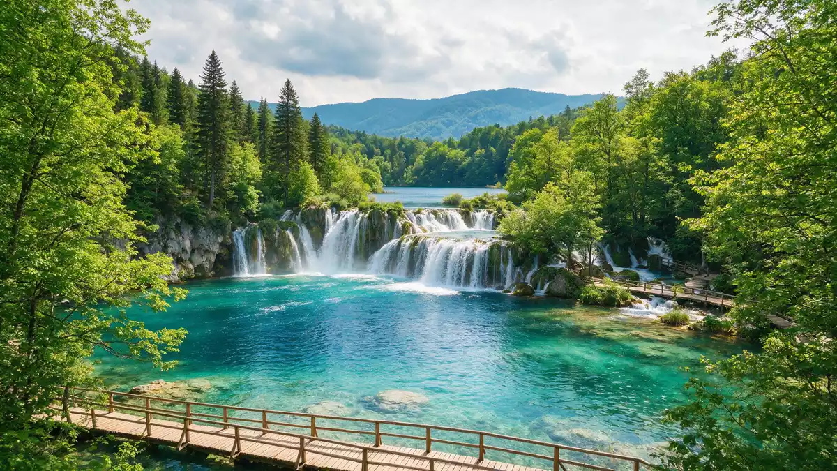
Plitvicka jezera at Plitvice in Croatia is best understood as a landscape built by water, limestone and forest working together over thousands of years. The protected area is a national park where a chain of lakes steps down through a wooded karst valley, linked by waterfalls and calm reaches of the Korana River.
A national park shaped by karst and water
Plitvicka jezera is the oldest and largest national park in Croatia, declared a protected area in 1949 and later expanded to cover nearly 300 km^2.^oldest and largest national park The park lies in central Croatia in a mountainous karst region between the Mala Kapela range on one side and the Li?ka Plješivica range on the other, with most of its territory falling within Lika-Senj County and the remainder in Karlovac County.mountainous karst region
The heart of Plitvicka jezera is a system of lakes formed where barriers of travertine, also known as tufa, have built up across the valley and impounded the water of the Korana and its headwater streams. Sixteen named lakes and several smaller ones cascade into each other, dropping from the upper plateau towards the lower reaches of the river.lake system of 16 named lakes The process of travertine formation is active, so the barriers and pools are part of a living geological system rather than a static set of basins.
UNESCO recognition and the structure of the lakes
Plitvicka jezera gained international recognition in 1979 when it was inscribed on the UNESCO World Heritage List for its outstanding series of lakes, caves and waterfalls created by tufa barriers in a karst landscape.inscribed on the UNESCO World Heritage List The World Heritage listing covers a large area of forest, water and rock, and was later extended to match the enlarged boundaries of the national park as adopted by the Croatian parliament.extension of the World Heritage site
The lakes occupy the valley of the Bijela rijeka and Crna rijeka streams, which join to become the Korana River. Travertine barriers cross the valley at many points, creating a staircase of deep, clear lakes separated by shelves where water spills over in curtains and plumes. The protected landscape extends over tens of thousands of hectares, including extensive forests that are home to bears, wolves and rare bird species as well as the water features that most visitors associate with Plitvicka jezera.forests with large mammals and birds
Walking the wooden paths between lakes and forest
On a visit to Plitvicka jezera the most immediate impression is the way paths, lakes and forest interleave. Wooden walkways run close to the water in many sections, crossing the lakes and following the lines of tufa barriers where water drops between levels. Elsewhere, routes climb through beech and conifer forest, giving views across wide basins of turquoise water and towards the surrounding slopes of the Mala Kapela and Li?ka Plješivica ranges.series of lakes and waterfalls
The contrasts between sections of the park are clear even on a single route. Some parts feel enclosed by steep valley sides where cascades drop into narrow channels, while others open onto broader lakes edged by forest and meadows. The visible tufa formations range from low rims at the edge of pools to higher barriers where water falls in many strands, and the colour of the water shifts with depth and mineral content. The settlement and municipality of Plitvicka Jezera lie within and near the park, with the main administrative centre at Korenica along the road that crosses the area.municipality of Plitvicka Jezera
Visiting Plitvicka jezera: what travellers from Western Europe should know
- Plitvicka jezera lies in central Croatia, south of the town of Slunj, in the Lika-Senj and Karlovac counties, and is reached by road on the main route between Zagreb and the Adriatic coast.
- Inside the park, many of the walking routes involve wooden walkways close to water and forest paths with some gradients, so footwear suited to uneven ground is important.
- The terrain combines lakes, rivers, forest and karst slopes at elevations ranging from a few hundred metres above sea level in the valley to higher points on the surrounding ridges.
- The official language is Croatian and the currency is the euro.
- Entry requirements depend on your nationality; UK travellers can check the FCDO travel advice at gov.uk/foreign-travel-advice, Irish travellers the Department of Foreign Affairs at ireland.ie.
Searching for Plitvicka jezera on social platforms
These links open searches for Plitvicka jezera on each platform.
Frequently asked questions about Plitvicka jezera
Where is Plitvicka jezera?
Plitvicka jezera is in central Croatia, in the Lika-Senj and Karlovac counties, between the Mala Kapela and Li?ka Plješivica mountain ranges, near the municipality of Plitvicka Jezera.
What should visitors expect on a visit?
A visit centres on walking among lakes, waterfalls and forest on marked routes, with wooden walkways close to the water and paths that rise and fall through the karst landscape.
What makes Plitvicka jezera distinctive?
Plitvicka jezera is distinctive for its active travertine barriers that create a linked series of clear lakes and waterfalls in a karst valley, recognised internationally through its UNESCO World Heritage status since 1979.


