
Plitvicka jezera: cascading lakes in Croatia’s karst heart
Published on 09/21/2026 at 07:11 | Editorial responsibility: Rafael Müller, Editor-in-Chief AD HOC NEWS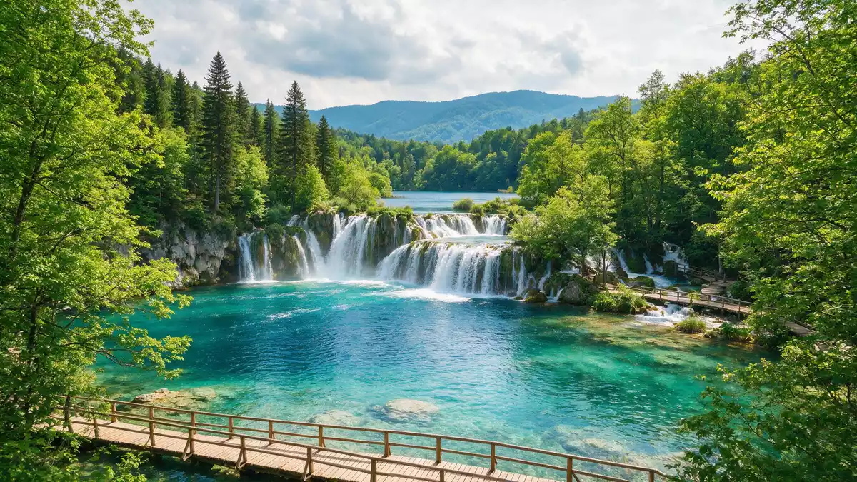
Plitvicka jezera in the Plitvice region of Croatia is a protected landscape where a chain of lakes and waterfalls steps down a former river valley through thick forest. Designated as Plitvice Lakes National Park in 1949, it is both the oldest and largest national park in the Republic of Croatia, recognised in 1979 as a UNESCO World Heritage site for its water-carved terraces of tufa rock and constantly changing cascades.
A terraced water world shaped by tufa
The defining feature of Plitvicka jezera is a sequence of lakes separated by natural barriers of tufa, also known as travertine, that have grown across the valley and turned a river into a tiered water system. The park sits in the Dinaric karst region, where limestone and dolomite dominate the bedrock and groundwater emerges in large springs, feeding the lakes with clear, mineral-rich water.Dinaric karst region Beneath the forest paths and wooden walkways lies a rock mass dated from the Upper Triassic to the Upper Cretaceous, a long geological history that underpins the present landscape.
Within this basin, tufa barriers have grown where water, dissolved calcium carbonate and living organisms meet on mossy surfaces, slowly building porous dams that raise water levels and divide the flow into separate basins.creator of waterfalls and lakes Sixteen larger named lakes, accompanied by many smaller pools, are separated by these barriers yet linked by waterfalls that spill from one level to the next. The result is a landscape where moving water takes countless forms, from broad curtain-like falls to narrow jets threading through vegetation.
The national park and its UNESCO status
Plitvicka jezera was proclaimed a national park on 8 April 1949, reflecting its scientific and scenic value as a karst lake system shaped by tufa formation.proclaimed a national park on 8 April 1949 The protected area lies mainly in Lika-Senj County, with a smaller portion in Karlovac County, and extends over almost 300 km² (about 115 square miles) of forest, grassland, lakes and rivers.covers an area just under 300 km² Within this wider landscape, the lakes form the central attraction but sit among steep slopes, sinkholes and wooded ridges characteristic of the Dinarides.
In 1979, Plitvice Lakes National Park was inscribed on the UNESCO World Heritage List under natural criteria (vii), (viii) and (ix), highlighting its outstanding natural beauty, geological processes and ongoing ecological dynamics.Plitvice Lakes National Park inscription The inscription later received an extension in 2000, aligning the World Heritage boundaries with those of the national park. UNESCO’s documentation emphasises the undisturbed production of travertine and the way this process continues to reshape the lakes and waterfalls, making Plitvicka jezera a rare example of a large landscape whose fundamental features are actively developing.
Landscape setting between mountain massifs
Plitvicka jezera lies in a mountainous part of central Croatia, between the Mala Kapela range in the west and northwest and the Li?ka Plješivica range to the southeast.between Mala Kapela and Li?ka Plješivica The lakes occupy a section of the Korana river basin, where karst springs emerge and feed the chain of basins and falls. Steep wooded slopes rise from the water’s edge, framing views where terraces of pale rock contrast with dark conifer stands and lighter patches of deciduous forest.
Walking routes make use of the natural terraces, bringing visitors close to the water on timber walkways that cross barriers and follow shorelines. Elsewhere, paths climb to higher viewpoints where the tiered structure of the system becomes clear: basins stepping down the valley, separated by vegetated dams and connected by streams that tumble between levels. Away from the lakes, the wider park includes forested plateaus and meadows, where the karst terrain is marked by sinkholes and irregular rock formations.
Visiting Plitvicka jezera: what travellers from Western Europe should know
- Plitvicka jezera lies in central Croatia, between Mala Kapela and Li?ka Plješivica, reached by state roads such as D429 and D52 that link Zagreb and Zadar with the Plitvice area.
- The terrain around the lakes includes stepped paths, timber walkways close to the water and sections of gradient where trails rise from valley floors to viewpoints.
- The park stands in a mountainous region with a mix of forest and open ground, so weather and underfoot conditions vary across seasons.
- The official language is Croatian and the currency is the Croatian kuna.
Searching for Plitvicka jezera on social platforms
These links open searches for Plitvicka jezera on each platform.
Frequently asked questions about Plitvicka jezera
Where is Plitvicka jezera?
Plitvicka jezera is in central Croatia, in the Plitvice area between the Mala Kapela and Li?ka Plješivica mountain ranges, mainly within Lika-Senj County.
What should visitors expect on a visit?
Visitors encounter a sequence of lakes linked by waterfalls, with timber walkways at water level and paths on slopes, all set within forest and karst terrain.
What makes Plitvicka jezera distinctive?
Its distinctive character comes from the active growth of tufa barriers that continue to reshape the lakes and waterfalls, a process recognised in its UNESCO World Heritage status since 1979.


