
Plitvicka jezera and the terraced lakes of Plitvice
Published on 09/12/2026 at 22:36 | Editorial responsibility: Rafael Müller, Editor-in-Chief AD HOC NEWS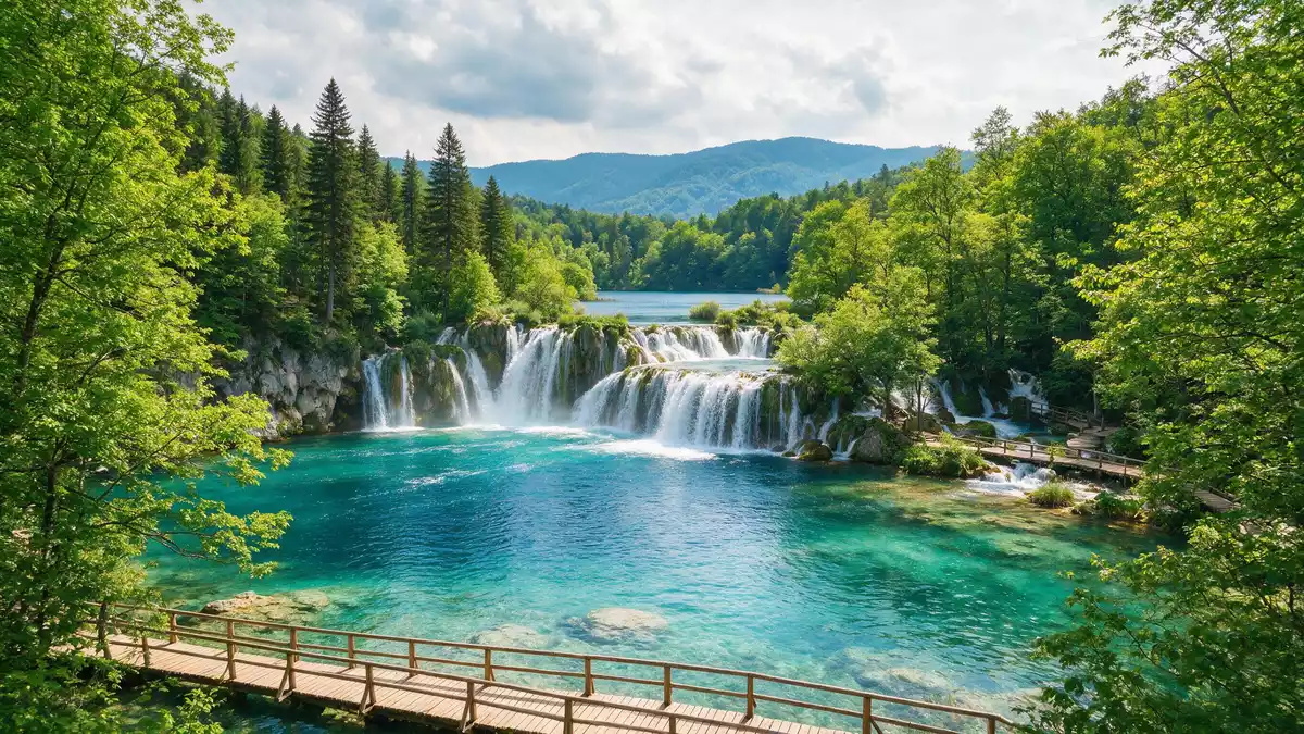
Plitvicka jezera in the Plitvice region of Croatia is a national park built around a chain of terraced lakes, waterfalls and forested slopes where water and karst rock meet in a single landscape. Founded as a protected area in 1949 and inscribed on the UNESCO World Heritage List in 1979, it preserves a lake system formed by tufa barriers that have grown over centuries and continue to shape the channels and basins today.Founded in 1949
Lakes stepping down through a karst valley
The core of Plitvicka jezera is a sequence of lakes arranged in terraces along the upper course of the Korana River, set between the Mala Kapela and Li?ka Plješivica mountain ranges in central Croatia.Between Mala Kapela and Li?ka Plješivica Travertine, a type of limestone known locally as tufa, has built natural dams across the valley, creating basins at different levels and a pattern of falling water between them.Travertine dams forming lakes These barriers are formed by chemical and biological processes around mosses and other vegetation, and their slow growth means the outline of each basin is not fixed but changes over generations.
The protected area covers just under 300 km² (around 115 sq mi), and within it the lakes occupy a smaller part, surrounded by extensive forest and grassland.Area just under 300 km² Sixteen named lakes step down the valley, divided into upper and lower groups, with clear water that ranges in colour from pale turquoise to deeper blue and green depending on depth, mineral content and light.Sixteen named lakes Wooden walkways and paths run close to the water and across the tufa barriers, bringing visitors into direct contact with the edge of the basins and the streams feeding them.
Waterfalls, forests and limestone cliffs
Between the lakes, water falls in countless steps, from narrow jets to broad curtains dropping over rock ledges. One of the most prominent is Veliki Slap, a tall waterfall at the lower end of the system where a river descends from a higher plateau into the canyon, adding its flow to the chain of lakes.Veliki Slap waterfall The valley itself is carved into limestone of the Dinaric karst, and cliffs rise above parts of the lake system, giving clear views over the water and the surrounding woodland.
Forest covers a large share of the park and ranges from dense beech stands to mixed woodland with fir and spruce. The combination of forest and water, broken by travertine barriers and cliffs, makes Plitvicka jezera an example of a karst landscape where surface streams, lakes and underground drainage all interact.Karst landscape with forest and lakes Wildlife lives across these habitats, from fish and aquatic invertebrates in the lakes to birds and larger mammals in the woodland, though much of this is hidden and the visible character of the park remains the contrast between water and rock.
A protected landscape with a long conservation history
Plitvicka jezera was declared a national park of Croatia in the mid-twentieth century, at a time when the region’s karst landscapes were gaining formal protection.Oldest and largest Croatian national park On 26 October 1979 it was inscribed on the UNESCO World Heritage List for its “outstanding natural beauty” and the undisturbed production of travertine that creates and maintains the lakes and waterfalls.Inscription on the World Heritage List In 1997 the boundaries of the protected area were expanded so that the World Heritage property and the national park now cover almost identical areas.
Administratively the park lies mainly in Lika-Senj County, with a smaller part in Karlovac County, and it is reached from the Croatian interior by a major north–south road link between the continental lowlands and the Adriatic coast.Location in Lika-Senj and Karlovac counties Within this framework the lake system is divided into several visitor routes and marked trails, but the underlying structure is still the same chain of basins, tufa barriers and forest that attracted early recognition.
Visiting Plitvicka jezera: what travellers from Western Europe should know
- Plitvicka jezera lies in central Croatia, in the Plitvice area of Lika-Senj County, reached by road between Zagreb and the Adriatic coast, with entrances near the lakes.
- Paths and walkways in the park follow the lakes and cross the travertine barriers, and some sections include stairways and short climbs on uneven surfaces near water.
- The terrain combines forest, lakes and limestone slopes, so footwear suited to walking on natural surfaces is important on the longer routes.
- The official language is Croatian and the currency is the Croatian kuna; card payment is widely used in Croatia.
- Entry requirements depend on your nationality; UK travellers can check the FCDO travel advice at gov.uk/foreign-travel-advice, Irish travellers the Department of Foreign Affairs at ireland.ie.
Searching for Plitvicka jezera on social platforms
These links open searches for Plitvicka jezera on each platform.
Frequently asked questions about Plitvicka jezera
Where is Plitvicka jezera and what kind of place is it?
Plitvicka jezera is in the Plitvice area of central Croatia, near the border with Bosnia and Herzegovina, and is a national park built around a terraced lake and waterfall system.
What should visitors expect on a visit to Plitvicka jezera?
Visitors encounter clear lakes at different levels, numerous waterfalls, forest trails and wooden walkways close to the water, with routes that range from short circuits to longer day walks.
What makes Plitvicka jezera distinctive among European landscapes?
The park combines a large karst valley, extensive forest and a chain of lakes formed by growing travertine dams, recognised by UNESCO for the continuing natural processes that shape the basins and waterfalls.


