
Playa Varadero follows Cuba’s long Hicacos shoreline
Published on 09/24/2026 at 09:12 | Editorial responsibility: Rafael Müller, Editor-in-Chief AD HOC NEWS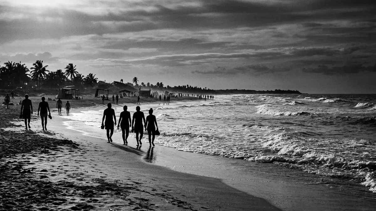
Playa Varadero is a long beach on Cuba’s Hicacos Peninsula, beside the resort town of Varadero in Matanzas Province. Pale sand follows the peninsula’s northern shore, creating a continuous coastal landscape between the Straits of Florida and the Bay of Cárdenas.
The beach is not an isolated cove but the seaward edge of an elongated settlement. Its length, sand and position on the peninsula define Varadero’s physical character, while the town’s history gives the shoreline a nineteenth-century setting.
Playa Varadero and the shape of Hicacos Peninsula
Hicacos Peninsula projects from Cuba’s northern coast between the Bay of Cárdenas and the Straits of Florida. Varadero occupies the peninsula, with the beach running along its northern side towards Punta Hicacos.
Playa Varadero extends for more than 20 km (12.4 mi) along the shoreline. The beach is formed by pale sand beside clear, shallow Caribbean water, while low vegetation and resort buildings appear behind sections of the coast. This long coastal line is the feature that gives Varadero its recognisable geography.
The peninsula has water on both sides, but the beaches are not identical in character. Playa Varadero faces the open northern coast, whereas the southern shore looks across the Bay of Cárdenas. The contrast belongs to the landscape itself: a narrow strip of land carries a town, roads, vegetation and a long strand between two maritime settings.
From nineteenth-century settlement to resort town
Varadero’s official town foundation dates to 15 December 1887. The settlement grew in connection with nearby Cárdenas, whose residents established houses on the Hicacos Peninsula during the nineteenth century.
The coast had earlier maritime uses. The name Varadero is linked to the Spanish word for a place where vessels could be brought ashore, and the peninsula was associated with boat handling, salt and charcoal during the sixteenth and seventeenth centuries.
In the late nineteenth century, houses, a church, a market square and a park formed the beginnings of the town. The first hotel opened in 1926, marking a new phase in the settlement’s relationship with the beach. Seasonal homes, hotels and leisure facilities expanded along the shore during the twentieth century.
The Cuban Revolution of 1959 changed property ownership and the organisation of tourism. Varadero developed into a large resort zone, with hotels and other visitor facilities occupying parts of the peninsula behind Playa Varadero. The shoreline therefore carries several periods at once: maritime history, the town founded in 1887, and twentieth-century resort development.
Sand, water and the northern Cuban coast
Playa Varadero’s physical details are straightforward: a long belt of pale sand, shallow water and a northern coastal position. The beach fronts the resort town, but parts of the peninsula also retain scrub, palms, low dunes and protected natural areas.
At Punta Hicacos, the Varahicacos Ecological Reserve contains coastal habitats and archaeological traces. Caves in the peninsula hold pre-Columbian pictographs, adding an indigenous and geological dimension to a destination more commonly associated with hotels and swimming.
The peninsula’s geology belongs to the Quaternary period. Its narrow form brings the sea close to the settlement, while Playa Varadero remains the dominant open landscape along the northern edge. Sand, limestone, vegetation and resort architecture appear in successive bands beside the coast.
Varadero also connects naturally with the wider region. Cárdenas lies on the bay side of the peninsula, while Havana is west along Cuba’s northern coast. The beach belongs to a regional landscape of bays, coastal wetlands, limestone formations and Caribbean water, rather than to the town alone.
Visiting Playa Varadero: what travellers from Western Europe should know
- Playa Varadero lies on the Hicacos Peninsula in Matanzas Province, east of Havana. Road connections approach through Varadero and the Via Blanca highway.
- The beach extends for more than 20 km (12.4 mi), so the shoreline includes resort-fronted sections, vegetation, low dunes and open sandy stretches.
- The peninsula combines beach terrain with low coastal vegetation and natural areas. The Varahicacos Ecological Reserve and caves with pre-Columbian pictographs are associated with Punta Hicacos.
- The official language is Spanish and the currency is the Cuban peso.
- Entry requirements depend on your nationality; UK travellers can check the FCDO travel advice at gov.uk/foreign-travel-advice, Irish travellers the Department of Foreign Affairs at ireland.ie.
Searching for Playa Varadero on social platforms
These links open searches for Playa Varadero on each platform.
Frequently asked questions about Playa Varadero
Where is Playa Varadero?
Playa Varadero is on the northern shore of the Hicacos Peninsula in Varadero, Matanzas Province, Cuba. The beach faces the Straits of Florida, while the peninsula’s southern side faces the Bay of Cárdenas.
What can visitors expect at the beach?
Visitors encounter a long sandy shoreline, shallow water, resort buildings, planted areas and sections of coastal vegetation. The beach extends for more than 20 km (12.4 mi).
What makes Playa Varadero distinctive?
Its defining feature is the relationship between a long beach and a narrow peninsula carrying an entire resort town. The shoreline also sits within a landscape containing the Varahicacos Ecological Reserve and caves with pre-Columbian pictographs.


