
Playa Flamenco and the curve of Culebra’s shore
Published on 09/24/2026 at 06:31 | Editorial responsibility: Rafael Müller, Editor-in-Chief AD HOC NEWS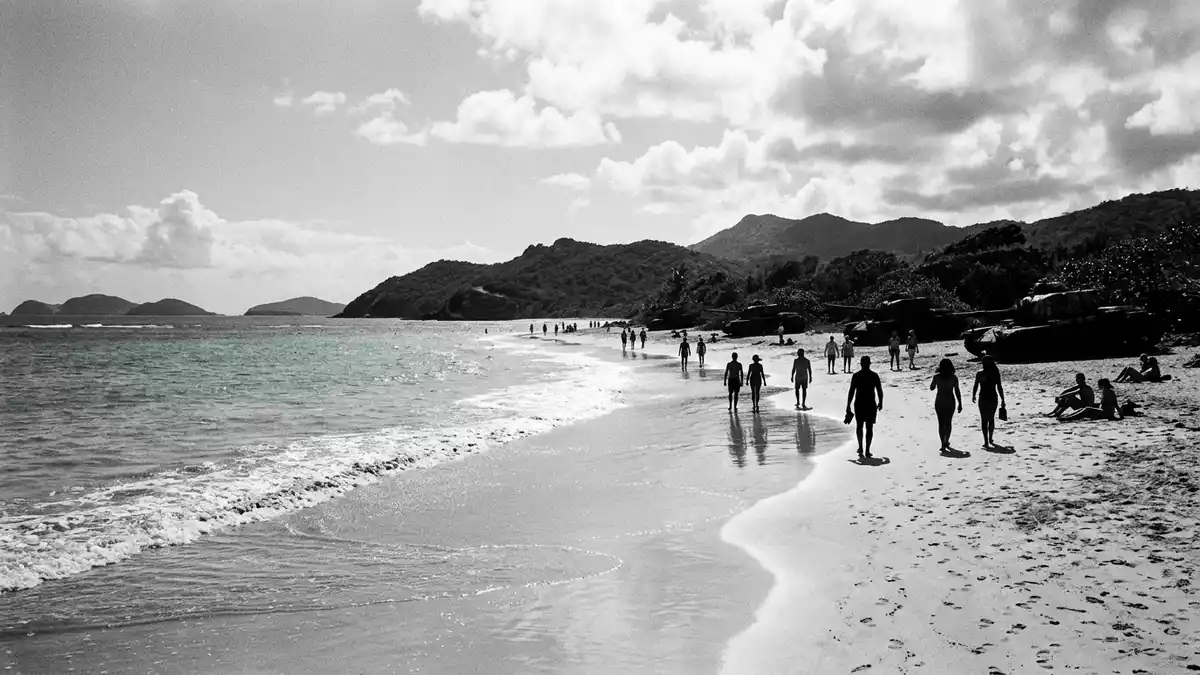
Playa Flamenco curves around a sheltered bay on Culebra, an island municipality of Puerto Rico. Pale sand, shallow turquoise water and the broad sweep of the coast define the beach, while a lagoon and protected land sit behind it.
Playa Flamenco around a sheltered bay
The beach lies on Culebra’s north-western shore, facing an open bay connected with the North Atlantic Ocean. Its coast follows the curve of Flamenco Bay, with sand extending for about 1.6 km (1 mile).
The horseshoe-shaped bay encloses shallow water with reef protection near the shore. Behind the beach is Flamenco Lagoon, a separate landscape of water, vegetation and low coastal ground.
Sand, lagoon and Caribbean wildlife
Playa Flamenco borders the Culebra National Wildlife Refuge, whose protected landscape includes beaches, lagoons, mangroves, dry forest and coral reefs. The refuge is also associated with nesting sea turtles and seabirds.
The beach’s name is linked to Caribbean flamingos that once occurred around the lagoon. The surrounding coast therefore carries two identities at once: a public beach shaped by sand and surf, and part of a wider island habitat.
The Culebra refuge contains three broad ecosystems and provides habitat for endangered sea turtles. Its coastal setting places Playa Flamenco within a larger protected environment.
From Spanish colonial Culebra to military relics
Culebra’s history includes Taíno presence, Spanish colonial rule and a long United States military chapter. The island’s strategic position between Puerto Rico and the Virgin Islands shaped its twentieth-century history.
Military training took place on parts of Culebra during the twentieth century. Rusting tanks beside Playa Flamenco remain visible reminders of that period, contrasting with the white sand and blue water around them.
The Culebra National Wildlife Refuge was established in 1909. The refuge’s 1909 foundation places the beach within a protected landscape with more than a century of recorded conservation history.
Visiting Playa Flamenco: what travellers from Western Europe should know
- Playa Flamenco lies on the north-western side of Culebra. The road PR-251 connects the beach area with Dewey, the island’s main town.
- The beach is a long open strand of sand beside Flamenco Lagoon. Its broad shore gives way to shallow coastal water and reef-protected areas.
- Culebra is reached from Puerto Rico’s main island by ferry or aircraft. Local transport connects the island’s settlement area with Playa Flamenco.
- The official language is Spanish and English, and the currency is the United States dollar.
- Entry requirements depend on your nationality; UK travellers can check the FCDO travel advice at gov.uk/foreign-travel-advice, Irish travellers the Department of Foreign Affairs at ireland.ie.
Searching for Playa Flamenco on social platforms
These links open searches for Playa Flamenco on each platform.
Frequently asked questions about Playa Flamenco
Where is Playa Flamenco?
Playa Flamenco is on the north-western coast of Culebra, an island municipality of Puerto Rico. The beach curves around Flamenco Bay beside Flamenco Lagoon.
What can visitors expect at the beach?
The shore combines pale sand, shallow turquoise water and a broad bay. The nearby refuge adds lagoons, coastal vegetation, coral reefs and protected wildlife habitat.
What makes Playa Flamenco distinctive?
The beach brings together a curved Caribbean shoreline, a named lagoon, protected land and visible military tanks. Its landscape connects natural history with Culebra’s twentieth-century past.


