
Playa Flamenco and the curve of Culebra’s shore
Published on 09/07/2026 at 13:29 | Editorial responsibility: Rafael Müller, Editor-in-Chief AD HOC NEWS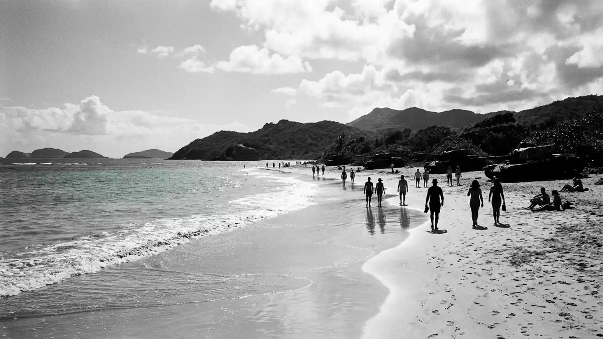
Playa Flamenco on Culebra is a broad beach on the island’s north-western shore, curving around a sheltered bay. The name belongs to a place where white sand, reef shelter and open water meet in one long sweep.
Playa Flamenco and its horseshoe bay
The beach is set on Culebra, an island-municipality of Puerto Rico, and the bay gives it a strong, continuous outline. One widely cited description links the beach to a mile-long curve around the bay and to the horseshoe-shaped bay behind it.
The shoreline is known for pale sand and clear water, but the most memorable element is the shape itself. The bay sits open to the sea, while the beach forms a continuous arc along the north-west coast of Culebra.
Military traces on the sand
Playa Flamenco also carries traces of Culebra’s twentieth-century military history. Two rusting tanks remain among the beach’s best-known landmarks, and the island’s period of U.S. Navy use ended in 1975.
That contrast between bright sand and old steel gives the beach an unusual visual layer. The tanks sit in the open, with the long curve of the bay and the low shoreline around them.
Culebra, the refuge and the shoreline
Playa Flamenco lies beside the Culebra National Wildlife Refuge, a protected area that borders parts of the coast. The refuge is named in the English and Spanish-language sources that describe the beach, and it forms part of the setting around the north coast.
The island itself is small, and the beach belongs to that scale. Culebra’s north shore, the sheltered bay and the refuge together make Playa Flamenco more than a single strip of sand; they frame it as part of a wider coastal landscape.
Visiting Playa Flamenco: what travellers from Western Europe should know
- Playa Flamenco is on the north-western side of Culebra in Puerto Rico. Access runs through the island’s road network and the approach to the coast.
- The beach has a long, open shoreline with sand, reef shelter and a wide bay. The military tanks stand in the open rather than being enclosed or restored into a display hall.
- The coast here is exposed enough to show the curve of the bay clearly. The refuge beside it adds a protected border to the beach landscape.
- The official language is English and Spanish, and the currency is the United States dollar.
- Entry requirements depend on your nationality; UK travellers can check the FCDO travel advice at gov.uk/foreign-travel-advice, Irish travellers the Department of Foreign Affairs at ireland.ie.
Searching for Playa Flamenco on social platforms
These links open searches for Playa Flamenco on each platform.
Frequently asked questions about Playa Flamenco
Where is Playa Flamenco?
Playa Flamenco lies on the north-west coast of Culebra, an island-municipality of Puerto Rico. It faces a sheltered bay rather than an inland street or harbour frontage.
What does a visit to Playa Flamenco involve?
The beach presents a long sandy curve, clear water and the remains of military tanks on the shore. The refuge beside it adds a protected coastal edge to the setting.
What makes Playa Flamenco distinctive?
The beach combines a horseshoe bay, pale sand and visible historical remnants in one scene. Its form, its setting and the tanks on the shore define the place more strongly than any single viewpoint.


