
Placencia, Belize: a Caribbean village between lagoon and sea
Published on 09/12/2026 at 16:40 | Editorial responsibility: Rafael Müller, Editor-in-Chief AD HOC NEWS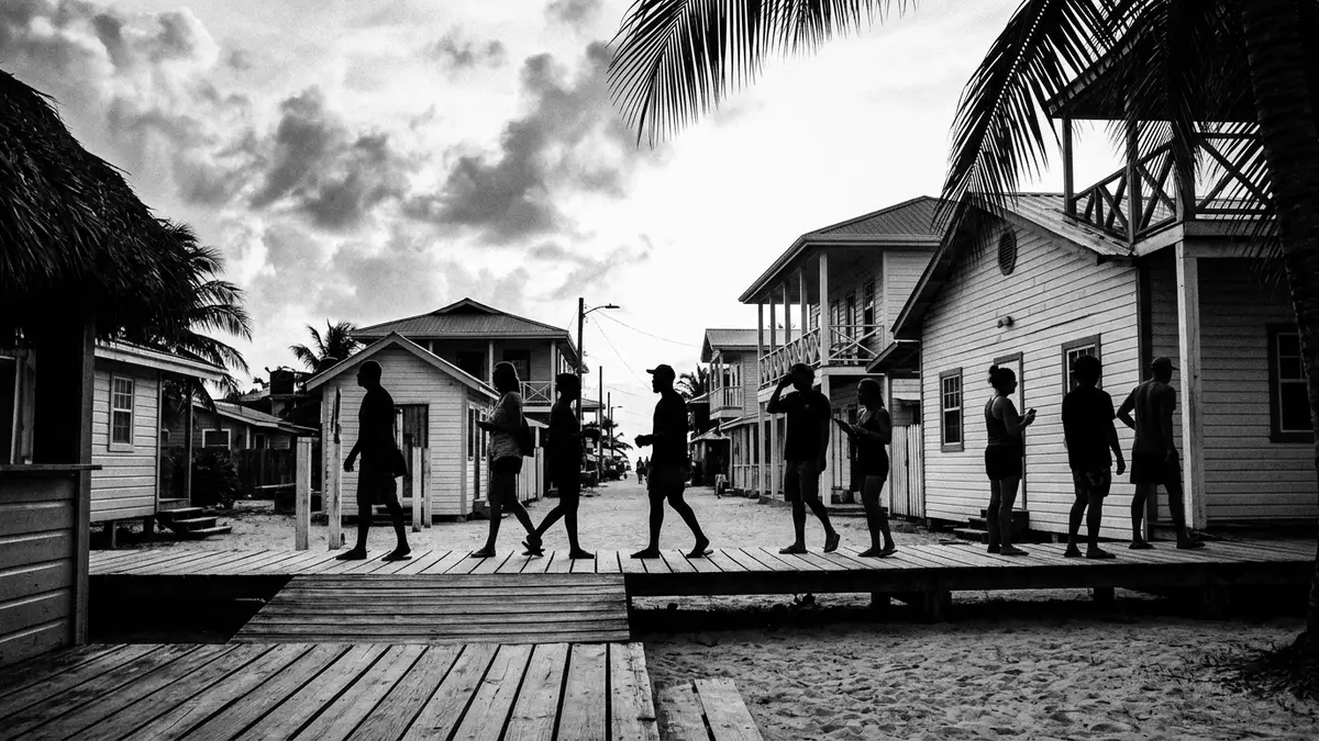
Placencia is a small village in southern Belize set at the tip of a long and narrow peninsula between a sheltered lagoon and the Caribbean Sea. It lies in the Stann Creek District and has grown from a fishing community into a coastal settlement known for its broad sand shoreline and access to offshore islands along the Belize Barrier Reef.small village in the Stann Creek District
A narrow peninsula of sand between two waters
The Placencia Peninsula forms a slender strip of land on Belize’s south-eastern coast, running for around sixteen miles (about 26 km) between inland districts and the open Caribbean.peninsula on Belize’s southeastern coast The peninsula’s eastern edge faces the Caribbean Sea, where the shoreline is lined with pale sand and palms, while the western side fronts the Placencia Lagoon, a mangrove-fringed expanse of calmer water that reflects the low-lying terrain and distant Maya Mountains.positioned between the placid Placencia Lagoon and the Caribbean Sea
Placencia Village sits at the southern tip of this peninsula, reached along the single main road that threads through communities such as Maya Beach and Seine Bight before arriving at the cluster of houses and small businesses close to the beach.village at the very tip of the narrow Placencia Peninsula The elevation here is low, with the settlement close to sea level, which gives long views along the coast and across the lagoon, and makes the line of the peninsula easy to follow on a map as it extends northwards from the village.small village situated in Stann Creek District
From Maya salt works to a modern coastal village
The area around Placencia Lagoon carries traces of occupation stretching back to the Maya civilisation, which established several sites around the lagoon and engaged in coastal trade and salt production using the shallow waters and favourable climate.Maya sites around the Placencia Lagoon Later, Spanish navigators sailing along the southern coast of Belize gave the peninsula a name derived from “Placentia”, with the point called Punta Placentia, a term that can be translated as Pleasant Point.Spanish navigators christened this cape Punta Placentia
In the seventeenth century English Puritans from Nova Scotia and the island of Providencia established a settlement on the peninsula that later faded during the Central American wars of independence in the early nineteenth century.settled by English Puritans in the seventeenth century The peninsula was resettled in the late nineteenth century by families including the Garbutts, Westbys and Eileys, whose fishing and coconut cultivation formed the basis of the village economy and helped shape Placencia into a recognised coastal community.late nineteenth century families laid the foundation of the modern village
A coastal settlement linked to reef and lagoon
Placencia’s position between lagoon and open sea shapes its layout and daily life: houses, small guesthouses and local businesses line the beachside and the interior streets, while jetties and small piers extend into the lagoon and sea for boats heading towards offshore cayes and fishing grounds. The village has an area with a narrow pedestrian way known locally as the sidewalk, running close to the seafront and lined with modest buildings, local eateries and shops, reflecting its origins as a working fishing settlement.seaside town at the tip of a peninsula
The wider peninsula links Placencia to other communities and to inland Belize, and its single main road and small airstrip near the village provide connections for travellers heading to the coastal strip from Belize City and other parts of the country.small village at the southern end of a long peninsula Offshore, the Belize Barrier Reef runs parallel to the coast and lies within reach of boat trips from the village, making Placencia a practical base for excursions to nearby cayes and reef sites while still retaining the scale and character of a compact settlement on a narrow piece of land.village near the barrier reef of Belize
Visiting Placencia: what travellers from Western Europe should know
- Placencia lies in southern Belize on the Placencia Peninsula in the Stann Creek District and can be reached by domestic flights to the small airstrip near the village or by road along the peninsula from inland towns.
- The village and its surroundings are low-lying coastal terrain of sand and littoral forest, and walking around involves stretches on compacted paths or beach sections where sand underfoot makes progress slower than on paved streets.
- Placencia is in Belize, where the official language is English and the currency is the Belizean dollar.
- Entry requirements depend on your nationality; UK travellers can check the FCDO travel advice at gov.uk/foreign-travel-advice, Irish travellers the Department of Foreign Affairs at ireland.ie.
Searching for Placencia on social platforms
These links open searches for Placencia on each platform.
Frequently asked questions about Placencia
Where is Placencia and what kind of place is it?
Placencia is a small village in the Stann Creek District of southern Belize, located at the southern tip of the Placencia Peninsula between the Caribbean Sea and Placencia Lagoon.small village in the Stann Creek District of Belize
What can visitors expect on a first visit to Placencia?
Visitors encounter a compact coastal settlement with sand beaches, simple streets and a waterfront setting that links lagoon and sea, along with small-scale local businesses and access to nearby cayes.
What makes Placencia distinctive among Belizean coastal villages?
Placencia’s setting on a narrow peninsula, with the village at its southern tip facing both lagoon and Caribbean, gives it a linear geography and a direct relationship to the Belize Barrier Reef and inland districts that is unusual among small coastal communities in Belize.coastal village and important tourist centre


