

Piopiotahi and the steep walls of a New Zealand fiord
Published on 08/31/2026 at 18:08 | Editorial responsibility: Rafael Müller, Editor-in-Chief AD HOC NEWS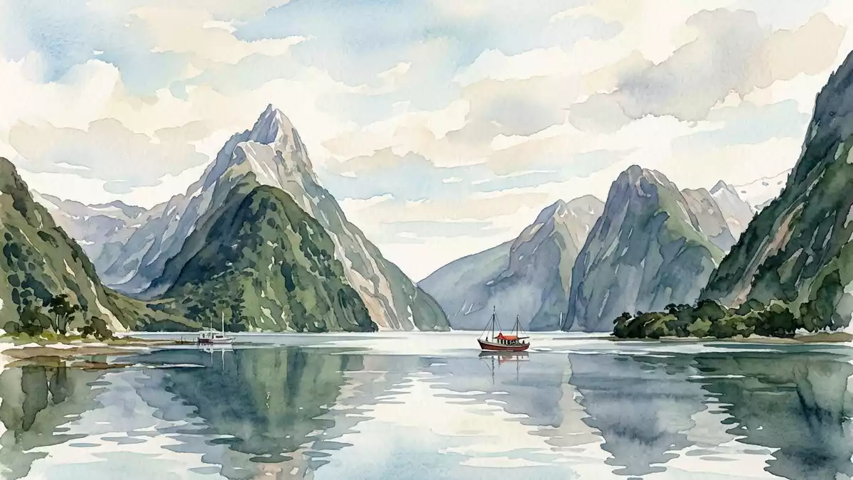
Piopiotahi is the M?ori name for the glacier-carved fiord known in English as Milford Sound on the southwest coast of New Zealand’s South Island. Set within Fiordland National Park and the wider Te Wahipounamu World Heritage area, it is a narrow arm of the Tasman Sea hemmed in by high peaks, deep water and temperate rainforest.Milford Sound / Piopiotahi
Rock walls, deep water and a narrow fiord
The defining impression of Piopiotahi is the way granite and other hard rock rise almost straight from the water, giving the fiord steep walls on both sides. The waterway runs for more than 15 km from the small settlement at its head to Dale Point, where it opens into the Tasman Sea, with the water extending to hundreds of metres in depth beneath the boat hulls.Milford Sound description Within that length the fiord remains comparatively narrow, a corridor of sea water framed by cliffs and forest rather than a broad bay.length and width of the fiord
The high walls carry peaks that have become landmarks in their own right. On the south side, Rahotu / Mitre Peak rises from near sea level to well over 1,600 m (5,249 ft), with its main ridge composed of closely spaced summits that drop steeply to the fiord.Mitre Peak height and form Around it, other mountains reach similar elevations, creating a ring of summits that crowd the waterway and help give Piopiotahi its enclosed, canyon-like character.surrounding mountain heights
Waterfalls, rainforest and the marine reserve
Despite the steep rock, Piopiotahi is not bare. The valley sides carry temperate rainforest, with dense vegetation clinging to ledges and gullies and reaching down towards the intertidal zone. High rainfall supports this growth and feeds numerous waterfalls that drop from hanging valleys and stream courses into the fiord, with Stirling Falls and Bowen Falls among those that fall directly into the waterway during cruises.named waterfalls in the fiord The combination of dark water, pale falling torrents and green slopes makes the fiord a layered landscape of rock, forest and moving water.
Below the surface, a protected marine environment extends along the northern side of the fiord in the Piopiotahi (Milford Sound) Marine Reserve. Established in 1993, it covers several hundred hectares from the village near the head of the fiord out towards Dale Point, taking in deep muddy basins, reef areas and sections of rock wall inhabited by invertebrates such as black corals, sponges and sea squirts.Piopiotahi Marine Reserve The reserve sits within Fiordland National Park, linking the underwater world to the protected forests and peaks above.Milford Sound within Fiordland National Park
Names, legends and protection
Piopiotahi is more than a geographical label. In te reo M?ori the name refers to a single piopio, a native thrush-like bird that is now extinct, with “tahi” meaning “one”.meaning of Piopiotahi The bird and its name are linked to a story of mourning after the death of the culture hero M?ui, giving the fiord a name that carries memory of both an animal and a narrative of grief.
The English name Milford Sound dates from the nineteenth century and commemorates Milford Haven in Wales, introduced by the mariner John Grono after his visit to the fiord.origin of Milford Sound name In administrative terms the place is recorded as Milford Sound / Piopiotahi, a dual name that reflects both the M?ori and English traditions.gazetted dual name The fiord lies within Fiordland National Park and forms part of the Te Wahipounamu World Heritage area recognised by UNESCO, linking its cliffs, water and wildlife to a wider protected landscape on the South Island’s southwest coast.World Heritage status
Visiting Piopiotahi: what travellers from Western Europe should know
- Piopiotahi lies on the southwest coast of New Zealand’s South Island and is reached by road along State Highway 94 from Te Anau to the small settlement at the head of the fiord.
- The terrain around the fiord is steep and rugged, with boat trips following the waterway and walking tracks using formed paths in a landscape of high cliffs and dense forest.
- The area is part of Fiordland National Park on the South Island of New Zealand, where English is an official language and the currency is the New Zealand dollar.
- Entry requirements depend on your nationality; UK travellers can check the FCDO travel advice at gov.uk/foreign-travel-advice, Irish travellers the Department of Foreign Affairs at ireland.ie.
Searching for Piopiotahi on social platforms
These links open searches for Piopiotahi on each platform.Frequently asked questions about Piopiotahi
Where is Piopiotahi?
Piopiotahi is a fiord on the southwest coast of New Zealand’s South Island, at the northern end of the chain of fiords within Fiordland National Park.
What can travellers expect on a visit?
Travellers encounter a long, narrow sea inlet bordered by steep cliffs, rainforest and waterfalls, with boat cruises and other activities using the fiord as their route.
What makes Piopiotahi distinctive?
The combination of sheer rock walls, a deep waterway, the peak of Rahotu / Mitre Peak and the dual M?ori–English naming within a World Heritage landscape gives Piopiotahi its particular character.


