
Pico de Orizaba, the star mountain above Orizaba
Published on 08/18/2026 at 13:39 | Editorial responsibility: Rafael Müller, Editor-in-Chief AD HOC NEWS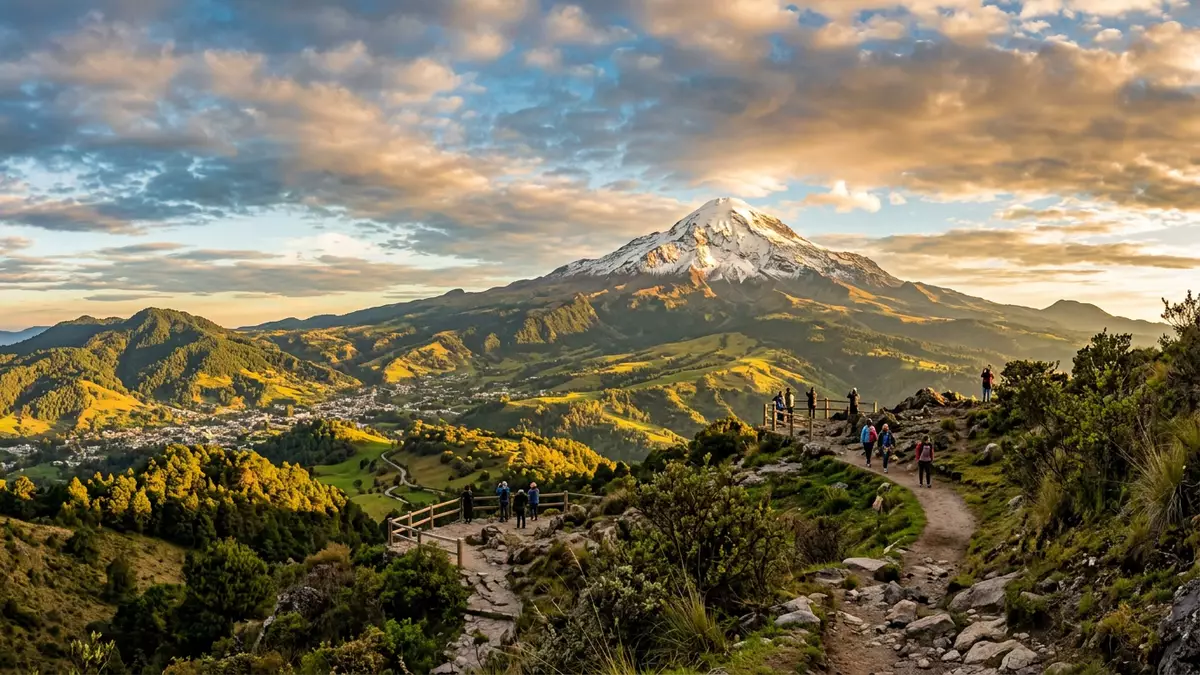
On the highlands above Orizaba in Mexico, Pico de Orizaba, also known by its Nahuatl name Citlaltépetl, dominates the horizon as a snowcapped stratovolcano and the country’s highest mountain.Pico de Orizaba rises to over 5,600 m (more than 18,000 ft), forming a symmetrical volcanic cone on the boundary between the states of Veracruz and Puebla in south-central Mexico.summit elevation It stands within the Trans-Mexican Volcanic Belt, overlooking the valley and city of Orizaba that lend it its Spanish name.Orizaba volcano overlooks the valley and the city of Orizaba
A stratovolcano shaped by ice and altitude
Pico de Orizaba is a classic stratovolcano, with steep upper slopes and broader lower aprons built from layers of lava, ash and reworked volcanic debris.tall volcanic cone The main cone rises from the eastern margin of the Mexican Plateau, forming a dominant peak whose summit area is covered by permanent snowfields and glaciers.summit glaciers Together with Popocatépetl and Iztaccíhuatl, it is one of three Mexican volcanic peaks that retain ice at their highest elevations, an unusual sight in tropical latitudes.three volcanic peaks in Mexico
The volcano’s height has been measured with slightly different results by various institutions, but all agree that it is the highest mountain in Mexico and the highest volcano in North America.highest mountain in MexicoNorth America's highest volcano Its topographic prominence, the vertical distance between the summit and the lowest contour line encircling it and no higher summit, ranks it among the most prominent mountains on Earth.ranked seventh in the world in its topographic prominence For travellers approaching from Orizaba or Puebla, the effect is a solitary peak rising far above surrounding ridges, its upper slopes often cloaked in white against the sky.
Geological setting and volcanic history
Pico de Orizaba belongs to the Trans-Mexican Volcanic Belt, a chain of volcanic terrain crossing Mexico roughly east–west from the Pacific margin towards the interior near the Gulf of Mexico.Trans-Mexican Volcanic Belt The volcano lies at the southern end of a volcanic chain that extends north to Cofre de Perote, with its flanks spreading across the border area between Veracruz and Puebla states.southern end of a volcanic chain Geological studies describe Pico de Orizaba as having formed in several stages beginning during the Pleistocene, building gigantic cones whose basal diameters reach tens of kilometres.three stages beginning during the mid-Pleistocene
Historic records show that Pico de Orizaba is a volcano with documented eruptions into the nineteenth century, though it is classified as dormant at present.large active stratovolcano Eruptive episodes identified in written sources include events in the sixteenth and seventeenth centuries and a confirmed eruption in 1846 with a moderate explosivity index.latest eruption of the volcano occurred in 1846last confirmed eruption of Pico de Orizaba occurred in 1846 Since then, no further eruptions have been recorded, yet the volcano is not considered extinct and remains a subject of monitoring and hazard assessment.considered dormant Climbers and researchers encounter lava flows, welded tuffs and other volcanic deposits on its slopes, a visible record of its past activity.
Cultural meaning and ascent traditions
The indigenous name Citlaltépetl comes from Nahuatl elements usually translated as “star” and “mountain”, a reflection of its striking profile above the plateau and of its role in local traditions.Citlaltépetl from Náhuatl citlal(in) and tep?tlname is derived from the Nahuatl for “Star Mountain” As the highest summit between Colombia and Alaska, it has long been a landmark for routes across central Mexico.highest peak between Colombia in South America and Alaska In the nineteenth century, climbers from outside Mexico began ascending the volcano, with early recorded ascents in the 1840s, adding mountaineering narratives to its existing cultural presence.first ascent 1848
The upper mountain lies within a national park that protects the volcanic cone and its surrounding ecosystems, framing Pico de Orizaba as both a geological monument and a protected natural landscape.Parque nacional Pico de Orizabaárea protege a la montaña de mayor altitud en México From the city of Orizaba and neighbouring towns, the volcano’s snow and ice fields can be seen in clear weather, giving everyday urban life a backdrop of high-altitude terrain and underscoring the connection between valley settlements and the summit cone.
Visiting Pico de Orizaba: what travellers from Western Europe should know
- Pico de Orizaba rises west of the city of Orizaba in Veracruz, with access routes approaching its flanks from both Veracruz and Puebla states by road and track.
- The mountain is a high-altitude stratovolcano with steep upper slopes and thinner air, and approaches to the glacier zone involve significant ascent on foot over rough volcanic terrain.
- The official language is Spanish and the currency is the Mexican peso.
- Entry requirements depend on your nationality; UK travellers can check the FCDO travel advice at gov.uk/foreign-travel-advice, Irish travellers the Department of Foreign Affairs at ireland.ie.
Searching for Pico de Orizaba on social platforms
These links open searches for Pico de Orizaba on each platform.
Frequently asked questions about Pico de Orizaba
Where is Pico de Orizaba located?
Pico de Orizaba stands on the boundary between Veracruz and Puebla in south-central Mexico, rising west of the city of Orizaba on the Mexican Plateau.
What should visitors expect on a visit to Pico de Orizaba?
Visitors encounter a high-altitude volcanic cone with steep slopes, snow and ice near the summit, and approaches that involve significant climbing above surrounding valleys.
What makes Pico de Orizaba distinctive among North American mountains?
It is Mexico’s highest mountain and the highest volcano in North America, with summit glaciers and great topographic prominence, forming a solitary peak above the Trans-Mexican Volcanic Belt.


