
Pico de Orizaba, Mexico’s star-shaped summit above Orizaba
Published on 09/16/2026 at 09:11 | Editorial responsibility: Rafael Müller, Editor-in-Chief AD HOC NEWS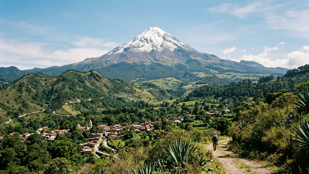
Pico de Orizaba, known in Náhuatl as Citlaltépetl or “Star Mountain”, is a snow-capped stratovolcano rising above the region around Orizaba in eastern Mexico. It is widely recorded as the highest mountain in Mexico and the tallest volcano on the North American continent, forming a dominant cone on the border between the states of Veracruz and Puebla in the eastern Trans-Mexican Volcanic Belt.highest mountain in Mexico
A volcanic cone shaped by ice and altitude
Pico de Orizaba is classified as a stratovolcano, a conical mountain built by successive layers of lava, ash and fragmented rock.stratovolcano in the Trans-Mexican Volcanic Belt Its cone rises to an officially documented elevation of around 5,636 m (18,491 ft), placing it among the very highest peaks in North America and giving it a striking vertical profile above the surrounding plateau and coastal lowlands.elevation of 5,636 metres
The mountain’s prominence, the height of the summit above the lowest contour encircling it and no higher peak, is recorded at 4,922 m (16,148 ft), a figure that underlines how isolated it is in the landscape and how abruptly it rises from its base.prominence of 4,922 metres Ice and permanent snow cover the upper slopes, with a glacier draped over the upper reaches of the cone and crevassed ice fields extending down towards the rocky shoulder. From the surrounding plains and hill towns the summit appears as a bright white cap above darker volcanic flanks, a landmark that can be seen from far across the region on clear days.
Citlaltépetl between Veracruz and Puebla
Geographically, Pico de Orizaba stands at the eastern end of the Trans-Mexican Volcanic Belt, the chain of volcanoes crossing central Mexico, and lies on the administrative boundary between Veracruz and Puebla states.border between Veracruz and Puebla Its Náhuatl name Citlaltépetl combines “citlalli” for star and “tep?tl” for mountain, a reflection of the snow-bright summit that stands out above the lower terrain and of the deep pre-Hispanic history woven into the region.Náhuatl name meaning Star Mountain
The peak forms part of a wider volcanic chain that includes Cofre de Perote to the north, but it stands apart as a solitary cone rising high above the Mexican Plateau and the Gulf coastal plain.southern end of a volcanic chain On maps the summit sits north-west of the city of Orizaba and north of the town of Córdoba, with rural settlements, pine forests and pastureland scattered across its lower slopes. Altitude changes quickly here: agricultural fields give way to highland pine and fir, then to bare rock and ice as the route climbs towards the crater rim.
Climbing Mexico’s highest peak
Pico de Orizaba has long attracted climbers and high-altitude hikers, drawn by its status as Mexico’s highest summit and the tallest volcano in North America.tallest volcano in North America Historical records describe ascents in the nineteenth century, when mountaineers began to treat Citlaltépetl as a goal alongside other continental high points, and modern guidebooks continue to present a range of routes across glaciers and rocky ribs.
The upper routes cross crevassed ice and steep snowfields, and the mountain’s height means that climbers contend with thin air and rapid changes in weather. Lower down, paths and vehicle tracks reach refuges and high camps on the volcanic flanks, linking rural communities in Veracruz and Puebla with the high mountain terrain. For those staying in the region around Orizaba, the volcano stands as a constant presence on the skyline, and various vantage points offer wide views of the summit cone against the surrounding highlands.
Visiting Pico de Orizaba: what travellers from Western Europe should know
- Pico de Orizaba rises north-west of the city of Orizaba in eastern Mexico, on the border between Veracruz and Puebla; regional roads link the mountain area with Orizaba and other nearby towns.
- The mountain reaches an altitude of over 5,600 m (18,373 ft), and approaches on foot involve long ascents on steep volcanic slopes, with high-altitude conditions on the upper glacier-covered cone.
- The broader region includes rural villages, pine forests and pastureland on the lower slopes, so visits combine high mountain terrain with journeys through agricultural landscapes and small-town Mexico.
- The official language is Spanish and the currency is the Mexican peso.
- Entry requirements depend on your nationality; UK travellers can check the FCDO travel advice at gov.uk/foreign-travel-advice, Irish travellers the Department of Foreign Affairs at ireland.ie.
Searching for Pico de Orizaba on social platforms
These links open searches for Pico de Orizaba on each platform.
Frequently asked questions about Pico de Orizaba
Where is Pico de Orizaba located?
Pico de Orizaba stands on the border between the Mexican states of Veracruz and Puebla, north-west of the city of Orizaba in eastern Mexico.location between Veracruz and Puebla
What should visitors expect on a trip to Pico de Orizaba?
Visitors encounter a high volcanic cone with permanent snow and ice on its upper slopes, steep approaches across rocky terrain, and wide views over the Mexican Plateau and Gulf coastal plain.
What makes Pico de Orizaba distinctive among North American mountains?
Pico de Orizaba combines the elevation of Mexico’s highest summit with the form of a stratovolcano, making it the tallest volcano on the North American continent and a prominent isolated peak.tallest volcano on the continent


