
Paseo de la Reforma, Mexiko-Stadt’s diagonal boulevard of monuments
Published on 09/14/2026 at 22:22 | Editorial responsibility: Rafael Müller, Editor-in-Chief AD HOC NEWS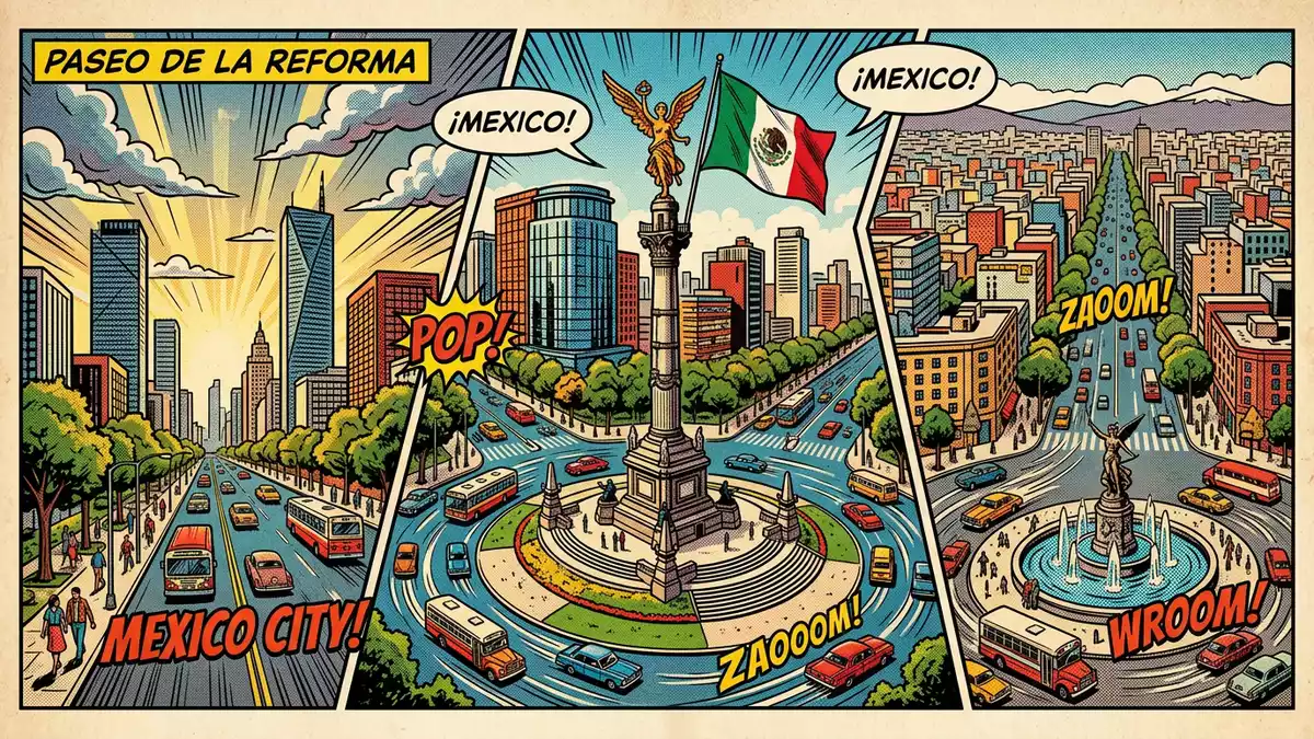
Paseo de la Reforma is the grand diagonal boulevard of Mexiko-Stadt, laid out in the nineteenth century under Emperor Maximilian I and later renamed for the liberal Reform era associated with President Benito Juárez. Modelled on broad European avenues and drawn as a direct line between Chapultepec Castle and the National Palace, it has grown into a long corridor of monuments, office towers and public spaces that carries much of Mexico City’s political and financial life.
A nineteenth-century imperial avenue reshaped by the republic
The origins of Paseo de la Reforma lie in the short-lived Second Mexican Empire of the 1860s, when Maximilian I of Mexico installed his court at Chapultepec Castle on a wooded hill to the west of the colonial centre.Second Mexican Empire Seeking a grand approach between his residence and the National Palace, he ordered a tree-lined avenue that cut diagonally across the grid of streets, following a route that connected the castle with the city’s core.route from Chapultepec Castle to the National Palace The layout was inspired by boulevards such as the Ringstraße in Vienna and the Champs-Élysées in Paris, giving Mexiko-Stadt a strongly European-style axis in the age of grand city-planning.modelled on European boulevards
When work began in the mid-1860s the avenue carried the name Paseo de la Emperatriz, honouring Empress Carlota of Belgium.Paseo de la Emperatriz Its character changed after Maximilian’s execution in 1867 and the restoration of the republic: the imperial promenade was progressively reclaimed and renamed Paseo de la Reforma in reference to the Reform laws of the mid-nineteenth century associated with Benito Juárez.renamed Paseo de la Reforma Later in the century President Sebastián Lerdo de Tejada widened the road, opened it more fully to the public and extended the planting, helping to turn an imperial route into a civic boulevard that reflected Mexico’s changing political landscape.Sebastián Lerdo de Tejada
A diagonal corridor of roundabouts, statues and towers
Paseo de la Reforma runs on a broad alignment linking the historic centre around the Zócalo with the green expanse of Chapultepec Park, and its scale becomes clear in the procession of roundabouts, monuments and fronting buildings along the way.grand diagonal boulevard Under President Porfirio Díaz in the late nineteenth and early twentieth centuries, new roundabouts known as glorietas were laid out on the axis and monumental sculptures such as the Angel of Independence were raised on their centres, giving the avenue a rhythm of circular plazas and vertical markers.Angel of Independence statue Around them, mansions and public buildings in European historicist styles lined the boulevard, signalling Mexico’s elite tastes of the Porfirian period.Porfirio Díaz era architecture
In the twentieth century, office blocks and towers were added along Paseo de la Reforma, introducing Art Deco buildings such as the National Lottery headquarters and, later, glass-fronted high-rises that helped define Mexiko-Stadt’s skyline.Art Deco and glass skyscrapers The boulevard now reads as a continuous corridor of civic spaces, monuments to independence heroes and indigenous rulers, and contemporary corporate towers, with tree-lined central reservations and pavements that frame the traffic lanes and provide long, straight views towards landmarks such as the Angel of Independence and Chapultepec Castle.statues of liberal heroes along the avenue
Experiencing Mexico City’s boulevard of history
Walking or driving along Paseo de la Reforma reveals its layered history in sequence, from the colonial core, through nineteenth-century roundabouts and memorials, to twentieth-century towers and the wooded slopes leading up to Chapultepec Castle.guide to Paseo de la Reforma The Angel of Independence, inaugurated in 1910 to mark the centenary of the start of Mexico’s war of independence, rises from one of the key roundabouts on the avenue, combining a tall column with a gilded statue and a base that incorporates remains of national figures.Angel inaugurated in 1910 Further along, fountains such as Diana the Huntress and additional memorials provide points of focus where the boulevard intersects with other major streets or shifts direction.
Towards its western end, Paseo de la Reforma meets the edges of Bosque de Chapultepec, one of the largest urban parks in Latin America, and the route rises towards the hill carrying Chapultepec Castle with its terraces and museums.Bosque de Chapultepec and castle Along the way, embassy buildings, cultural institutions and financial headquarters front the avenue, underlining its role as both a ceremonial street and a working artery of Mexiko-Stadt.
Visiting Paseo de la Reforma: what travellers from Western Europe should know
- Paseo de la Reforma runs between the historic centre of Mexiko-Stadt and Bosque de Chapultepec, and is accessible by metro lines serving stations near the National Palace and Chapultepec Park.
- The boulevard is a long, straight avenue with generous pavements, central reservations and several major junctions, so crossing points are spaced out and some roundabouts involve lengthy walks on foot.
- Towards Chapultepec the route rises onto gently sloping ground leading to the park and the hill carrying Chapultepec Castle, and some approaches include extended stairways and ramps.
- Spanish is the official language of Mexico and the currency is the Mexican peso.
- Entry requirements depend on your nationality; UK travellers can check the FCDO travel advice at gov.uk/foreign-travel-advice, Irish travellers the Department of Foreign Affairs at ireland.ie.
Searching for Paseo de la Reforma on social platforms
These links open searches for Paseo de la Reforma on each platform.
Frequently asked questions about Paseo de la Reforma
Where is Paseo de la Reforma in Mexiko-Stadt?
Paseo de la Reforma is a major avenue running diagonally between Mexiko-Stadt’s historic centre around the National Palace and the western district containing Bosque de Chapultepec and Chapultepec Castle.
What should visitors expect along the boulevard?
Visitors encounter a wide, multi-lane avenue with tree-lined pavements, roundabouts carrying monuments such as the Angel of Independence, and a mix of historic façades and modern office towers.
What makes Paseo de la Reforma distinctive among Mexico City’s streets?
Its diagonal alignment, nineteenth-century imperial origin under Maximilian I, later association with the Reform era, and concentration of monuments and towers give Paseo de la Reforma a character unlike Mexiko-Stadt’s regular street grid.


