
Parque Nacional Pico Bonito rising from La Ceiba to cloud forest
Published on 09/14/2026 at 08:23 | Editorial responsibility: Rafael Müller, Editor-in-Chief AD HOC NEWS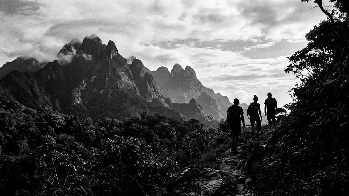
Parque Nacional Pico Bonito climbs inland behind La Ceiba, carrying travellers from Caribbean lowlands into steep rainforest slopes and misty mountain ridges in a single sweep of terrain. Established as a national park on 1 January 1987, it protects a band of the Cordillera Nombre de Dios where humid coastal forest gives way to cloud forest around the summit of Pico Bonito itself.Pico Bonito National Park Within sight of La Ceiba’s waterfront it offers one of Honduras’ most abrupt changes in altitude, rising from near sea level to more than 2,400 m (7,900 ft) and sheltering dense forest, gorges and fast rivers along the way.stretching from sea level to mountain peaks
From Caribbean coast to the Cordillera Nombre de Dios
Parque Nacional Pico Bonito occupies the northern flank of Honduras, stretching inland from the Caribbean coastal city of La Ceiba into the Cordillera Nombre de Dios mountain range.located on the northern area of Honduras The park’s core lies just south of La Ceiba, with the prominent peak of Pico Bonito rising above the town and forming a constant backdrop for the coastal plain.montaña cerca de la ciudad costera de La Ceiba Municipal boundaries tie the protected area to La Ceiba and neighbouring towns such as El Porvenir and San Francisco in the department of Atlántida, extending inland towards Olanchito in Yoro.sus límites abarcan el área de cuatro municipios
The park covers more than 100,000 hectares of protected and buffer zones, forming one of the larger continuous blocks of forest in Honduras.protected area covers more than 100,000 hectares Altitudes inside Parque Nacional Pico Bonito range from around 60 m above sea level near the coastal rivers to heights above 2,400 m on the highest ridges, creating a steep corridor between the Caribbean and interior highlands.altitude ranging between 60 and 2,480 meters Pico Bonito, the peak that lends its name to the park, reaches roughly 2,435 m (7,989 ft) and stands in the municipality of El Porvenir, close to La Ceiba.tiene una altura de 2,435 metros
Rainforest, gorges and layered ecosystems
Within its boundaries Parque Nacional Pico Bonito contains a sequence of ecosystems that follow the slope from humid lowland forest through premontane rainforest to cloud forest on the upper ridges.ranges in altitude from sea level to more than 2,000m Steep mountain sides are cloaked in dense tropical vegetation, while narrow gorges cut deep into the range and carry streams down towards the coastal plain.includes dense tropical rainforest, steep gorges The variation in altitude and moisture supports a high level of biodiversity, including many bird species recorded across the park’s valleys and slopes.at least 400 species of bird
Rivers play a central role in the landscape of Parque Nacional Pico Bonito. The Río Cangrejal forms part of the eastern boundary of the park and is known for its clear water and boulder-strewn channels descending towards La Ceiba.la cuenca del Rio Cangrejal, que forma el limite oriental del parque On the western side, forest trails near El Pino follow streams such as the Río Zacate, passing through secondary and primary forest as they climb away from the banana plantations of the coastal plain.Sendero del Rio Zacate Together these waterways link the park’s upper slopes with lowland communities and highlight its role in protecting regional water sources.
Entrances, trails and the park’s protected status
The Honduran government created Parque Nacional Pico Bonito as a protected area in 1987, recognising the need to safeguard its forest, rivers and wildlife.government established the protected area in August 1987 The legal designation as a national park dates from 1 January 1987, marking its inclusion in the country’s network of conservation areas.established on January 1, 1987 Management responsibilities involve government agencies and organisations such as the Fundación Parque Nacional Pico Bonito, which work with local communities around La Ceiba and El Porvenir.Fundación Parque Nacional Pico Bonito
Access to Parque Nacional Pico Bonito from La Ceiba usually follows two main corridors. One runs south-west from the city towards the community of El Pino, where roads leave the coastal highway and climb towards forest trailheads at the base of the mountain.entrando o bien por la comunidad de El Pino The other turns inland along the valley of the Río Cangrejal, crossing bridges such as the Puente Pico Bonito and following the river’s course between large boulders and forested slopes.Puente Pico Bonito From these entrances marked paths lead into the park’s buffer zone and, on longer routes, towards its core, offering a gradual transition from cultivated land into protected rainforest.
Visiting Parque Nacional Pico Bonito: what travellers from Western Europe should know
- Parque Nacional Pico Bonito lies inland from La Ceiba on Honduras’s northern Caribbean coast, reached by road corridors towards El Pino and up the Río Cangrejal valley from the city.
- Terrain inside the park is steep and varied, with forest paths that climb from lowland riverbanks to higher slopes; some trails involve sustained gradients and uneven, rocky sections.
- The official language is Spanish and the currency is the Honduran lempira, used in La Ceiba and surrounding communities that serve as gateways to the park.
- Entry requirements depend on your nationality; UK travellers can check the FCDO travel advice at gov.uk/foreign-travel-advice, Irish travellers the Department of Foreign Affairs at ireland.ie.
Searching for Parque Nacional Pico Bonito on social platforms
These links open searches for Parque Nacional Pico Bonito on each platform.
Frequently asked questions about Parque Nacional Pico Bonito
Where is Parque Nacional Pico Bonito in relation to La Ceiba?
Parque Nacional Pico Bonito lies just inland from La Ceiba on Honduras’s northern Caribbean coast, rising south of the city into the Cordillera Nombre de Dios.
What can visitors expect inside the park?
Visitors encounter dense tropical rainforest, steep mountain slopes, clear rivers such as the Río Cangrejal and a marked change in altitude from lowland forest to cloud forest.
What makes Parque Nacional Pico Bonito distinctive among Honduran parks?
The park stands out for its rapid rise from near sea level to high peaks above 2,400 m, its extensive forest cover and its position directly behind a major coastal city.


