
Parque Nacional Pico Bonito and the mountain behind La Ceiba
Published on 08/28/2026 at 13:57 | Editorial responsibility: Rafael Müller, Editor-in-Chief AD HOC NEWS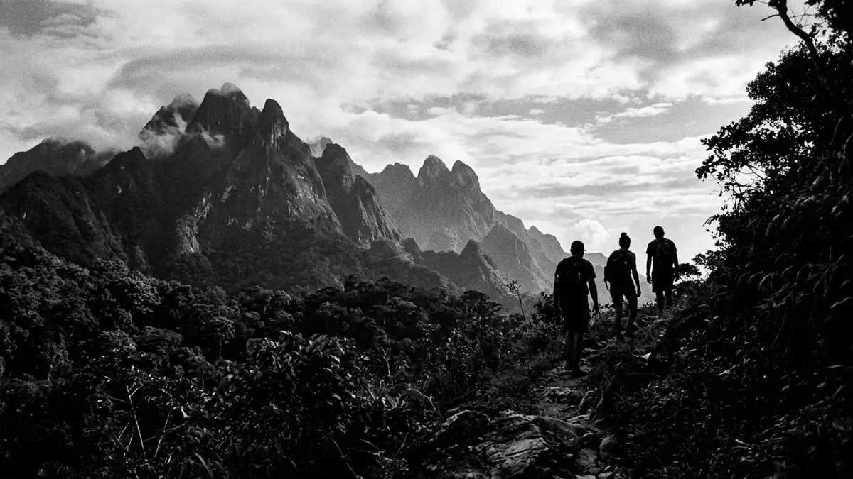
Parque Nacional Pico Bonito lies in northern Honduras, above La Ceiba and within the Cordillera Nombre de Dios. Its defining sight is Pico Bonito, a 2,435 m (7,989 ft) mountain that gives the park its name.2,435 m mountain The protected area stretches across lowland forest and higher slopes, so the landscape changes as the ground rises.
The park was established in 1987, placing it among Honduras’s better-known protected areas of the late twentieth century.established in 1987 Pico Bonito itself sits near El Porvenir, while La Ceiba remains the easiest reference point for finding the park on a map.
Pico Bonito and the Cordillera Nombre de Dios
The Cordillera Nombre de Dios gives the park its larger setting: a mountain chain running behind the Caribbean coast. Within that setting, Parque Nacional Pico Bonito combines dense forest, steep slopes and a summit that rises sharply above the coastal plain.
The name points to a mountain rather than a single viewpoint or built monument. That matters, because the park is read first as terrain: a long green mass, broken by ridges, streams and the bulk of Pico Bonito itself.Cordillera Nombre de Dios
Forest, water and high ground
Parque Nacional Pico Bonito is shaped by contrast between lower forest and higher mountain slopes. The park’s elevations range from humid low ground to a summit above 2,400 m, and that vertical spread gives it a strong physical identity.elevations range
Rivers and ravines are part of the same picture. The Cangrejal area forms one of the familiar access corridors from La Ceiba, and the park’s forests are part of the wider northern Honduran landscape around Atlántida and Yoro.Cangrejal area
Parque Nacional Pico Bonito and La Ceiba
Parque Nacional Pico Bonito sits close enough to La Ceiba to be read as part of the city’s wider setting, yet it is unmistakably a mountain park. The approach from the coast moves quickly from urban streets to forested hills and then into the park’s higher ground.
That change of scale is one of its strongest features. A visitor moves from a Caribbean port city to a landscape of steep slopes, river valleys and a named peak that dominates the skyline.Caribbean port city
Visiting Parque Nacional Pico Bonito: what travellers from Western Europe should know
- The park is associated with La Ceiba in Honduras and is reached from the city by road towards the Cangrejal side or towards El Pino. The mountain setting is the main feature, not a built entrance complex.
- The terrain includes steep slopes, river valleys and changes in altitude. Footpaths move through forest and uneven ground rather than flat promenades.
- The park lies in the Cordillera Nombre de Dios. That mountain range is part of the north Honduran coastal landscape and forms the broad backdrop to the site.
- Pico Bonito is the name of both the park and the central mountain. The peak stands at 2,435 m (7,989 ft), which gives the park its most recognisable profile.
Searching for Parque Nacional Pico Bonito on social platforms
These links open searches for Parque Nacional Pico Bonito on each platform.
Frequently asked questions about Parque Nacional Pico Bonito
Where is Parque Nacional Pico Bonito?
It is in northern Honduras, close to La Ceiba, within the Cordillera Nombre de Dios. The park centres on the mountain of Pico Bonito.
What does a visit involve?
It involves mountain scenery, forest and river valleys rather than a single built attraction. The ground rises quickly, and the park reads as a landscape of slopes and watercourses.
What makes it distinctive?
The park is named after a 2,435 m mountain that dominates the area. Its combination of coastal location, high relief and forested terrain gives it a strong sense of place.


