
Parque Nacional Manuel Antonio’s beaches and forest edge
Published on 08/30/2026 at 13:47 | Editorial responsibility: Rafael Müller, Editor-in-Chief AD HOC NEWS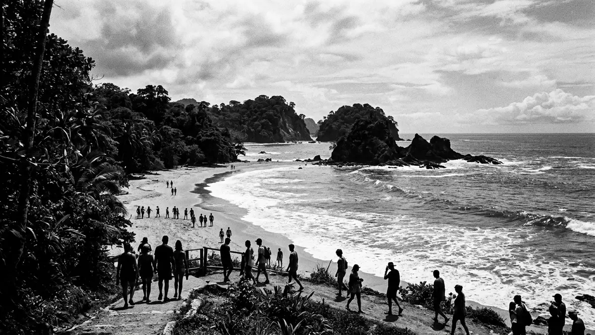
Parque Nacional Manuel Antonio near Quepos brings together beaches, forest and headlands in a compact coastal landscape. Established by Law No. 5100 in 1972, it sits on Costa Rica’s central Pacific coast and remains closely tied to Quepos and Puntarenas.Law No. 5100 central Pacific coast
Quepos, beaches and a protected coastal edge
The park lies south of Quepos, on the Pacific shoreline of Costa Rica. Its setting combines lowland coastal terrain, sandy stretches and wooded slopes, with the sea forming part of the park’s identity.south of Quepos
The protected area was created in 1972, and the name Manuel Antonio has long been tied to the beaches and the district that surrounds them. The legal declaration fixes the place in the conservation history of Costa Rica, while the landscape keeps its strong coastal character.1972 Quepos
Law, land and the park’s national status
The park’s formal status comes from Costa Rican legislation, which names it directly and sets its boundaries in law. That legal frame matters because Manuel Antonio is not just a scenic bay, but a declared national park with defined territory.declared national park
The surrounding coast gives the park its character: island views, exposed shoreline and vegetation that meets the sea in short distances. The landscape is defined by contrast between open water, beach and tree cover rather than by any single monument.open water
From coastal reserve to familiar national park
Manuel Antonio’s place in Costa Rica’s park system is rooted in the early 1970s, a period that produced several conservation measures across the country. The name appears in both the park law and later legal reforms, which keeps the designation stable in public records.Law No. 5100 later reforms
For visitors, the main impression is the closeness of different coastal elements. Forest, sand and sea sit within the same protected edge, and that combination gives the park its lasting appeal as a coastal landscape rather than a single-viewpoint stop.
Visiting Parque Nacional Manuel Antonio: what travellers from Western Europe should know
- The park is reached from Quepos on Costa Rica’s central Pacific coast. VisitCostaRica names Quepos as the nearest reference point and links the park with Route 27 and Route 34 approaches.
- The terrain mixes beach, coastal vegetation and uneven paths. Expect a national park landscape where shoreline and wooded slopes meet closely.
- Spanish is the official language and the currency is the Costa Rican colón.
- Entry requirements depend on your nationality; UK travellers can check the FCDO travel advice at gov.uk/foreign-travel-advice, Irish travellers the Department of Foreign Affairs at ireland.ie.
Searching for Parque Nacional Manuel Antonio on social platforms
These links open searches for Parque Nacional Manuel Antonio on each platform.
Frequently asked questions about Parque Nacional Manuel Antonio
Where is Parque Nacional Manuel Antonio?
It lies on Costa Rica’s central Pacific coast, south of Quepos in Puntarenas. The park forms part of the country’s protected coastal landscape.
What does a visit involve?
The park combines beaches, forested slopes and shoreline, all within a compact protected area. The setting is coastal rather than mountainous, with short distances between land and sea.
What makes it distinctive?
Its combination of national-park status, named legal foundation and direct contact with the Pacific coast defines it. The park is closely associated with Quepos and the Manuel Antonio shoreline.


