
Parque nacional de Timanfaya and Lanzarote’s lava fields
Published on 08/29/2026 at 09:14 | Editorial responsibility: Rafael Müller, Editor-in-Chief AD HOC NEWS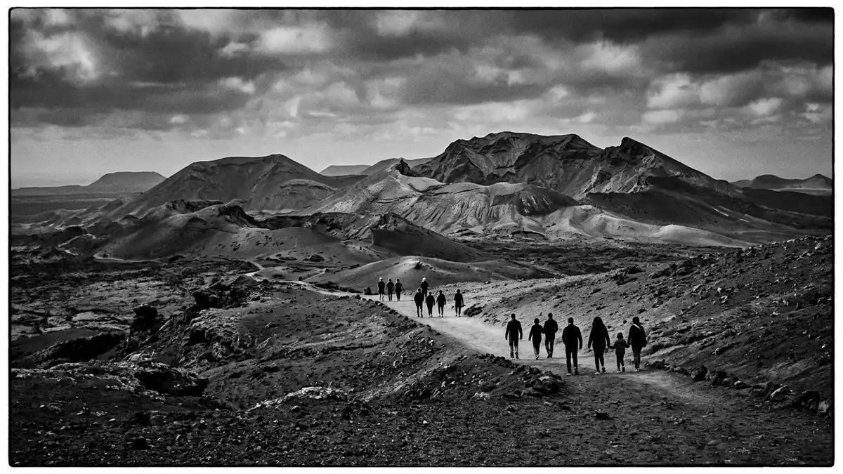
Parque nacional de Timanfaya on Lanzarote is a volcanic landscape of black cones, lava fields and craters. The park lies in the centre-west of the island and was declared in 1974.
Timanfaya’s lava fields and volcanic cones
The park is defined by the eruptions of 1730 to 1736, with later volcanic activity in 1821. Its core includes the Montañas del Fuego, a cluster of craters and cones that gives the landscape its rough outline.1730 to 1736
Timanfaya is one of Lanzarote’s clearest volcanic scenes: lava sheets, cinder cones and bare, mineral ground dominate the view. The park’s geology is the feature that gives it its identity, and the land reads as a record of repeated eruptions rather than of settlement.centre-west of the island
Parque nacional de Timanfaya in Lanzarote’s west
The national park covers more than 51 square kilometres and sits between Yaiza and Tinajo. It forms part of the volcanic southwest of Lanzarote and belongs to the Canary Islands archipelago.
Chinero, Tao and Tinguatón are among the named volcanic features within the park. The landscape also includes a broad lava field that stretches across much of the western side of the island.Montañas del Fuego
Declarations, names and geological status
Parque nacional de Timanfaya was declared a national park in 1974. The site is also known for its recent volcanism, which remains visible in the rock, ash and lava forms across the park.declared a national park in 1974
The Spanish name is used locally, while the English form keeps the same place identity. In Timanfaya, the volcanoes themselves are the main monument, and the park’s name points directly to that landscape.Parque Nacional de Timanfaya
Visiting Parque nacional de Timanfaya: what travellers from Western Europe should know
- Parque nacional de Timanfaya lies in the centre-west of Lanzarote, in the Canary Islands. Yaiza and Tinajo are the municipalities most closely associated with the park.
- The terrain is volcanic and exposed. Lava, ash and cinder cones dominate, so the place reads as open, rough ground rather than a conventional park.
- The park’s geological core includes the Montañas del Fuego and named volcanoes such as Chinero and Tinguatón. Their forms are visible across the western side of the island.
- English is widely used in travel material for Lanzarote, and the park’s official information is also available in English.
Searching for Parque nacional de Timanfaya on social platforms
These links open searches for Parque nacional de Timanfaya on each platform.
Frequently asked questions about Parque nacional de Timanfaya
Where is Parque nacional de Timanfaya?
It is in the centre-west of Lanzarote, in the Canary Islands. The park lies between Yaiza and Tinajo.
What does a visit involve?
The landscape is dominated by lava, ash and volcanic cones. The place is about geology and exposed terrain rather than buildings.
What makes it distinctive?
Its landscape comes from the eruptions of 1730 to 1736, with later volcanic activity in 1821. The Montañas del Fuego and the surrounding lava fields give it its character.


