
Parque Nacional Cotopaxi and the high plains east of Latacunga
Published on 09/07/2026 at 22:36 | Editorial responsibility: Rafael Müller, Editor-in-Chief AD HOC NEWS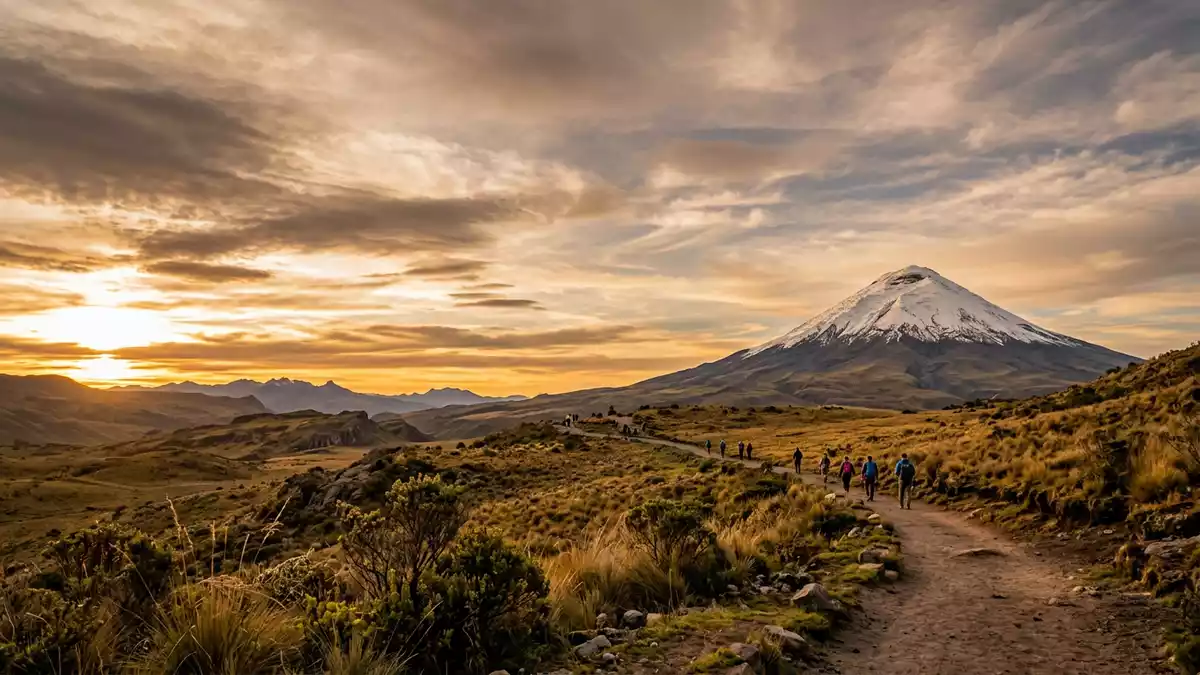
Parque Nacional Cotopaxi in central Ecuador is a high Andean protected area east of Latacunga, wrapped around the volcanic cone of Cotopaxi and neighbouring peaks. Created as a national park on 11 August 1975, it safeguards páramo grassland, lagoons and lava fields across parts of Cotopaxi, Pichincha and Napo provinces.
A national park built around an Andean volcano
Parque Nacional Cotopaxi is structured around Cotopaxi, an active stratovolcano that rises to about 5,897 m (19,347 ft) above sea level within the park boundary.an active stratovolcano The protected area lies in Ecuador’s central Sierra, between the cities of Quito and Latacunga, with its limits following the Cotopaxi and Rumiñahui massifs and stretching towards the basin of the Pita River.limits following the Cotopaxi and Rumiñahui massifs
The park was formally established as a national park on 11 August 1975 by an interministerial agreement that incorporated it into Ecuador’s system of protected areas.created on 11 August 1975 Parque Nacional Cotopaxi covers tens of thousands of hectares of highland terrain, with elevations ranging roughly from 3,400 m (11,155 ft) to the summit area of Cotopaxi around 5,897 m (19,347 ft).elevations ranging from about 3,400 m to 5,897 m
Páramo plains, lagoons and volcanic landscapes
One of the defining features of Parque Nacional Cotopaxi is its wide expanse of páramo, the high Andean grassland that surrounds Cotopaxi and the lower slopes of Rumiñahui. Within this landscape lie lava fields and ash deposits that record Cotopaxi’s eruptions, together with shallow valleys carved by streams descending towards the Pita River basin.high Andean grassland with volcanic deposits
Lagunas punctuate the park, including high-altitude lakes that sit on the plains below Cotopaxi’s cone and reflect the snow-covered summit in clear weather.high-altitude lakes below the cone The páramo vegetation includes hardy grasses and cushion plants adapted to the cool, thin air of the central Andes. Wildlife recorded in the park ranges from Andean foxes and deer to highland bird species such as the Andean condor, which use the rising air around the volcano’s slopes.wildlife such as condors, foxes and deer
High-altitude approaches from Latacunga and Quito
Parque Nacional Cotopaxi lies along the corridor of the Pan-American Highway that links Quito with Latacunga, with access routes signposted from this road towards control points such as Caspi and northern entrances near Machachi.access routes from the Pan-American Highway From Latacunga, the approach climbs onto the Andean plateau, where tracks and roads lead to parking areas near Cotopaxi’s lower slopes and to viewpoints over the surrounding grassland.
Within the park, altitudes above 3,400 m (11,155 ft) make every walk a high-altitude experience, even before any ascent towards the volcano’s refuges and glaciers. The high plains around Cotopaxi provide space for day walks on gentle tracks, while more demanding routes climb towards refuges such as the Jose F. Ribas shelter that stands high on the volcanic cone.refuge on the volcanic cone
Visiting Parque Nacional Cotopaxi: what travellers from Western Europe should know
- Parque Nacional Cotopaxi lies in central Ecuador between Quito and Latacunga, with road access from the Pan-American Highway towards control points such as Caspi and northern entrances near Machachi.
- The terrain inside the park is high-altitude Andean landscape, with approaches and trails starting above 3,400 m (11,155 ft) and rising towards Cotopaxi’s volcanic slopes.
- Within the park, paths and tracks cross páramo plains, lava fields and shallow valleys, so sturdy footwear and readiness for uneven volcanic ground are important.
- The official language is Spanish and the currency is the US dollar.
- Entry requirements depend on your nationality; UK travellers can check the FCDO travel advice at gov.uk/foreign-travel-advice, Irish travellers the Department of Foreign Affairs at ireland.ie.
Searching for Parque Nacional Cotopaxi on social platforms
These links open searches for Parque Nacional Cotopaxi on each platform.
Frequently asked questions about Parque Nacional Cotopaxi
Where is Parque Nacional Cotopaxi located in relation to Latacunga?
Parque Nacional Cotopaxi lies east of Latacunga in Ecuador’s central Sierra, with the park boundary including the Cotopaxi volcano north-east of the city.
What should visitors expect on a first visit to Parque Nacional Cotopaxi?
Visitors encounter high Andean grasslands, lagoons and volcanic terrain above 3,400 m (11,155 ft), together with views of Cotopaxi’s snow-covered cone when conditions are clear.
What makes Parque Nacional Cotopaxi distinctive among Ecuador’s protected areas?
The park combines páramo plains, lagoons and wildlife with the presence of Cotopaxi, one of Ecuador’s highest active volcanoes rising to about 5,897 m (19,347 ft).


