
Parque Nacional Cotopaxi and the Andean cone above Latacunga
Published on 08/29/2026 at 06:31 | Editorial responsibility: Rafael Müller, Editor-in-Chief AD HOC NEWS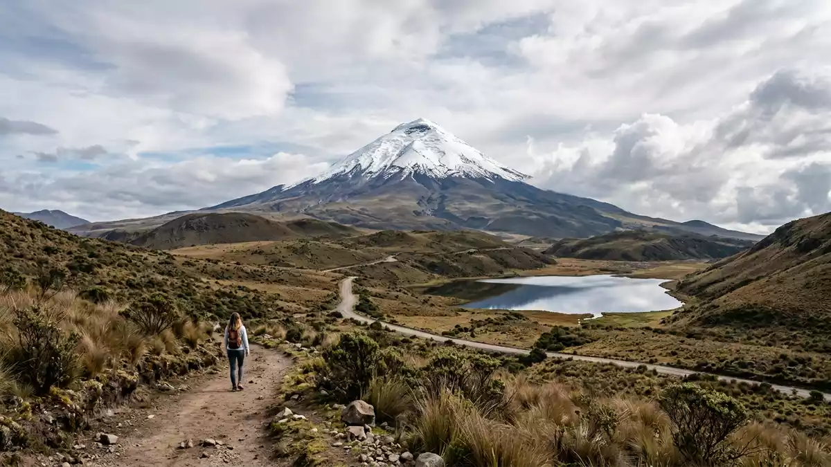
Parque Nacional Cotopaxi centres on the great cone of Cotopaxi, a glacier-capped stratovolcano in Ecuador’s central Andes. Created in 1975, the park spreads across high páramo, lava fields and highland basins south-east of Quito.Created in 1975glacier-capped stratovolcano
Cotopaxi’s cone and high plains
The volcano rises to 5,897 m (19,347 ft), a figure that places it among Ecuador’s highest summits and gives the park its dominant vertical form.5,897 m Its shape is visible from the surrounding uplands as a broad, symmetrical cone topped by ice and ringed by dark volcanic slopes.
That profile sits inside a wider Andean landscape of páramo grassland, ash-coloured ground and scattered lagoons. The contrast between snow, rock and open plain gives the park its clear physical character, with Cotopaxi as the fixed point in every direction.
Land, rock and other volcanoes
The protected area also includes the flanks of other volcanic landforms, including Rumiñahui and Morurco, which rise beside Cotopaxi in the same Andean setting. The park extends across the provinces of Cotopaxi, Pichincha and Napo, linking mountain scenery with a broad central highland region.three provinces
At ground level, the place is a study in elevation and exposure. The visitor sees open terrain, volcanic soil and long views rather than dense forest, and the landscape remains governed by altitude and bare slopes.
Cotopaxi in Ecuador’s mountain history
Cotopaxi is one of the country’s best-known active volcanoes and part of a long historical record that has shaped the region around Latacunga. Its summit first drew documented European climbers in the nineteenth century, when Wilhelm Reiss and Ángel Escobar reached it in 1872.Wilhelm Reiss1872
The name itself belongs to the Andean world that surrounds the mountain, and the park preserves that relation between volcano, high pasture and settlement below. Latacunga lies to the south-west of the park, while the cone remains the visual and geological centre of the area.
Visiting Parque Nacional Cotopaxi: what travellers from Western Europe should know
- The park lies in central Ecuador, with access from the Pan-American corridor towards Latacunga and Quito. The main approach runs into the highlands, where the road gives way to open mountain terrain.
- The ground is high and exposed, with strong elevation changes and long stretches of bare volcanic landscape. Paths and tracks cross pasture, ash and rock rather than shaded woodland.
- The park includes Cotopaxi itself and the neighbouring volcanic landforms of Rumiñahui and Morurco. The broader setting is the Ecuadorian Andes, not a lowland valley.
- English is not an official language here. The official language is Spanish and the currency is the United States dollar.
- Entry requirements depend on your nationality; UK travellers can check the FCDO travel advice at gov.uk/foreign-travel-advice, Irish travellers the Department of Foreign Affairs at ireland.ie.
Searching for Parque Nacional Cotopaxi on social platforms
These links open searches for Parque Nacional Cotopaxi on each platform.
Frequently asked questions about Parque Nacional Cotopaxi
Where is Parque Nacional Cotopaxi?
Parque Nacional Cotopaxi is in central Ecuador, around Cotopaxi volcano and the highlands south-east of Quito. It reaches into the provinces of Cotopaxi, Pichincha and Napo.
What does a visit involve?
The place is defined by altitude, open terrain and volcanic ground. Expect broad views, sparse vegetation and the presence of other volcanic forms around the main cone.
What makes Parque Nacional Cotopaxi distinctive?
The park is shaped by Cotopaxi itself, a 5,897 m stratovolcano with an ice-covered summit. Its combination of páramo, lava and high Andean relief gives it a striking physical identity.


