
Parque Nacional Cahuita’s coral coast and forest edge
Published on 09/14/2026 at 11:17 | Editorial responsibility: Rafael Müller, Editor-in-Chief AD HOC NEWS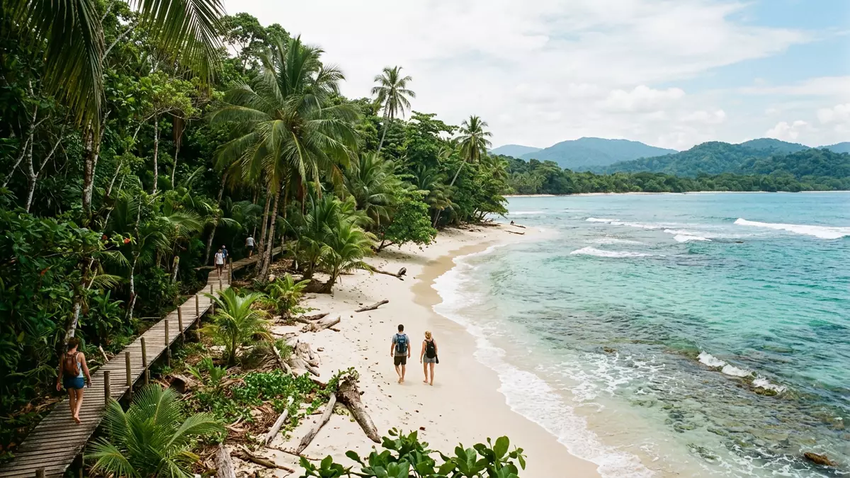
Parque Nacional Cahuita stretches along Costa Rica’s southern Caribbean coast beside the town of Cahuita, where beach, lowland forest and marine habitat meet in a single protected strip. It belongs to the Caribbean La Amistad Conservation Area and was established on 27 December 1982.
A coastal park of reef, sand and forest
The park protects both land and sea, including beaches, lowlands and a marine area with coral reefs. Its documented area combines 10.679 km² of land with 224.00 km² of marine waters.
That mix gives Cahuita a broad visual range within one boundary. The shoreline is backed by forest, while the reef lies offshore in protected water, and the park remains tied to the settled edge of Cahuita itself.
Established in the 1980s, with a longer park history
Parque Nacional Cahuita was formally established in 1982, after an earlier protected status in the 1970s. The park is administered within SINAC, Costa Rica’s national conservation system.
That sequence matters because the place is not a recent creation. It carries the layered history of a coastal protected area that moved from monument status to national park status while keeping its relationship with Cahuita.
Reefs, turtles and the Caribbean setting
The marine section is known for coral reefs, and the park also serves as nesting ground for sea turtles. On land, the lowland setting supports beach and forest species rather than high mountain vegetation.
The park’s character comes from that close combination of reef and coast. The Caribbean location, the marine waters and the forest edge make the place read as both seascape and woodland, not one or the other.
Visiting Parque Nacional Cahuita: what travellers from Western Europe should know
- The park lies beside Cahuita in Limón Province on Costa Rica’s southern Caribbean coast. It can be reached from the town on foot, and road access also comes from the north and south.
- The ground is a coastal mix of sand, lowland terrain and marine shoreline. The reef sits offshore, while the land side is level enough to connect directly with the town.
- The park has two entrances, including the town-side Kelly Creek entrance and the Puerto Vargas sector to the south.
- The official language is Spanish and the currency is the Costa Rican colón. Entry requirements depend on your nationality; UK travellers can check the FCDO travel advice at gov.uk/foreign-travel-advice, Irish travellers the Department of Foreign Affairs at ireland.ie.
- These links open searches for Parque Nacional Cahuita on each platform.
Searching for Parque Nacional Cahuita on social platforms
Frequently asked questions about Parque Nacional Cahuita
Where is Parque Nacional Cahuita?
It lies on Costa Rica’s southern Caribbean coast beside Cahuita in Limón Province. The park forms part of the Caribbean La Amistad Conservation Area.
What does a visit reveal?
It shows a coastal park of beach, lowland forest and coral reef. The land and marine areas sit together in one protected setting.
What makes it distinctive?
The combination of shoreline, reef and forest is the park’s defining feature. Its long-established status and direct link with Cahuita add a strong historical layer.


