
Pamir Highway through Chorugh and the heart of Tajikistan
Published on 09/14/2026 at 13:59 | Editorial responsibility: Rafael Müller, Editor-in-Chief AD HOC NEWS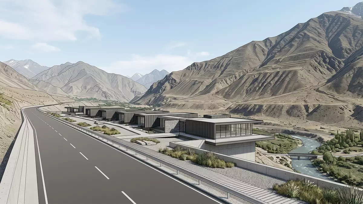
The Pamir Highway is best known as a long, high?altitude road across Tajikistan, but at Chorugh it becomes a compact landscape where mountains, rivers and daily life meet in one place. Here the route passes through the capital of Gorno?Badakhshan Autonomous Province, creating a rare moment on this trans?boundary road where a small city, steep valleys and the main artery of the region all share the same limited space.capital of Gorno-Badakhshan
Chorugh: a mountain town built along the highway
Chorugh, often written Khorog in English, lies in the south?western Pamirs of Tajikistan at an elevation of around 2,200 m (7,200 ft), spread along the valley where the Ghunt River meets the Panj.elevation of around 2,200 m The Pamir Highway runs through the centre of the town, following the Panj valley from the west before turning east up the Ghunt valley, so the main road, riverbanks and clusters of housing sit closely together.leaves the Panj valley and heads east
Chorugh serves as an administrative centre for Gorno?Badakhshan and for the Shughnon District, giving the town a role that reaches far beyond its compact footprint.administrative centre of Gorno-Badakhshan For travellers on the Pamir Highway this translates into a place where transport routes, markets and institutional buildings are concentrated, framed on all sides by steep slopes that rise from the valley floor.
Following the M41 through rivers and valleys
The Pamir Highway forms part of the M41 route that crosses Central Asia through the Pamir mountains, connecting Tajikistan and Kyrgyzstan across high passes and long valleys.M41 route that crosses Central Asia From the west the highway reaches Chorugh after running eastwards from Dushanbe, crossing major rivers such as the Kafirnigan, Vakhsh and Bartang before arriving in the Panj valley.crossing the Kafirnigan, Vakhsh and Bartang
Beyond Chorugh the road continues east for roughly 310 km to Murghab in the higher Pamirs, eventually reaching the Ak?Baital Pass at about 4,655 m (15,272 ft), one of the highest points on an international highway.second highest international highway This long line of asphalt and gravel is usually described under its formal designation of M41, yet on the ground near Chorugh it reads less as a through?route and more as a lived?in street that shares space with river terraces, gardens and small neighbourhoods.
Chorugh’s role on the Pamir Highway
Chorugh sits near the border with Afghanistan, and the Pamir Highway passes through the town before climbing towards Murghab, China and Kyrgyzstan via the Alay Valley and Osh.passes through Khorog towards Murghab Many transport routes within Gorno?Badakhshan either pass through or radiate from Chorugh, which makes the town a practical hub along the highway for vehicles heading north towards Dushanbe or east into higher, more remote sections of the Pamirs.
Across guide material the stretch between Osh in Kyrgyzstan and Dushanbe in Tajikistan is commonly framed as the classic Pamir Highway journey, with Chorugh marking a point roughly in the middle of this long traverse.approximately in the middle of the Pamir Highway In Chorugh the route splits, one branch running north through a deep mountain gorge towards Murghab and another following the southern line into the Wakhan Corridor, where villages and historical sites sit on river terraces above the valley.
Visiting Pamir Highway: what travellers from Western Europe should know
- The Pamir Highway reaches Chorugh after crossing Tajikistan from Dushanbe, and from Chorugh road traffic continues towards Murghab, the Alay Valley and Osh along the same M41 route.
- The terrain around Chorugh is high?mountain valley landscape, with steep slopes rising from the Panj and Ghunt rivers and sections of road that curve along riverbanks and through narrow gorges.
- Chorugh lies in Tajikistan near the border with Afghanistan, in a region where road conditions can vary with season and elevation; travellers encounter a mixture of paved sections and rougher mountain surfaces.
- The town functions as a regional centre in Gorno?Badakhshan, so travellers find local services concentrated along the highway corridor as it passes through the centre of Chorugh.
- The official language is Tajik and the currency is the Tajik somoni, used throughout the shops and services along the highway in Chorugh and the wider Gorno?Badakhshan region.
Searching for Pamir Highway on social platforms
These links open searches for Pamir Highway on each platform.Frequently asked questions about Pamir Highway
Where is the Pamir Highway in relation to Chorugh?
The highway runs directly through Chorugh in the south?western Pamirs of Tajikistan, following the Panj valley before turning east up the Ghunt valley.
What should travellers expect when passing Chorugh on the Pamir Highway?
Travellers encounter a compact mountain town at around 2,200 m (7,200 ft), where the main road, rivers and local services share the same narrow valley floor.
What makes Chorugh a distinctive stop along the Pamir Highway?
Chorugh is the capital of Gorno?Badakhshan Autonomous Province and a transport hub near the Afghan border, with the Pamir Highway branching north and south towards different sections of the Pamirs.


