
Otaru Unga: stone warehouses and water in northern Hokkaido
Published on 09/01/2026 at 06:46 | Editorial responsibility: Rafael Müller, Editor-in-Chief AD HOC NEWS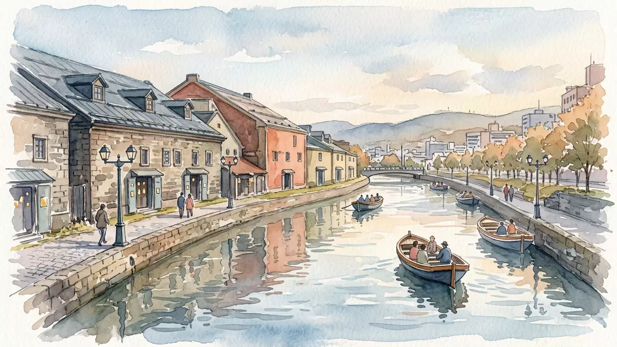
Otaru Unga, known in English as the Otaru Canal, runs through the harbour district of Otaru on the coast of Hokkaido and threads water between rows of historic warehouses and the town streets. Completed in 1923, it preserves a rare slice of early twentieth-century port infrastructure, reshaped into a linear public space where stone, brick and water read as clearly as the ships and cargoes that once defined it.
The canal that shaped Otaru’s waterfront
Otaru Unga was constructed in the early twentieth century to serve small ships carrying cargo between larger vessels moored in Otaru’s harbour and the warehouses that lined the town’s shore.Completed in 1923, the canal allowed barges to move along a sheltered inland waterway parallel to the coast rather than relying entirely on open docks.Otaru Unga was a central part of the city’s busy port in the first half of the twentieth century and its alignment still follows the line of the historic quay.
The waterway extends for about 1,140 m (3,740 ft) through the harbour area, with stone warehouses and port buildings facing the canal on one side and streets such as Minatomachi on the other.The canal’s length and continuous quayside promenade create a walkable axis that links the historic port to the rest of the city. Although modern docks elsewhere in Otaru now handle larger vessels, the canal’s water surface and embankments remain as a visible reminder of the era when coastal shipping underpinned Hokkaido’s trade.
Warehouses, stone and gas lamps along the water
One of Otaru Unga’s defining features is the sequence of stone and brick warehouses along its banks. Many of these warehouses were built by merchant families and shipping firms on reclaimed land after the canal took shape, their walls facing the water to give direct access from barges to storage floors.The warehouses lining Otaru Unga form some of the most characteristic views of the city, their robust masonry and simple rooflines reflecting the canal in all seasons.
Later in the twentieth century, as cargo handling shifted to modern port facilities, many of these buildings changed function. Inside, several former warehouses now house restaurants, shops and museums, while others serve as cultural venues or galleries.A citizens’ movement supported the canal’s restoration and helped protect its warehouses from demolition, so the waterfront presents a continuous frontage of historic structures rather than isolated remnants. Along the canal edge, a paved promenade runs beside the water, punctuated by old-fashioned gas lamps that trace the route and echo the industrial age in which the canal was first lit.
From working waterway to promenade and festival setting
Although Otaru Unga once carried barges heavily loaded with cargo, its role has shifted towards public access and waterfront leisure. A cobbled path follows the curve of the canal, and the combination of masonry walls, quayside planting and the broad water surface gives the district a clear, linear focus for walking and photography.Sections of the canal have been preserved alongside road infrastructure, turning former working quays into a continuous walking route lined with gas lamps. Cruise boats also operate along the waterway, boarding near bridges such as Chuo Bridge, so visitors can see the canal and its warehouses from the level of the water.
Seasonal events make particular use of this linear setting. In winter, the canal is associated with Otaru’s Snow Light Path, when lanterns and small lights trace patterns along the waterfront and reflect in the water. At other times of year, artists set up along the promenade with paintings, photographs and crafts, using the canal’s stone embankments and moored boats as backdrops. Because the canal sits close to the town streets, it links directly to other parts of Otaru’s historic centre, making it easy to read the relationship between the port, the commercial district and the hillside neighbourhoods above.
Visiting Otaru Unga: what travellers from Western Europe should know
- Otaru Unga runs through Minatomachi in Otaru on the coast of Hokkaido; JR Otaru Station on the Hakodate Line is the nearest main rail stop.
- The canal-side promenade is level and paved, with quayside sections, steps down to boat landings and stone surfaces that can feel uneven underfoot.
- Otaru lies on Hokkaido’s northern shore, where winters bring cold temperatures and snow; the canal’s warehouses and gas lamps remain visible against the frozen waterfront.
- The official language is Japanese and the currency is the yen.
Searching for Otaru Unga on social platforms
These links open searches for Otaru Unga on each platform.
Frequently asked questions about Otaru Unga
Where is Otaru Unga located?
Otaru Unga runs through the harbour district of Otaru in Hokkaido, Japan, with its main section beside streets such as Minatomachi close to JR Otaru Station.
What can visitors expect along the canal?
Visitors find a level waterfront promenade beside a narrow canal, backed by historic stone and brick warehouses, cruise boat landings and gas lamps that line the quayside.
What makes Otaru Unga distinctive among Japanese port areas?
Its preserved early twentieth-century canal and continuous row of warehouses create a clear corridor of industrial heritage, reshaped into a walkable, stone-lined waterfront within an active port city.


