
Okavango Delta as Botswana’s inland labyrinth of water and sand
Published on 08/27/2026 at 19:59 | Editorial responsibility: Rafael Müller, Editor-in-Chief AD HOC NEWS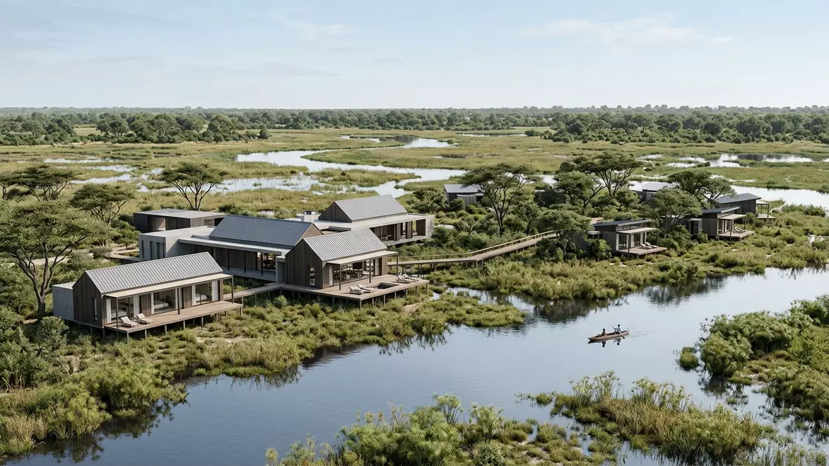
The Okavango Delta in northern Botswana is a rare inland wetland where a major African river dissolves into the sands of the Kalahari instead of reaching the sea. Centred north of Maun, this wide fan of channels, floodplains and islands forms one of the continent’s most recognisable river landscapes and has been inscribed as a UNESCO World Heritage Site since 2014.
An inland delta in the Kalahari Basin
The Okavango Delta lies in the Ngamiland region of Botswana, within the broader Kalahari Basin, where the Okavango River spreads into a low-gradient alluvial fan. The river rises in the highlands of Angola, then crosses Namibia before entering Botswana as a single channel that continues south-east and breaks into a maze of waterways and swamps.The Okavango River reaches a tectonic trough and the minimal change in elevation encourages water to fan out across the desert floor rather than cut a single downstream course.
The delta’s geomorphology is shaped by subtle variations in height, faults and sediment. A narrow “Panhandle” section upstream marks the initial spread of the river, after which the waters flood permanent marshes and seasonally inundated plains that together cover several thousand square kilometres in the north-west of Botswana.The World Heritage property encompasses just over two million hectares, with an additional buffer that extends the protected mosaic of channels, islands and grassland even further into the Kalahari.
Water, islands and seasonal rhythms
At the heart of the Okavango Delta is a pulsing cycle in which water movements and vegetation create a shifting patchwork of habitats. Rain falling in the Angolan highlands takes months to travel down the Okavango River and arrive in Botswana, and as it reaches the fan it spills over the floodplains and into a web of lagoons, channels and swamps.The river discharges large volumes of water into the delta each year, supporting an extensive permanent wetland alongside a wider belt of seasonal flooding that advances and retreats across the sandy terrain.
Dry land within the delta appears in the form of countless islands rising from the wetlands. Some islands are barely larger than a termite mound, while others stretch for many kilometres and carry woodland, savanna and sandveld tongues that reach in from the surrounding desert.Chief’s Island is one of the best-known larger islands, formed along a tectonic line and standing slightly higher than the floodplains around it. Together, the islands and channels create an intricate labyrinth where open water, reeds, papyrus beds and tree-lined ridges sit side by side.
Maun, Moremi and the human approach
Although the Okavango Delta is a predominantly wild landscape of water and sand, its southern edge connects closely with the town of Maun, which serves as the principal gateway for visitors. Maun sits near the Thamalakane fault, where the waters dispersing across the delta reach the edge of the basin and begin to fade into the drier lands of central Botswana.The town has developed as a logistical centre for flights and vehicle access into the surrounding wetlands and reserves.
Within the delta itself, Moremi Game Reserve forms a major conservation area that includes large tracts of permanent swamp, seasonal floodplain and dry islands. The reserve lies roughly in the central-eastern part of the delta and brings together river channels, lagoons and woodland into a compact area of protected terrain.Road and light-aircraft routes link Maun with Moremi’s access points, while other conservation areas and community-managed concessions extend across the northern and western parts of the wetland system.
Visiting Okavango Delta: what travellers from Western Europe should know
- The Okavango Delta lies in northern Botswana, with Maun on its southern fringe acting as the main access town; flights and road links connect Maun with the wider region.
- Terrain within the delta ranges from swamp and flooded plains to firm islands; travel between lodges, camps and airstrips frequently involves small aircraft, boats or high-clearance vehicles.
- The wetland lies in a semi-arid climatic zone where seasonal flooding and strong sun can coincide; walking on islands and moving between vehicles and boats involves uneven ground, mud and sand.
- The Okavango Delta is in Botswana, where the official language is English and the currency is the pula.
- Entry requirements depend on your nationality; UK travellers can check the FCDO travel advice at gov.uk/foreign-travel-advice, Irish travellers the Department of Foreign Affairs at ireland.ie.
Searching for Okavango Delta on social platforms
These links open searches for Okavango Delta on each platform.
Frequently asked questions about Okavango Delta
Where is the Okavango Delta?
The Okavango Delta is in northern Botswana, within the Ngamiland region, with the town of Maun near its southern edge.
What kind of landscape does the Okavango Delta offer?
The delta combines river channels, lagoons, permanent marsh, seasonal floodplains and islands that rise from the wetlands and sandveld of the Kalahari Basin.
What makes the Okavango Delta distinctive among river deltas?
The Okavango Delta is an inland delta whose waters end in desert sands, and it is recognised as a UNESCO World Heritage Site for its intact wetland system.


