
National Mall, the grand axis of Washington, D.C.
Published on 09/18/2026 at 21:14 | Editorial responsibility: Rafael Müller, Editor-in-Chief AD HOC NEWS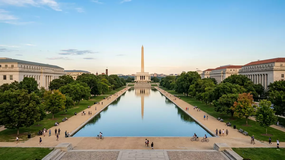
The National Mall in Washington, D.C. is a broad ceremonial landscape that draws a straight line through the heart of the United States capital, linking the Capitol, the Washington Monument and the great memorials beside the Potomac River. It forms the central axis of the federal city first laid out in 1791 by the French-born engineer Pierre Charles L’Enfant, whose plan set out a grand avenue between the seat of Congress and the riverfront.L’Enfant’s 1791 vision The Mall’s long lawns are framed by rows of trees and flanked by museums and government buildings, making the space both a national stage and a daily urban park.
A two-mile greensward framed by monuments
Seen on a map, the core of National Mall stretches for around 3 km (about 2 miles) from the U.S. Capitol at its eastern end to the Lincoln Memorial at the western end, with the Washington Monument rising close to its centre.Length of about 3 km Along most of this axis the space reads as a broad greensward bounded by Constitution Avenue to the north and Independence Avenue to the south, with cross streets dividing the lawns into a sequence of panels.
Between the Capitol grounds and the Washington Monument, the Mall takes the form of a landscaped grass lawn lined on both sides by tree groves and edged with gravel paths for walking.Description of the lawn and tree groves West of the monument the axis continues through West Potomac Park towards the Reflecting Pool and Lincoln Memorial, passing memorials that mark twentieth-century wars and presidents. The uninterrupted sightlines along this route give a clear sense of how the capital’s major symbols were aligned to face each other across open ground.
From L’Enfant’s grand avenue to the McMillan Plan
The idea of a formal Mall dates back to L’Enfant’s late eighteenth-century plan for the new federal city, where he drew a 400-foot-wide grand avenue running west from the Capitol towards the Potomac.Grand avenue in the 1791 plan His design used broad, tree-lined avenues and open spaces to link public buildings, creating what he described as a “monument centre” for the young republic.
During the nineteenth century the area of the Mall saw mixed uses, including gardens and rail lines, and its appearance differed from the open lawns seen today.Nineteenth-century uses such as gardens and rail lines In the early twentieth century the McMillan Plan of 1901–02 reasserted L’Enfant’s axial concept, reshaping the Mall as a continuous greensward lined by museums and completing its western composition with sites for the Lincoln and later Jefferson memorials.McMillan Plan and placement of memorials The result is a landscape that combines nineteenth- and twentieth-century monuments within an eighteenth-century urban framework.
Museums, memorials and the national park
National Mall is part of the wider National Mall & Memorial Parks, managed as a unit of the United States National Park System.Part of National Mall & Memorial Parks Within its boundaries, the grass panels and cross paths are framed by federal institutions, including several museums of the Smithsonian Institution, galleries of the National Gallery of Art and the National Museum of Natural History. These buildings form a continuous urban wall along both sides of the lawns, turning the Mall into a spine that links a dense concentration of cultural sites.
West of 14th Street, the Mall merges visually with the grounds of the Washington Monument and West Potomac Park, where the landscape accommodates memorials to Abraham Lincoln, Thomas Jefferson, Franklin Delano Roosevelt and Martin Luther King Jr., as well as memorials to conflicts including the Second World War, the Korean War and the Vietnam War.List of presidential and war memorials Together, these structures and the long reflecting pools and water basins around them form a sequence of spaces that extend the Mall’s axis to the river’s edge.
Visiting National Mall: what travellers from Western Europe should know
- National Mall lies between Constitution Avenue and Independence Avenue in central Washington, D.C., stretching from the U.S. Capitol towards the Washington Monument and Lincoln Memorial.
- The core lawns are approached along paved paths and broad gravel walkways, with long, level surfaces and occasional road crossings between the panels of grass.
- Many of the Smithsonian museums and federal buildings that border the Mall stand directly along its northern and southern edges, so a visit combines outdoor walking with potential indoor museum stops.
- Washington, D.C. is in the United States; the official language is English and the currency is the US dollar.
- Entry requirements depend on your nationality; UK travellers can check the FCDO travel advice at gov.uk/foreign-travel-advice, Irish travellers the Department of Foreign Affairs at ireland.ie.
Searching for National Mall on social platforms
These links open searches for National Mall on each platform.
Frequently asked questions about National Mall
Where is National Mall located in Washington, D.C.?
National Mall occupies the central east–west axis of Washington, D.C., running from the grounds of the U.S. Capitol towards the Washington Monument and the memorials in West Potomac Park.
What should visitors expect when walking along the Mall?
Visitors encounter long lawns divided into panels, tree-lined paths and broad views towards the Capitol, Washington Monument and Lincoln Memorial, with museums and federal buildings lining both sides.
What makes National Mall distinctive among urban parks?
National Mall combines a formal greensward, axial vistas and a dense concentration of national museums and memorials, all laid out within the historic L’Enfant and McMillan plans for the capital.


