
Namaqualand near Springbok: a semi-desert that turns into flowers
Published on 09/08/2026 at 14:31 | Editorial responsibility: Rafael Müller, Editor-in-Chief AD HOC NEWS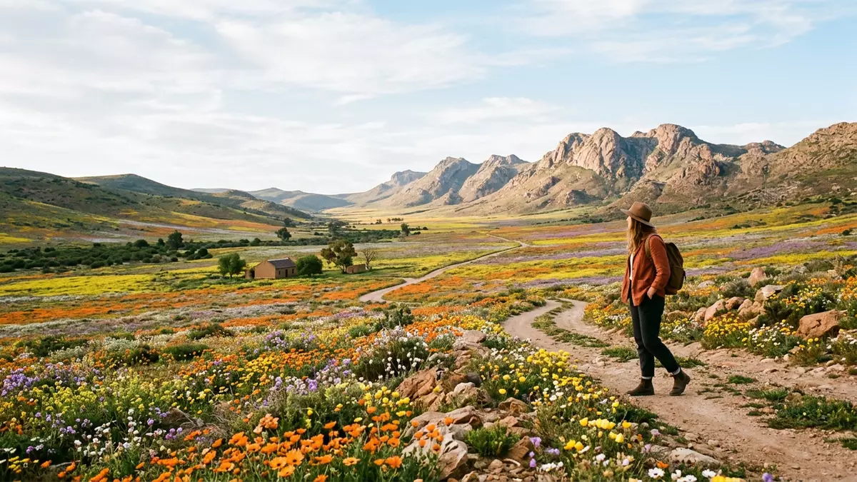
Namaqualand around Springbok in South Africa’s Northern Cape is a semi-arid landscape that, for part of the year, turns into vast sheets of wildflowers across hills and plains. The region forms the northern part of the Namaqualand belt that stretches along the west coast of South Africa and Namibia, with Springbok acting as a practical centre for exploring its surrounding flower routes.Namaqualand belt
A semi-desert framed by rock, shrubs and seasonal colour
Namaqualand is known for its dry climate, open horizons and rocky outcrops, with hardy shrubs and succulents covering much of the ground outside the flowering period.Arid region Around Springbok, the terrain consists of weathered hills and gravelly plains, broken by valleys where soil and rainfall support dense growth during the flowering season.Area around Springbok
Botanically, the area forms part of a wider region that is recognised for a high diversity of annual wildflowers, including Namaqualand daisies and many other species that germinate after winter rain and bloom in late winter and early spring in the Southern Hemisphere.Wild flower region The contrast between bare rock and bands of colour forms the core visual character of Namaqualand near Springbok when the flowers are out.
Springbok and its neighbouring reserves
Springbok lies in the northern part of South Africa’s Northern Cape province and serves as the main town for the Namaqualand region described here.Springbok in Northern Cape It stands roughly on the long road between Cape Town and the Namibian border, and has become associated with wildflower tourism because the surrounding countryside transforms during the flowering period.Flower routes cluster around Springbok
Several nature reserves near Springbok form core parts of local flower routes. To the east, the Goegap Nature Reserve combines semi-desert scenery with stands of shrubs and, during the flowering season, extensive patches of blooms on its plains.Goegap Nature Reserve Further south, the Namaqua National Park includes the Skilpad Wild Flower Reserve near Kamieskroon, which is known for dense flower displays on a high plateau above surrounding valleys.Skilpad Wild Flower Reserve
Following the Namaqualand flower routes near Springbok
The name Namaqualand-Blutenroute is used for a network of routes through the Namaqualand region, centred on Springbok and linking nature reserves, gravel backroads and small settlements where flowers appear in large numbers during their season.Namaqualand-Blutenroute around Springbok There is no single marked highway; rather, visitors follow existing roads such as the N7 and smaller regional roads that cross plains and low hills, watching for areas where rainfall and soil have produced dense carpets of flowers.Regional flower map
During the flowering period, Springbok’s own streets and surrounding farmland can show ribbons of colour along verges and open land, and routes radiating from the town give access to reserves such as Goegap and sections of Namaqua National Park.Springbok as practical base Gravel tracks off the main roads lead deeper into low hills and valleys, where the mixture of rock, shrubs and flowers illustrates how a semi-desert responds to seasonal rain.
Visiting Namaqualand: what travellers from Western Europe should know
- Namaqualand near Springbok lies in South Africa’s Northern Cape, with road approaches from the south along routes such as the N7 that link Cape Town to the interior.
- The terrain around Springbok includes rocky hills, gravel plains and farm roads, and some viewpoints and reserve tracks involve walking over uneven ground rather than paved paths.
- Nearby reserves such as Goegap Nature Reserve and the Namaqua National Park’s Skilpad section sit within driving distance of Springbok and combine marked roads with stretches of gravel and dirt.
- The wider region forms part of the semi-arid Namaqualand belt that extends northwards towards Namibia, so exposed sun and relatively sparse shade are characteristic away from the flowering period.
- The official language is Afrikaans and English is widely used; the currency is the South African rand.
Searching for Namaqualand on social platforms
These links open searches for Namaqualand on each platform.Frequently asked questions about Namaqualand
Where is Namaqualand near Springbok?
This part of Namaqualand lies around the town of Springbok in South Africa’s Northern Cape province, along routes linking Cape Town to the Namibian border.
What can visitors expect during the flowering season?
When conditions favour flowers, plains and hills around Springbok can be covered by dense patches of wildflowers, especially in nearby reserves and along regional roads.
What makes this area of Namaqualand distinctive?
The combination of semi-desert rock formations, hardy shrubs and short-lived but wide-ranging wildflower displays gives Namaqualand near Springbok a strong visual contrast on the landscape.


