
Mount Rainier National Park’s volcanic peak and icebound valleys
Published on 08/20/2026 at 15:10 | Editorial responsibility: Rafael Müller, Editor-in-Chief AD HOC NEWS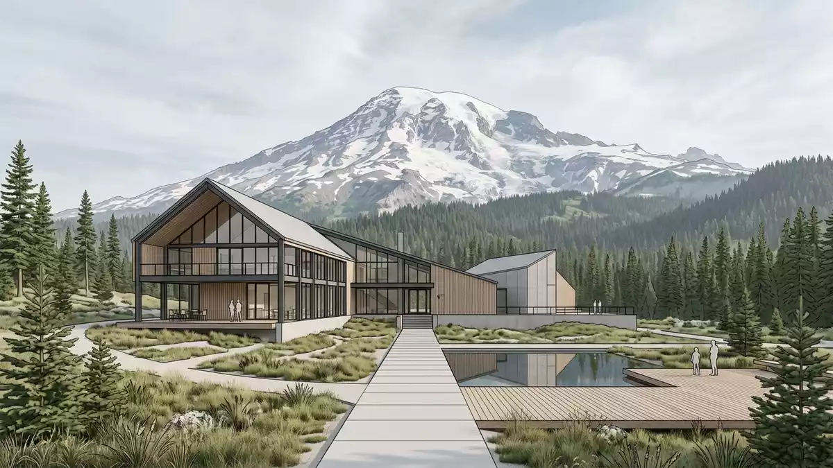
Mount Rainier National Park in Washington state gathers dense forests, river valleys and a single high volcano into one protected landscape south-east of Ashford. The park was established on 2 March 1899, when President William McKinley signed the act that created this national park around Mount Rainier, a summit reaching 4,392 m (14,410 ft) above sea level.The 1899 founding date and elevation anchor the park’s identity, giving visitors a sense of both its age and its vertical scale.
Volcano, glaciers and rivers on a single mountain
Mount Rainier itself is a stratovolcano rising from the Cascade Range, built of layered andesite and dacite lava flows, pumice and other volcanic deposits that have been reshaped by ice over hundreds of thousands of years.These volcanic rocks form the bulk of the mountain, creating cliffs, ridges and broad shoulders that frame the park’s valleys. The summit stands as one of the most prominent peaks in the Pacific Northwest, visible from the lowlands around Tacoma and Seattle when skies are clear, and acting as a reference point for the region’s geography.The mountain lies south-south-east of Seattle within the park boundary, tying urban views directly to protected terrain.
Ice is as defining as rock here. Mount Rainier carries 28 named glaciers and numerous permanent snowfields, wrapped around its flanks and flowing into deep valleys.Carbon, Emmons, Nisqually, Winthrop and Tahoma glaciers are among the major ice streams that radiate from the summit region. These glaciers supply water to several river systems that begin as meltwater channels on the upper slopes and widen into gravelly rivers lower down, shaping the approach roads and many viewpoints. The surrounding park landscape includes cirques, U-shaped valleys, moraines and hanging valleys formed by past glaciations, giving each valley a different combination of cliffs, benches and waterfalls.Glacial erosion and deposition have carved much of the park’s backcountry topography, and the present ice continues to work on the volcanic slopes.
Forests, subalpine meadows and high alpine terrain
Below the ice, broad bands of vegetation mark the change from valley floor to high ridge. Lower elevations carry coniferous forests with tall trees, thick undergrowth and rivers crossing between them, creating dark, enclosed valleys where the mountain itself appears only in occasional openings. Mid-elevation slopes open out with smaller trees and clearings, where glacial landforms such as moraines and old channels sit among the forest, providing platforms for trails and viewpoints.
Higher up, around the subalpine zone, the tree cover thins and gives way to meadows, rock outcrops and talus slopes. In these areas footpaths may cross patches of lingering snow even in warmer months and pass close to stream sources fed directly from glacier melt. Above the meadows, only rock and ice dominate, with ridges and faces leading towards the summit cap. The transition from lush valley forest to sparse alpine ground is one of the most striking experiences in Mount Rainier National Park, as travellers encounter different climates and ecosystems on the same mountain over relatively short horizontal distances.The park’s geodiversity atlas highlights these stacked zones of forest, meadow and alpine rock as key parts of its character.
Founding a national park around a single peak
Mount Rainier National Park was created at the end of the nineteenth century, when the United States Congress designated the area as a national park and President William McKinley signed the establishing act on 2 March 1899.The park’s basic information pages still trace back to this founding legislation, which set out the protection of the mountain, its glaciers and its surrounding forests. Later adjustments to the boundary extended the park eastward to follow the crest of the Cascade Range, bringing more high ground and headwater valleys within its protection.A 1940 guidebook records this extension to the summit of the range, reflecting the long-running effort to frame the park around both the volcano and its wider setting.
This focus on a single dominant mountain contrasts with parks built around spreads of lowland terrain. The designation here centres on Mount Rainier’s height, its concentration of glacier ice and its role as a watershed, rather than on a broad mix of unrelated landforms. As a result, many park features—roads, trails, viewpoints and visitor facilities—take their orientation from the volcano. Approach routes move along valleys that rise towards the summit, and named glaciers, cleavers and walls appear in both scientific literature and everyday signage, reinforcing how closely the park’s identity is tied to the mountain’s physical structure.Scientific studies emphasise that Mount Rainier supports the largest concentration of glacier ice in the United States outside Alaska, underlining why the area around it was reserved as a national park.
Visiting Mount Rainier National Park: what travellers from Western Europe should know
- Mount Rainier National Park lies in south-east Pierce County and north-east Lewis County in Washington, with Ashford serving as a gateway locality on State Route 706 leading towards the Nisqually Entrance.
- Terrain within the park ranges from forested river valleys to high alpine slopes, and many viewpoints and trails involve noticeable gradients, uneven ground and sections of narrow mountain paths.
- The park is reached by road from regional centres such as Tacoma and Seattle, with State Route 706 and other highways following river valleys towards entrances on different sides of Mount Rainier.
- Weather and visibility can change rapidly in mountainous terrain, and higher elevations may retain snow patches and cold conditions even when lower valleys feel comparatively mild.
- The official language is English and the currency is the United States dollar. Entry requirements depend on your nationality; UK travellers can check the FCDO travel advice at gov.uk/foreign-travel-advice, Irish travellers the Department of Foreign Affairs at ireland.ie.
Searching for Mount Rainier National Park on social platforms
These links open searches for Mount Rainier National Park on each platform.
Frequently asked questions about Mount Rainier National Park
Where is Mount Rainier National Park located?
Mount Rainier National Park lies in Washington state in the United States, in south-east Pierce County and north-east Lewis County, with Ashford nearby on a main approach road to the Nisqually Entrance.
What can visitors expect on a visit to the park?
Visitors encounter a high stratovolcano with glaciers, forested valleys, subalpine meadows and mountain viewpoints, with roads and trails giving access to different elevations and aspects of Mount Rainier.
What makes Mount Rainier National Park distinctive among mountain parks?
The park centres on a single very high volcanic cone carrying dozens of glaciers and feeding several river systems, combining dramatic elevation, extensive ice cover and varied vegetation zones on one mountain.


