
Monument Valley and its red sandstone buttes
Published on 09/16/2026 at 18:03 | Editorial responsibility: Rafael Müller, Editor-in-Chief AD HOC NEWS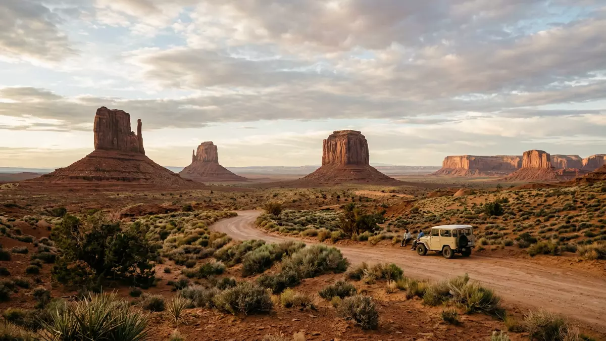
Monument Valley near Oljato is a landscape of red sandstone buttes, flat mesas and layered rock on the Arizona–Utah border. The broad forms rise from an open desert floor and make the geology visible at a glance.
Layered rock above the desert floor
The valley’s best-known landforms are buttes and mesas with distinct bands of rock. Their lower slopes, steep middle faces and capped tops create a profile that can be read from a distance.
The sandstone here belongs to the wider Navajo sandstone landscape of the Colorado Plateau, and the rock has been shaped by long erosion rather than by any single event. The name Monument Valley is usually linked with the Navajo Nation and the Navajo Tribal Park, which places the setting within a cultural landscape as well as a geological one.geological facts
Buttes, mesas and the familiar skyline
The valley is known for isolated rock towers and wider table-like masses that stand clear of the surrounding plain. Their red colour, flat summits and steep sides give the area its recognisable outline.
Among the formations most closely associated with the place are the Mittens and Merrick Butte. The layered structure is easy to see on their faces, where harder rock protects softer layers beneath.Mittens and Merrick Butte
Monument Valley on the Colorado Plateau
The valley sits in the Four Corners region, where Arizona and Utah meet on the Colorado Plateau. That setting explains the broad horizons, dry air and the long sightlines between the rock formations.
Monument Valley lies on Navajo Nation land and is part of a larger plateau landscape associated with sedimentary rock, uplift and erosion. The rock units visible in the buttes belong to a sequence that includes Organ Rock shale, de Chelly sandstone and Moenkopi layers.Navajo Nation landNavajo sandstone landscape
Visiting Monument Valley: what travellers from Western Europe should know
- The landscape lies on the Arizona–Utah border, reached by road from the surrounding plateau towns. US 163 and the approach to Oljato-Monument Valley are the main references used for access.
- The ground is open, dry and exposed, with unshaded distances between formations. The rock underfoot is desert terrain, not a paved urban site.
- The valley’s layered cliffs and mesas are visible from the main roads and the rim of the desert floor. The most familiar forms are red sandstone towers and flat-topped rock masses.
- The setting belongs to Navajo Nation land, and the local cultural name is Tsé Bii? Ndzisgaii. English is not the only language associated with the place.
Searching for Monument Valley on social platforms
These links open searches for Monument Valley on each platform.
Frequently asked questions about Monument Valley
Where is Monument Valley?
It lies on the Arizona–Utah border in the Four Corners region of the United States. The landscape sits within Navajo Nation land near Oljato.
What does a visit involve?
The place is an open desert landscape with major landforms seen from road approaches and designated viewpoints. The terrain is broad, exposed and shaped by rock, not by buildings.
What makes Monument Valley distinctive?
Its red sandstone buttes, mesas and layered cliffs create a skyline that is immediately recognisable. The rock strata are visible enough to read the valley’s geology from the surface.


