
Mont Tremblant: a mountain shaped by forest, lakes and ski trails
Published on 09/23/2026 at 19:14 | Editorial responsibility: Rafael Müller, Editor-in-Chief AD HOC NEWS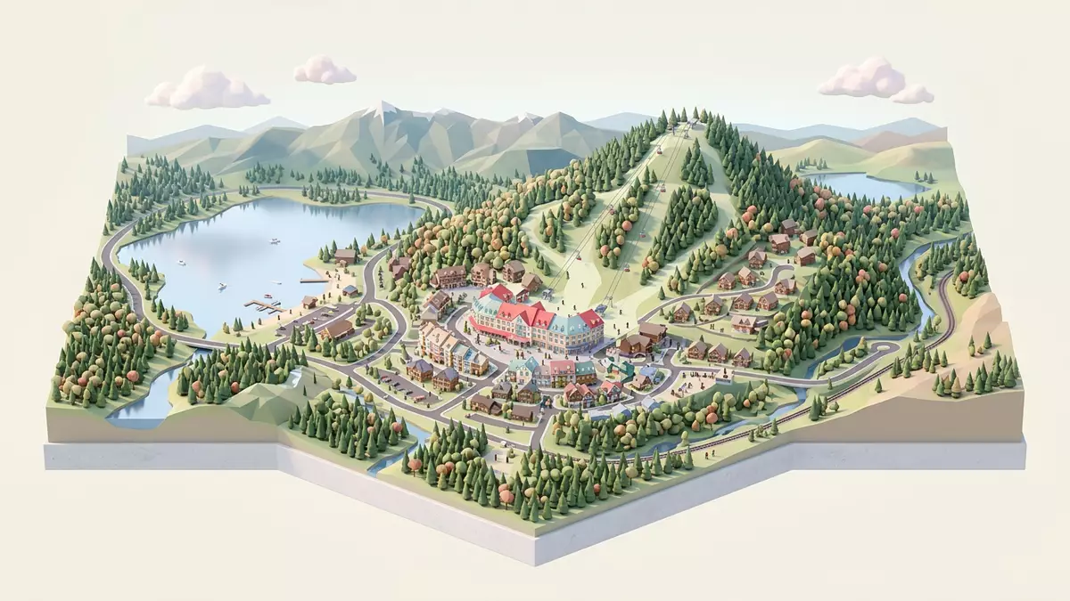
Mont Tremblant rises through the Laurentians as a mountain of forest, water and ski trails. Its summit reaches 875 m (2,871 ft), while the nearby pedestrian village places alpine recreation beside Quebec’s northern hardwood landscape.
The name belongs both to the mountain and to the resort town of Mont-Tremblant in Quebec, Canada. Around it, protected parkland, lakes and rivers create a setting whose identity rests on the relationship between built slopes and open landscape.
Mont Tremblant’s summit above the Laurentians
Mont Tremblant forms part of the Laurentian Mountains, a range whose rocks preserve the remains of terrain formed about a billion years ago. The southern Laurentians rise through a transition zone between hardwood forest and boreal vegetation.
The mountain’s summit stands at 875 m (2,871 ft). The resort’s ski area covers 309 hectares and contains 102 trails spread across four slopes, giving the mountain a visible recreational layer without concealing its wooded form. These mountain statistics anchor the resort’s scale in measurable features.
From the village, the mountain rises behind a cluster of low buildings, lifts and trails. The slopes are cut into the forest, while the summit belongs to the wider Laurentian landscape rather than to the resort alone.
From forest reserve to national park
Parc de la Montagne Tremblante was created on 12 January 1895 as a forest reserve centred largely on Mont Tremblant. Its territory and legal status changed through the twentieth century, with the Parks Act of 1977 marking a new stage in protection.
Parc du Mont-Tremblant was established under that Act in 1981. In 2000, its conservation mission and national-park status were confirmed. The protected area covers 1,510 km² and includes a network of rivers, lakes and forest habitats. Its park history and geography connect the mountain with a much larger natural region.
The park contains the Diable, Boulée, Cachée, Petite Cachée, L’Assomption and Lavigne rivers, alongside roughly 400 lakes. Maple and yellow birch forest meet boreal species such as balsam fir, creating a transition landscape across valleys, slopes and higher ground.
A mountain with two visible identities
Mont Tremblant carries a recreational history that reaches back to the first decades of the twentieth century. Skiers reached the summit in 1916, and Herman Smith Johannsen explored the mountain and the Diable valley during the late 1920s.
Joe Ryan installed the first chairlift in Canada and opened the Mont-Tremblant Lodge in 1939. That date remains part of the resort’s built history, while the surrounding park preserves a separate identity based on forests, waterways and wildlife.
The mountain therefore presents two connected but distinct landscapes. Ski trails, lifts and a pedestrian village occupy one side of the experience, while lakes, rivers and protected forest extend through Parc national du Mont-Tremblant.
The contrast is visible in the terrain itself. A compact resort settlement sits below wooded slopes, and the mountain’s recreational infrastructure gives way to open stretches of Laurentian country. The result is not a single monument but a layered place shaped by altitude, vegetation, water and human use.
Visiting Mont Tremblant: what travellers from Western Europe should know
- Mont Tremblant lies in Quebec’s Laurentian Mountains, near the town of Mont-Tremblant and north-west of Montreal. The resort is reached by road, while Montreal–Trudeau International Airport is the nearest major international gateway.
- The mountain rises to 875 m (2,871 ft), and the ski area occupies wooded slopes above the pedestrian village. Outdoor routes in the surrounding park cross forest, lake country and uneven mountain terrain.
- Parc national du Mont-Tremblant contains six named rivers and roughly 400 lakes. Its landscape extends well beyond the resort slopes into protected Laurentian country.
- The official languages of Canada include English and French, and the currency is the Canadian dollar.
- Entry requirements depend on your nationality; UK travellers can check the FCDO travel advice at gov.uk/foreign-travel-advice, Irish travellers the Department of Foreign Affairs at ireland.ie.
Searching for Mont Tremblant on social platforms
These links open searches for Mont Tremblant on each platform.
Frequently asked questions about Mont Tremblant
Where is Mont Tremblant?
Mont Tremblant is in Quebec’s Laurentian Mountains, near the town of Mont-Tremblant and north-west of Montreal. The mountain stands beside Parc national du Mont-Tremblant.
What can visitors expect there?
The area combines a pedestrian resort village, wooded ski slopes and access to a large protected landscape. The national park adds rivers, lakes, forests and mountain routes.
What makes Mont Tremblant distinctive?
Its 875 m summit, resort infrastructure and protected Laurentian surroundings occupy the same geographic setting. The mountain’s history includes the Mont-Tremblant Lodge, opened in 1939.


