

Lineas de Nazca: vast geoglyphs on the Peruvian desert plateau
Published on 08/21/2026 at 06:24 | Editorial responsibility: Rafael Müller, Editor-in-Chief AD HOC NEWS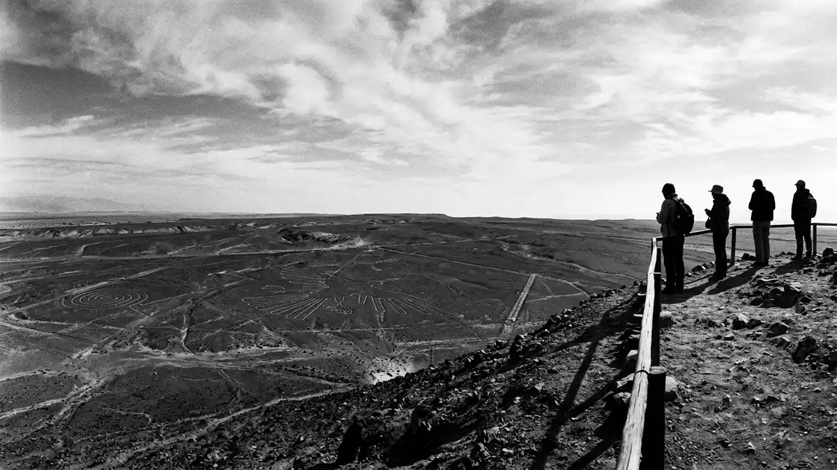
Lineas de Nazca, known internationally as the Nazca Lines, spread across the desert plateau near the town of Nazca in southern Peru, forming a field of immense geoglyphs cut into the earth. Created by pre-Columbian societies between the first millennium BC and the first millennium AD, these figures and lines turn a dry pampa into a vast graphic landscape that reveals its full form when viewed from high above.
A desert canvas of lines, shapes and figures
The Nazca Desert forms part of the arid coastal plain of southern Peru, a region where rainfall is scarce and the ground is a mixture of pebbles and pale soil. Across this plateau, ancient inhabitants created geoglyphs by scraping away the darker surface layer to expose lighter-coloured earth beneath, producing lines that stand out against the surrounding terrain.arid Pampa Colorada The geoglyphs extend for hundreds of square kilometres, with thousands of individual elements drawn across the plain.massive collection of geoglyphs
Among the Nazca Lines are long straight runways, sweeping geometric patterns and recognisable depictions of animals and plants. Sources describe more than 800 straight lines, hundreds of geometric shapes and dozens of figures representing living creatures such as birds and other animals.straight lines and figures Some designs stretch for kilometres, while others occupy smaller sections of the plateau, but together they form a continuous visual field that has survived because of the desert’s stability.
Ancient cultures and a World Heritage inscription
The Nazca Lines sit within the basin of the Río Grande de Nasca, in the Ica Region, on plains shared between the provinces of Nazca and Palpa. Archaeological and historical research associates the creation of the geoglyphs primarily with the Nazca culture, which flourished in southern Peru between around 200 BCE and 600 CE, with earlier contributions linked to the Paracas culture.Nazca civilization flourished The lines are dated broadly between 500 BC and AD 500, based on the period of the societies active in the region and studies of associated material.scratched on the surface between 500 B.C. and A.D. 500
In 1994, the Lines and Geoglyphs of Nasca and Palpa were inscribed on the UNESCO World Heritage List as a cultural site, under criteria that recognise them as a masterpiece of human creative genius and as an exceptional testimony to the magical-religious traditions of ancient societies on the Peruvian south coast.World Heritage inscription The protected area covers more than 75,000 hectares of desert plains and low foothills, encompassing both the Nazca and Palpa geoglyph fields within a single archaeological landscape.Lines and Geoglyphs of Nasca and Palpa
Viewing Lineas de Nazca from land and air
Lineas de Nazca lie inland from the Pacific coast, several hundred kilometres south of Lima along the route of the Pan-American Highway, with the town of Nazca acting as the main gateway to the plateau.driving south from Lima At ground level, visitors encounter a flat, windswept landscape crossed by low hills and desert plains, where individual lines cut across the surface and guide the eye towards the horizon.
To see the full design of many figures, travellers make use of elevated viewpoints or flights that pass over the area, revealing shapes and paths that are difficult to grasp from the desert floor. From above, outlines of birds, other animals and complex geometric compositions become clear, highlighting how the makers used the scale of the plateau as part of the drawing. The contrast between the minimal change on the surface and the vast effect when seen from altitude underlines the character of Lineas de Nazca as a landscape-scale work.
Visiting Lineas de Nazca: what travellers from Western Europe should know
- Lineas de Nazca lie inland near the town of Nazca in southern Peru, reached overland from Lima along the Pan-American Highway that runs down the coastal region.
- The geoglyphs occupy a desert plateau with open, exposed terrain, where the ground is dry and stony and approaches to viewpoints involve walking over uneven surfaces.
- In winter in the southern hemisphere, temperatures on the plateau can fall noticeably after sunset, while the daytime sun remains strong on the open desert.
- The official language is Spanish and the currency is the Peruvian sol.
- Entry requirements depend on your nationality; UK travellers can check the FCDO travel advice at gov.uk/foreign-travel-advice, Irish travellers the Department of Foreign Affairs at ireland.ie.
Searching for Lineas de Nazca on social platforms
These links open searches for Lineas de Nazca on each platform.
Frequently asked questions about Lineas de Nazca
Where are Lineas de Nazca located?
Lineas de Nazca are located on the desert plains near Nazca and Palpa in the Ica Region of southern Peru, inland from the Pacific coast.
What should visitors expect on a visit to Lineas de Nazca?
Visitors encounter an open desert plateau with long lines and figures etched into the ground, best understood using elevated viewpoints or flights that reveal the full designs.
What makes Lineas de Nazca distinctive among archaeological sites?
The Nazca Lines form a single landscape of large-scale geoglyphs spread across tens of thousands of hectares, created by ancient cultures over centuries on an otherwise bare desert plain.


