
Lake Tekapo’s turquoise lake and sky of stars
Published on 09/10/2026 at 15:50 | Editorial responsibility: Rafael Müller, Editor-in-Chief AD HOC NEWS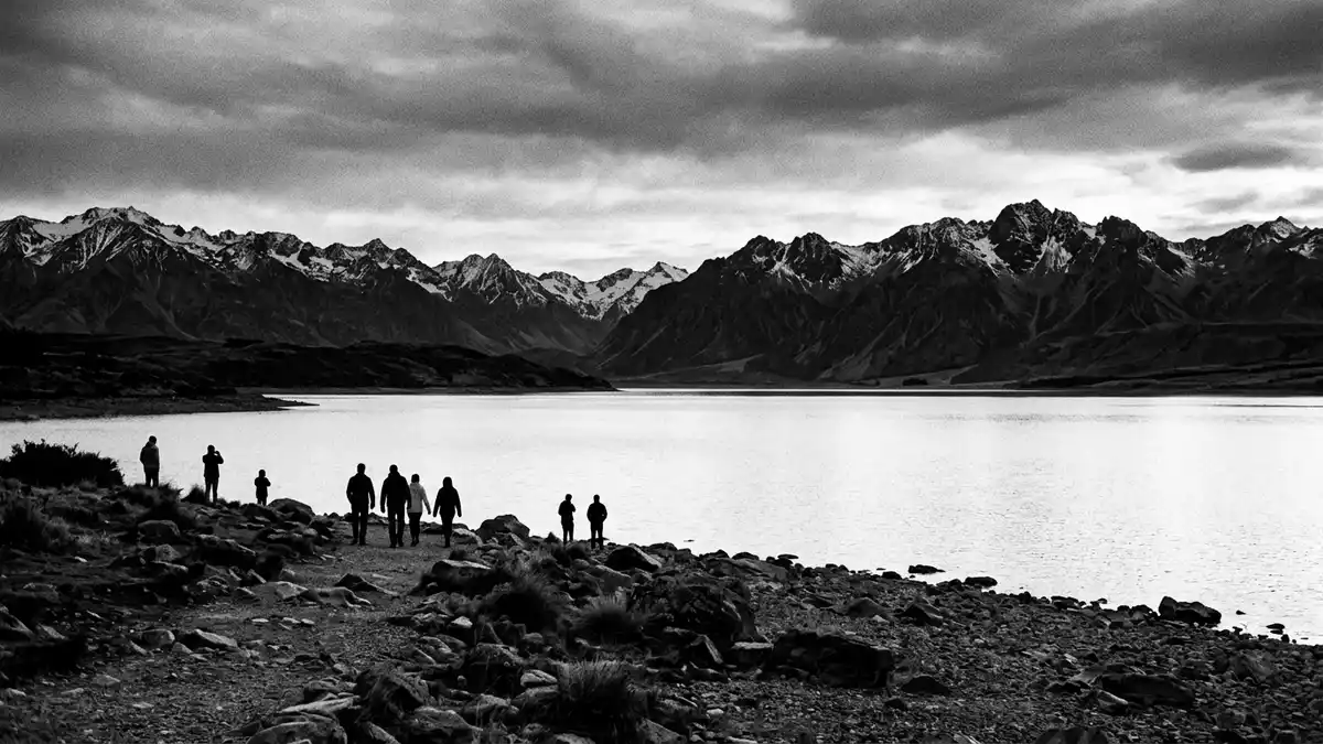
Lake Tekapo in New Zealand’s South Island is a place where glacial turquoise water, tussock-covered hills and an exceptional night sky meet in one wide basin. Set within the Mackenzie District inland from the coast, the lake and its small township form a compact high-country landscape that draws together alpine geology, hydropower engineering and heritage architecture.
A long, high glacial lake in the Mackenzie Basin
Lake Tekapo is a large glacial lake lying within the Mackenzie Basin in the Canterbury region of the South Island. It is one of three roughly parallel lakes – alongside Lake Pukaki and Lake ?hau – that follow a north–south line along the basin’s northern edge, with the Southern Alps rising beyond.three roughly parallel lakes The lake occupies a long valley that was carved by ice and later dammed by glacial debris, giving it the elongated form and depth characteristic of many South Island lakes.lake in central South Island
Different measurements place Lake Tekapo’s length at around two dozen kilometres, with a width that remains modest relative to its reach, so the shoreline always feels close, even when looking across the water. Its surface lies at a high elevation above sea level for a settled lake, giving the surrounding basin an alpine character even though the shore itself is easily reached by road.lies at an elevation The lake is fed by rivers that descend from glaciers in the Southern Alps, including the Godley and Macaulay rivers, and drains at its southern end through the Tekapo River.primary inflows and outflow
Turquoise water, tussock hills and a small township
The colour of Lake Tekapo’s water is one of its most striking features. Finely ground rock suspended in the glacial melt – often called rock flour – scatters light in a way that gives the lake a distinctive turquoise hue under clear skies.beautiful turquoise colour On calm days this turbid water surface can appear almost opaque and milky, while a breeze breaks it into shifting facets that pick up the surrounding slopes and sky.
The basin around Lake Tekapo is wide and open, covered in tussock grassland that emphasises the lake’s elongated form. To the west, the Southern Alps rise as a weather barrier; to the east, ranges such as the Two Thumb Range frame the basin and shelter it from coastal systems.protected from rough coastal weather At the southern end of the lake sits the settlement known as Lake Tekapo or Takap?, a rural township classified as a small settlement by Statistics New Zealand.small township located at the southern end The town occupies only a few square kilometres, with streets and houses rising gently above the shore and a compact commercial area serving travellers and residents.
A lakeside memorial church and dark-sky reserve
On the lake’s southern shore, a short walk from the township’s centre, stands the Church of the Good Shepherd, one of New Zealand’s best-known small churches. This Anglican church, used by various denominations, was completed in 1935 as a memorial to the pioneers of the Mackenzie Country.built in 1935 as a memorial church It occupies a low rise above the lakeshore, with stone walls and a simple gabled roof that sit naturally among rock, scrub and open water.situated on the shores
The Church of the Good Shepherd has a Category I heritage registration from Heritage New Zealand, reflecting its significance as a memorial and its setting beside the lake.Category I heritage registration Visitors walking around the grounds can see how the building frames views of the lake and mountains through its openings, and how it anchors the otherwise open shoreline with a single, modestly scaled piece of architecture. Nearby, Lake Tekapo lies within the wider Aoraki Mackenzie International Dark Sky Reserve, an area recognised by the International Dark-Sky Association since 2012 for the quality of its night sky.designated as an International Dark Sky Reserve The reserve covers thousands of square kilometres, including Aoraki / Mount Cook National Park, Lake Pukaki and the Mackenzie Basin, with Lake Tekapo’s township among its main settlements.
Visiting Lake Tekapo: what travellers from Western Europe should know
- Lake Tekapo lies in the Mackenzie District of the Canterbury region on New Zealand’s South Island, reached by road on the inland route that links Timaru and Christchurch with Aoraki / Mount Cook and Queenstown.State Highway 8, Tekapo Village
- The lake and township sit at high elevation, and paths from the village to the shore and the Church of the Good Shepherd cross uneven ground with rocks and low steps rather than formal pavements.located on Pioneer Drive
- Winter brings snow to the surrounding hills and cold temperatures to the basin, while summer days can be bright and dry, so clothing and footwear need to suit a high-country climate.
- The official language is English and the currency is the New Zealand dollar.
- Entry requirements depend on your nationality; UK travellers can check the FCDO travel advice at gov.uk/foreign-travel-advice, Irish travellers the Department of Foreign Affairs at ireland.ie.
Searching for Lake Tekapo on social platforms
These links open searches for Lake Tekapo on each platform.
Frequently asked questions about Lake Tekapo
Where is Lake Tekapo?
Lake Tekapo is in the Mackenzie District of the Canterbury region on New Zealand’s South Island, with a small township at the lake’s southern end.
What can visitors expect at Lake Tekapo?
Visitors find a long glacial lake with turquoise water, tussock grassland, views towards the Southern Alps and a compact settlement that includes the lakeside Church of the Good Shepherd.
What makes Lake Tekapo distinctive?
Lake Tekapo’s combination of high-elevation turquoise water, memorial church on the shore and inclusion within the Aoraki Mackenzie International Dark Sky Reserve gives it a character that ties water, architecture and night sky together.


