
Laguna de Apoyo, Masaya’s volcanic crater lake sanctuary
Published on 09/05/2026 at 22:39 | Editorial responsibility: Rafael Müller, Editor-in-Chief AD HOC NEWS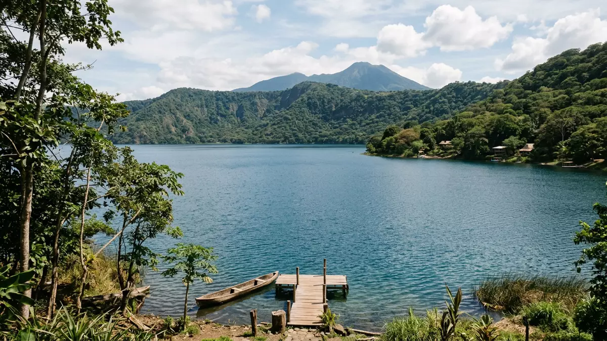
Laguna de Apoyo in western Nicaragua is a near-circular volcanic crater lake where steep forested slopes descend directly into clear, deep water between the cities of Masaya and Granada. Formed within the caldera of the extinct Apoyo Volcano and protected as a nature reserve since 1991, it combines geology, landscape and wildlife in a compact basin that feels self-contained.
A volcanic crater filled with water and forest
Laguna de Apoyo occupies the interior of the Apoyo caldera, a large volcanic depression created by an eruption that geological studies date to roughly 23,000 years ago. The result is a basin with water at its centre and an encircling rim of higher ground, giving the lake its regular outline and enclosing it on all sides.Eruption around 23,000 years ago The body of water sits at an elevation modestly above sea level, while the crater walls rise several hundred metres higher, forming a kind of amphitheatre around the lake.Description of the Apoyo caldera
The surface area of Laguna de Apoyo is recorded at just under 19.5 square kilometres, making it one of Nicaragua’s larger crater lakes.Surface area and diameter Measurements of its depth reach figures in the mid hundreds of metres, and the floor of the basin lies below sea level, while the shoreline stands above it.Depth and relation to sea level The lake’s water has a reputation for being clear, with a blue tone that stands out against the darker greens of the forested slopes.
Nature reserve between Masaya and Granada
Laguna de Apoyo and its surrounding slopes are protected as the Laguna de Apoyo Nature Reserve, an officially designated area recognised by Nicaragua’s Ministry of the Environment and Natural Resources through a decree issued in 1991.Decree 42-91 declaring the reserve The reserve straddles the boundary between the departments of Masaya and Granada, with the nearest urban centre identified as Masaya, and the wider basin extending into neighbouring municipalities such as Catarina and Diriá.Location between Masaya and Granada
The protected area covers several thousand hectares, taking in both the water and the dry forest on the crater walls, which provide habitat for monkeys, birds and a range of smaller species described in tourism and nature guides.Dry forest and wildlife on the crater walls Within the reserve, development is restricted by law, and motorised watercraft are prohibited on the lake, which keeps most activity centred on small-scale lakeside facilities and non-motorised use of the water.Restrictions on development and motorised craft
Shape, water and approaches to the crater lake
Seen on a map, Laguna de Apoyo is close to circular, matching the outline of the caldera in which it sits and measuring around 6 to 6.6 kilometres across.Near-circular crater lake and diameter The shore forms a continuous ring, with stretches of beach and patches of vegetation at the water’s edge, while the crater walls rise quite steeply away from the lake.
Approach roads reach the rim from both the Masaya–Granada highway and the Masaya–Catarina road, then descend towards the shore on sections with notable gradients, eventually arriving at small lakeside communities and accommodation clusters.Access from the Masaya–Granada highway Public buses run from Masaya towards the lake and down into the coastal strip, with services turning around near a school close to the water and connections from Granada using buses that stop at the entrance on the main road.Bus services from Masaya to the lake
Visiting Laguna de Apoyo: what travellers from Western Europe should know
- Laguna de Apoyo lies between Masaya and Granada in western Nicaragua, with approach roads dropping from the Masaya–Granada highway and the Masaya–Catarina road down to the lakeshore.
- The crater walls are steep and the approach roads include strong gradients, so reaching lakeside level involves travelling along downhill sections and, in places, walking on sloping terrain.
- The official language is Spanish and the currency is the Nicaraguan córdoba.
- Entry requirements depend on your nationality; UK travellers can check the FCDO travel advice at gov.uk/foreign-travel-advice, Irish travellers the Department of Foreign Affairs at ireland.ie.
Searching for Laguna de Apoyo on social platforms
These links open searches for Laguna de Apoyo on each platform.
Frequently asked questions about Laguna de Apoyo
Where is Laguna de Apoyo in relation to Masaya and Granada?
Laguna de Apoyo lies between the departments of Masaya and Granada in western Nicaragua, with Masaya identified as the nearest city and Granada a short distance away.
What can visitors expect when they reach the lake?
Visitors encounter a near-circular volcanic crater lake with clear water, steep forested slopes rising around it and small lakeside settlements at points along the shore.
What makes Laguna de Apoyo distinctive among Nicaragua’s lakes?
Laguna de Apoyo combines significant depth in a regular crater form with protected dry forest on its crater walls and an officially designated nature reserve that covers both water and surrounding land.


