
Lago di Como’s inverted Y of water and mountains
Published on 09/04/2026 at 06:29 | Editorial responsibility: Rafael Müller, Editor-in-Chief AD HOC NEWS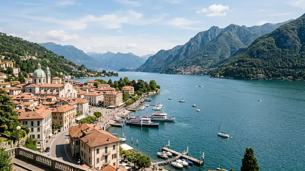
Lago di Como, known in English as Lake Como and traditionally called Lario, is a glacial lake in Lombardy in northern Italy. Its long outline with three slender branches meeting near Bellagio gives the lake a distinctive inverted Y form that shapes how towns, mountains and water relate to one another.
An Alpine lake of depth and scale
Lago di Como lies in the southern foothills of the Alps in the Lombardy region of Italy, north of Milan and within the provinces of Como and Lecco. It sits at an elevation of around 199 m (653 ft) above sea level in a deep depression surrounded by limestone and granite mountains that rise steeply from the shoreline.Lombardy lake north of Milan The lake’s glacial origin gives it a pronounced depth that contrasts with the relatively narrow width of its surface.
By surface area Lago di Como is among the largest lakes in Italy, covering about 146 km² (56 sq mi), with a maximum length of roughly 46–47 km (29 mi) from the northern end down to Como in the south-west branch.146 square kilometre surface The water plunges to well over 400 m (about 1,350 ft) at its deepest point, making Lago di Como one of the deepest lakes in Europe and the deepest in Italy, while average depths remain high over much of its basin.deep glacial basin
The inverted Y and its three branches
On a map Lago di Como appears as an inverted letter Y, each branch stretching between steep valley sides and converging near the promontory of Bellagio. The south-western branch ends at the city of Como, a historic settlement that sits at the extreme southern tip of the lake, while the south-eastern branch runs towards Lecco, an industrial and commercial centre on the opposite leg.inverted Y layout The northern branch continues towards Colico and the upper Adda valley, opening out towards the Alpine passes.
The meeting point of the three arms lies near Bellagio, where a narrow tongue of land projects into the water and separates the branches. Along the lake’s perimeter towns such as Bellagio, Menaggio, Varenna and Tremezzo occupy terraces and small plains between the water and the slopes, reflecting centuries of settlement along the shore.principal lakeside centres The combination of elongated branches, converging valley lines and close mountain walls gives travellers varied perspectives even over short stretches of shoreline.
Water, mountains and historic villas
Lago di Como is fed principally by the river Adda and other Alpine streams, with the Adda also flowing out of the lake towards the Po basin.Adda inflow and outflow The combination of deep water and surrounding peaks has long made the region a setting for grand villas and gardens on narrow strips of land between lake and mountain. Historic residences such as Villa del Balbianello near Lenno and lakeside estates around Tremezzo and Cernobbio stand above small harbours, with façades oriented towards the water.
Along the shore, stone embankments, small beaches and waterfront promenades mark the transition between the lake and the towns. Como at the southern tip combines its lakeside position with a compact historic centre, while Bellagio occupies the ridge between two branches, looking along both southern legs. These settlements, together with others like Menaggio and Varenna on opposite banks, form a chain of communities that reflect the lake’s role as both a transport route and a landscape destination.
Visiting Lago di Como: what travellers from Western Europe should know
- Lago di Como lies in northern Italy’s Lombardy region, with the city of Como at the end of the south-western branch; trains from Milan reach Como and Lecco, and regional roads follow much of the shoreline.
- The lake is framed by steep valley sides, and many paths and streets between shore and hillside involve noticeable gradients and flights of steps, especially in towns built on terraces above the water.
- The surrounding mountains rise to well over 600 m (2,000 ft) near the southern end and higher towards the north, so viewpoints above the lake can involve sustained uphill walking on paved lanes or mountain paths.
- Nearby highlights include the historic centre of Como, lakeside promenades in towns such as Menaggio and Varenna, and boat services that link settlements along the three branches of the lake.
- The official language is Italian and the currency is the euro.
Searching for Lago di Como on social platforms
These links open searches for Lago di Como on each platform.Frequently asked questions about Lago di Como
Where is Lago di Como located?
Lago di Como is in Lombardy in northern Italy, within the provinces of Como and Lecco, about 40–50 km north of Milan.
What should travellers expect on a visit to Lago di Como?
Travellers encounter a deep glacial lake with three long branches, steep valley sides, lakeside towns and mountain views that change with each bend in the shoreline.
What makes Lago di Como distinctive among Italian lakes?
Lago di Como combines great depth and elongated scale with an inverted Y outline, placing towns such as Como, Lecco and Bellagio along separate branches of the same lake.


