
Lago di Como’s inverted Y between Alps and Como
Published on 08/27/2026 at 09:07 | Editorial responsibility: Rafael Müller, Editor-in-Chief AD HOC NEWS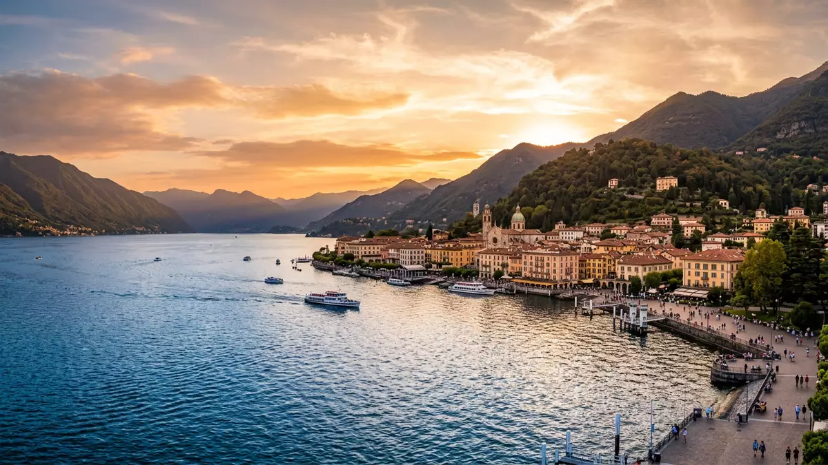
Lago di Como, known in English as Lake Como, is a deep glacial lake in Lombardy, with Como at the end of one of its long branches. Its characteristic inverted Y shape, cut into the foothills of the Alps, gives the lake three slender arms that meet around Bellagio and defines how settlements and views unfold along its shores.
An Alpine lake carved into an inverted Y
Lago di Como lies in northern Italy, in the provinces of Como and Lecco, at the southern edge of the Alps. The water surface sits at around 198 m (650 ft) above sea level, hemmed in by limestone and granite mountains that rise steeply on both sides.elevation and surrounding rock The basin is of glacial origin, formed during the last Ice Age, when ice and meltwater scoured a trough along an existing river valley.glacial basin below the Alps
The lake stretches for roughly 45–47 km (about 28–29 miles) from its northern end down to the southern tips near Como and Lecco.length and general dimensions Its plan takes the form of an inverted Y: one branch leads south-west towards Como, another runs south-east towards Lecco, and the third continues north towards Colico near the Adda river. Bellagio, projecting between the southern branches, marks the point where the three arms meet and has long been a strategic and scenic tongue of land in the middle of the lake.inverted Y with Bellagio at the centre
Depth, dimensions and the water itself
Lago di Como is one of Italy’s largest lakes by surface area, covering around 146 km² (56 sq mi) and ranking behind Lake Garda and Lake Maggiore in size.surface area and national ranking What distinguishes it more strongly is its depth: the basin reaches more than 410 m (around 1,350 ft) below the water surface, making it the deepest lake in Italy and putting its floor some 200 m below sea level.maximum depth and depth below sea level
The main inflow is the Adda river, which enters from the north, while its outflow runs south-east through the Lecco arm and onwards towards the Po basin.Adda river as main inflow Smaller mountain streams descend from the surrounding pre-Alpine slopes into the three arms, feeding the lake from short, steep catchments. The water fills a long, narrow basin, giving Lago di Como the feel of a flooded valley, with villages and villas clustered on ledges and tiny plains between steep slopes and the shore.
Como, Lario and a long human history
The Latin name for the lake, Larius, still lingers in the alternative name Lario alongside Lago di Como.Larius and Lario as names The basin has attracted settlement since ancient times, but Como’s documented urban history takes shape under Roman rule. In 59 BC Julius Caesar founded the colony of Novum Comum on drained land near the lake, giving the town a planned street grid that still shapes parts of the historic centre.Novum Comum founded in 59 BC
Writers such as Pliny the Elder and Pliny the Younger are associated with the area during the Roman period, reflecting the lake’s role as a place where villas faced out across the water towards the mountains.Roman-era villas and authors Later centuries brought Lombard rule and shifting control linked to powers such as Milan’s Visconti and Sforza families. By the nineteenth century, after Giuseppe Garibaldi’s campaigns in 1859, the lake and the city of Como were integrated into the Kingdom of Italy under the House of Savoy, tying this pre-Alpine basin into the emerging Italian state.integration into the Kingdom of Italy in 1859
Visiting Lago di Como: what travellers from Western Europe should know
- Lago di Como lies in Lombardy, north of Milan, with Como and Lecco at the southern ends of two branches. Trains from Milan reach lakeside towns, and roads follow the three arms along the shore and over low passes.
- The shoreline alternates between flat lakeside promenades and steep stretches where villages climb in tiers above the water. Many approaches involve narrow streets and stairways linking upper levels with harbours and quays.
- The lake is surrounded by pre-Alpine mountains, and some viewpoints above Como and other towns involve sustained uphill walking on paths or paved lanes with a noticeable gradient.
- Nearby, the northern arm approaches the Swiss border, and the wider region includes other Lombardy lakes such as Garda and Maggiore, linked by rail and road networks.
- The official language is Italian and the currency is the euro (EUR).
Searching for Lago di Como on social platforms
These links open searches for Lago di Como on each platform.Frequently asked questions about Lago di Como
Where is Lago di Como and how is it laid out?
Lago di Como is in Lombardy in northern Italy, in the provinces of Como and Lecco. Its basin has three arms forming an inverted Y, meeting around Bellagio.
What should a visitor expect when approaching the lake from Como?
Approaching from Como leads along the south-western branch, where the town’s streets descend towards the lakeside. The waterfront opens to views along the arm and uphill towards surrounding pre-Alpine slopes.
What makes Lago di Como distinctive among Italian lakes?
Its combination of great depth, glacial origin and the three-armed inverted Y shape makes Lago di Como distinctive. The lake’s floor lies far below sea level while its surface sits within an Alpine setting.


