
Lago di Como and its Y-shaped basin
Published on 09/08/2026 at 16:05 | Editorial responsibility: Rafael Müller, Editor-in-Chief AD HOC NEWS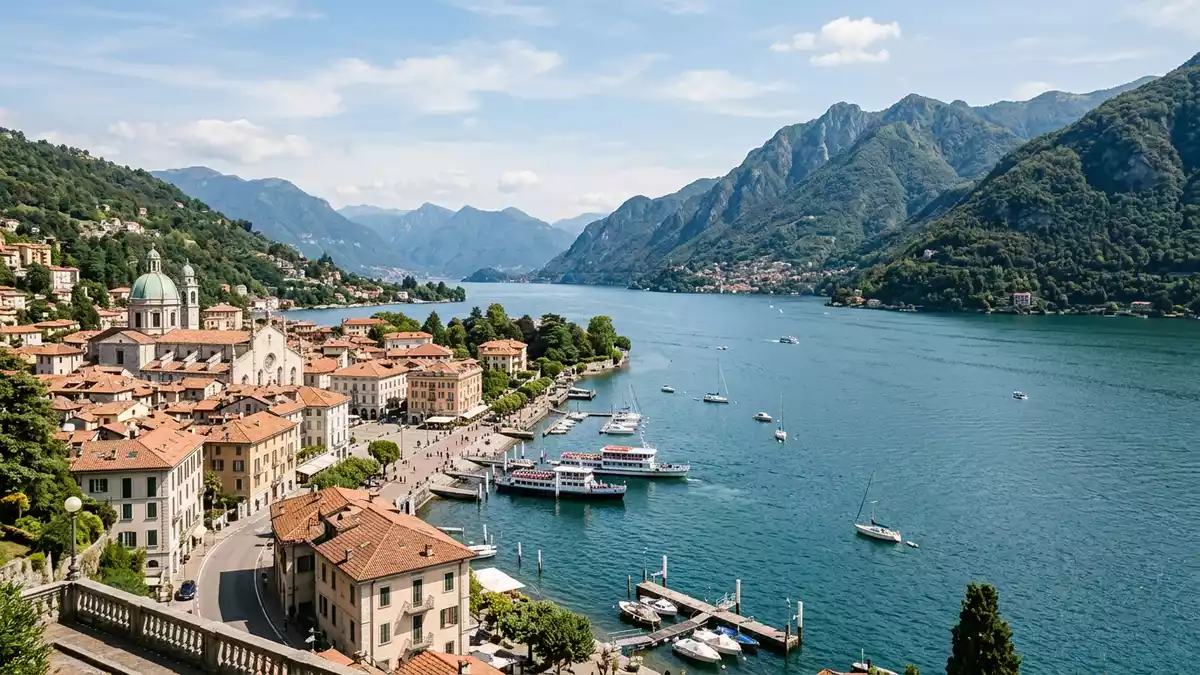
Lago di Como, also called Lario, is a glacial lake in Lombardy, northern Italy, with Como at its southern end. Its Y-shaped basin and deep water make the landscape legible at a glance, from the city edge to the mountain walls beyond.
The alpine basin of Lago di Como
The lake lies in a depression surrounded by limestone and granite mountains, with branches running towards Como, Lecco and the northern arm. Its surface area is 146 km², and its maximum depth is over 400 metres, placing it among Europe’s deepest lakes.lake in Lombardy
The outline is the first thing that stays in memory: three long arms meeting in a sharp central point near Bellagio. The form is not decorative, but part of the lake’s most recognisable geography, and it shapes how the shoreline is read from boat, road and hillside.Y-shaped basin
Roman Como and the lake’s long cultural edge
Como was known as Novum Comum in Roman times, linked to Julius Caesar and the settlement history of the southern shore. That Roman layer sits behind the later villas, churches and townscapes that line the water today.Julius Caesar
The lake has drawn settlement, trade and later leisure along a narrow band between water and slope. That long use is visible in the pairing of lakeside towns with steep land rising directly behind them, a relationship that gives the area its compact, layered character.southern end of the lake
Water, branches and the northern arm
The branches of Lago di Como form a wide northern section and two southern arms, with the lake narrowing and widening again along its length. The Adda enters near Colico and leaves the lake at Lecco, giving the basin a clear hydrographic structure.principal emissaries
The lake’s setting is alpine without being remote: mountain slopes rise close to the water, while towns, villas and ferry landings occupy the gentler edges. The result is a shoreline that changes from urban at Como to more open and steep-sided further north, without losing the same basin form.limestone and granite mountains
Visiting Lago di Como: what travellers from Western Europe should know
- Lago di Como lies in Lombardy, northern Italy, with Como at the southern tip and Lecco on the eastern branch. Rail links and roads serve the lakeshore towns.
- The shore combines flat waterfront stretches with steep slopes and mountain roads. Ferries connect towns across the basin, and some villages sit high above the water.
- The official language is Italian and the currency is the euro.
- The lake’s three-branch form is easiest to understand from the water or from higher viewpoints above the shore. The central meeting point near Bellagio is the clearest part of that pattern.
Searching for Lago di Como on social platforms
These links open searches for Lago di Como on each platform.
Frequently asked questions about Lago di Como
Where is Lago di Como?
It is in Lombardy, in northern Italy, with Como at the southern end and the lake stretching north into an alpine basin.
What does a visit involve?
The main impressions are the water, the steep shore and the towns linked by ferry and road. The lake also has a clear three-branch form.
What makes Lago di Como distinctive?
Its Y-shaped basin, deep water and mountain setting define it. Roman Como adds a historical layer at the southern shore.


