
Lago di Como: a Y?shaped lake between mountains and villages
Published on 09/03/2026 at 18:21 | Editorial responsibility: Rafael Müller, Editor-in-Chief AD HOC NEWS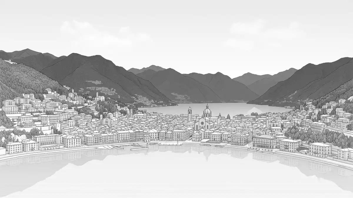
Lago di Como in northern Italy is a deep glacial lake framed by steep mountains and linked villages, shaped like a reversed Y with Bellagio at its centre. Its long shores have connected Lombardy with Alpine passes for centuries, and the lake’s depth and branching form give Como a landscape where water, stone and town sit tightly together.
A glacial lake with a distinctive reversed Y
Lago di Como lies in Lombardy in the provinces of Como and Lecco, in a basin carved by ancient glaciers at the southern flank of the Alps.basin carved by ancient glaciers The lake’s outline forms a reversed Y, with three long branches that meet near Bellagio, a settlement on a triangular promontory known locally as the “spartivento”, where the water divides towards Como and Lecco.three long branches that meet near Bellagio
The surface of Lago di Como extends to about 145–146 km², placing it among Italy’s largest lakes by area, behind Lago di Garda and Lago Maggiore.among Italy’s largest lakes by area The water level sits close to 199 m (653 ft) above sea level, while soundings reach more than 400 m (about 1,300 ft) below the surface, making it the deepest Italian lake and one of the deepest in Europe.more than 400 m below the surface The main body runs roughly 45–47 km from the northern reaches near Colico down to Como at the south-western tip, with a width that varies between narrow corridors and broader reaches of around 4 km.
Water, villages and historic routes
Lago di Como has carried traffic and settlement since antiquity, sitting on routes between the Po Valley and passes such as Maloja and Stelvio in the Alps.routes between the Po Valley and passes Roman sources used the name Larius for the lake, a term that remains in use as Lario, and opened roads along the western shore to reach the Rhaetian region to the north.opened roads along the western shore Later, during Lombard rule, the lakeside route known as the Regina was restored, and mediaeval communes such as Como defended control of these corridors.
The shoreline is punctuated by towns including Como at the south-western end, Lecco on the south-eastern branch and Menaggio and Varenna on the central sections, each pressed between the water and rising slopes.towns including Como and Lecco Villas and gardens on terraces above the lake reflect long-standing use of the gentle lower slopes for residence, while higher ground is formed of limestone and granite ridges that climb to elevations of around 600 m (2,000 ft) near the southern rim and more than 2,400 m (8,000 ft) towards the north-east.limestone and granite ridges
Shape, branches and the Adda
The reversed Y form divides Lago di Como into three branches linked by the central junction at Bellagio, giving each arm distinct relationships between water, settlements and enclosing mountains.divides into three branches The south-western branch runs towards Como, with relatively steep banks and a series of villages and towns aligned along the shore and on low promontories. The south-eastern branch leads to Lecco, where the enclosing mountains narrow the corridor and industrial towns sit near the outlet.
The northern branch stretches towards Colico, opening out towards the Valtellina and the surrounding Alpine valleys. Lago di Como is fed by rivers including the Adda, which enters in the upper area and leaves near Lecco, and the Mera, which flows from the direction of Chiavenna.fed by rivers including the Adda The long perimeter, measured at around 170 km in some surveys, means the water’s edge passes varied terrain: gentle alluvial fans, rocky bluffs and embankments where roads and railway lines have been threaded between slope and lake.perimeter measured at around 170 km
Visiting Lago di Como: what travellers from Western Europe should know
- Lago di Como lies in Lombardy in northern Italy, about 45–50 km north of Milan, with the city of Como at its south-western tip and Lecco at the south-eastern end.
- Access to the lake includes rail connections to Como and Lecco and roads running along the western and eastern shores, with ferries linking towns across the water.
- The terrain around the lake combines flat waterfront promenades with steep streets and stairways rising towards hillside districts, and paths that climb onto terraces above the shore.
- The official language is Italian and the currency is the euro.
- Entry requirements depend on your nationality; UK travellers can check the FCDO travel advice at gov.uk/foreign-travel-advice, Irish travellers the Department of Foreign Affairs at ireland.ie.
Searching for Lago di Como on social platforms
These links open searches for Lago di Como on each platform.Frequently asked questions about Lago di Como
Where is Lago di Como and what kind of place is it?
Lago di Como is a natural glacial lake in Lombardy in northern Italy, in the provinces of Como and Lecco, about 45–50 km north of Milan.
What should visitors expect when they arrive at the lake?
The lake presents long shorelines backed by steep mountains, compact towns and villages close to the water, and roads and ferries that follow and cross the branches.
What makes Lago di Como distinctive among Italian lakes?
Lago di Como is distinguished by its reversed Y shape with three branches meeting near Bellagio, its great depth of more than 400 m and its long role as an Alpine corridor.


