
Lago de Atitlan and Panajachel: a volcanic lake in the Guatemalan highlands
Published on 08/24/2026 at 14:30 | Editorial responsibility: Rafael Müller, Editor-in-Chief AD HOC NEWS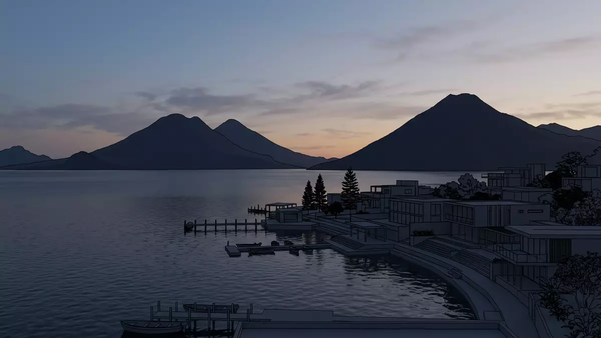
Lago de Atitlan is a deep volcanic lake in the highlands of Guatemala, stretching below the town of Panajachel and enclosed by steep slopes and three prominent volcanoes. Set within the Sololá Department at an elevation of around 1,560 m (about 5,125 ft), the lake forms a broad mirror of water inside a vast volcanic basin created tens of thousands of years ago.
A highland lake inside a volcanic caldera
Lago de Atitlan lies in the Guatemalan Highlands within the Sierra Madre mountain range, occupying a large depression left by a powerful eruption and subsequent caldera collapse during the Late Pleistocene.Guatemalan Highlands The water surface sits at roughly 1,560 m (5,125 ft) above sea level, giving visitors arriving from Western Europe a clear sense of altitude as they step out on lakeside terraces.surface sits at approximately 1,562 meters From east to west the lake reaches about 18 km (11 mi), with a wide mid-section that extends for nearly 10 km (6 mi) in places, and covers in the region of 130 km² (about 50 square miles).has a surface of 130 km² and length of 18 km
The basin forms part of a large volcanic structure known as the Atitlan caldera, where the lake occupies the central floor and younger volcanoes rise along its southern rim.massive volcanic caldera Below the surface the basin plunges to depths of more than 300 m (about 980 ft), and measurements taken around the lake indicate a maximum depth in the region of 340 m (1,120 ft), making Lago de Atitlan the deepest lake in Central America.deepest lake in Central America The water body therefore combines a broad horizontal expanse with a pronounced vertical dimension, framed by high walls of rock and soil.
Volcanoes and villages around the shore
Three stratovolcanoes stand along the southern margin of Lago de Atitlan: Volcán San Pedro, Volcán Tolimán and Volcán Atitlán, each rising well above 3,000 m (around 9,800 ft) and forming distinct peaks in the skyline.three post-caldera volcanoes Their cones climb steeply from the lakeside, so that from Panajachel and other shore towns the summits appear as separate dark masses above the blue water. The lake’s steep encircling slopes mark the edges of the caldera, where layers of volcanic ash, lava and weathered rock create a stepped profile cut by gullies and small rivers.
Around the lake, a ring of towns and villages occupies deltas, slopes and coves, many of them with strong Maya cultural traditions visible in language, dress and local markets.main towns along the lake Panajachel on the north-eastern shore forms one of the main gateways, linked to Guatemala City and other centres and providing boat connections to settlements such as Santiago Atitlán, San Pedro La Laguna, San Lucas Tolimán, Santa Catarina Palopó and San Antonio Palopó.municipalities around the lake including Panajachel Small harbours with wooden jetties and piers punctuate the shoreline, making the water itself a main route between communities.
Panajachel: delta town on the lakeside
Panajachel is located in the Sololá Department on the north-eastern shore of Lago de Atitlan, set on an alluvial fan built by the Panajachel River.alluvial delta formed by the Panajachel River The town lies at an altitude of around 1,500 m (about 4,920 ft), close to the lake’s level, and spreads back from the shore along streets laid over gently sloping ground.altitude of 1500 meters above sea level On clear days, the three southern volcanoes form a continuous backdrop behind the town’s buildings, reinforcing the sense that Panajachel sits within a volcanic basin.
As a settlement, Panajachel combines lakeside jetties and waterfront promenades with inland neighbourhoods defined by low-rise houses, small hotels and local shops. From its docks, motorised launches depart across Lago de Atitlan to the ring of villages around the shore, and the town’s position on a main road in the Guatemalan Highlands makes it a practical base for reaching other parts of the region.Panajachel is the best-known town The combination of water transport and road access gives visitors a clear sense of transition from the wider highlands down to the lake edge.
Visiting Lago de Atitlan: what travellers from Western Europe should know
- Lago de Atitlan lies in the Sololá Department of south-western Guatemala, with Panajachel on its north-eastern shore functioning as a common arrival point via road connections from Guatemala City and other major towns.
- The lake sits at roughly 1,560 m (about 5,125 ft) above sea level, and paths and streets in Panajachel and other lakeside towns rise and fall over sloping ground between the shore, river gullies and surrounding hills.
- Small passenger boats link Panajachel with other settlements on the lake, departing from simple piers and jetties that may involve stepping down onto moving platforms and boarding from low wharves.
- The official language is Spanish and the currency is the Guatemalan quetzal.
- Entry requirements depend on your nationality; UK travellers can check the FCDO travel advice at gov.uk/foreign-travel-advice, Irish travellers the Department of Foreign Affairs at ireland.ie.
Searching for Lago de Atitlan on social platforms
These links open searches for Lago de Atitlan on each platform.
Frequently asked questions about Lago de Atitlan
Where is Lago de Atitlan?
Lago de Atitlan is in the Sololá Department of south-western Guatemala, in the Guatemalan Highlands, with the town of Panajachel on its north-eastern shore.
What should visitors expect on a visit?
Visitors encounter a deep volcanic lake at altitude, ringed by steep slopes, three volcanoes and a series of towns and villages linked by small passenger boats.
What makes Lago de Atitlan distinctive?
Its combination of great depth, caldera setting, elevation and the skyline formed by Volcán San Pedro, Volcán Tolimán and Volcán Atitlán gives the lake a distinctive highland character.


