
La Rambla, the tree-lined spine of Barcelona’s old city
Published on 09/15/2026 at 10:50 | Editorial responsibility: Rafael Müller, Editor-in-Chief AD HOC NEWS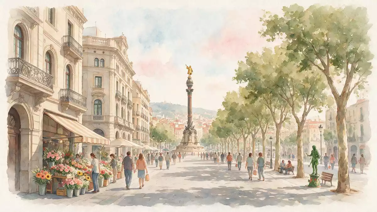
La Rambla is the tree-lined pedestrian boulevard that cuts through Barcelona’s historic centre, running between Plaça de Catalunya and the waterfront near the Christopher Columbus monument. It forms a broad corridor between the Gothic Quarter on one side and El Raval on the other, making it one of the clearest routes for understanding how the old city meets the sea.western edge of the Gothic Quarter
A single promenade made of several rambles
Although most visitors know La Rambla as one continuous street, it is historically divided into several named sections, each with its own character. The boulevard’s modern layout follows the line of medieval walls that once marked the edge of Barcelona’s core, with the present promenade emerging in the eighteenth and nineteenth centuries as those fortifications disappeared.La Rambla was laid out in 1766
The street reaches roughly 1.2 km (0.75 mi) in length from Plaça de Catalunya in the north to the Columbus monument and Port Vell in the south, and within that distance the route passes through a sequence of rambles historically known as Canaletes, Estudis, les Flors, Caputxins, Santa Mònica and, by some accounts, a shorter extension towards the water.sequence of five smaller ramblas Taken together, these sections form a single promenade that many people simply call La Rambla or Las Ramblas.
From seasonal watercourse to urban boulevard
Long before La Rambla became a paved avenue, this strip of land was a seasonal watercourse known as the Riera d’en Malla, channelling rainwater along the margin of the medieval city. Over centuries, as fortifications and convent buildings rose on either side, the channel shifted from drainage role to informal ground for paths and social life.Riera d'en Malla
The transformation into a recognisable boulevard accelerated in the eighteenth century, when sections of city walls were removed and a central walkway was laid out and planted with trees, creating a formal axis across the lower part of the old town. During the nineteenth century further changes followed, including the replacement of former religious complexes with public squares, theatres and markets, turning La Rambla into a civic promenade lined with secular institutions and commercial activity.assumed its present shape between 1849 and 1856
Trees, stalls and the line between two neighbourhoods
Walking La Rambla today means following a broad pedestrian way flanked by traffic lanes, with plane trees and other planting marking the central strip and forming one of the defining features of the street’s profile.tree-lined boulevard Along much of the route, kiosks, flower stalls and other small stands occupy parts of this central promenade, echoing patterns that became established in the nineteenth century when such elements were introduced as regular fixtures.flower stalls, newsstands and fountains
Geographically, La Rambla acts as a boundary between two districts at the heart of Ciutat Vella. On one side lies the dense Gothic Quarter, with its narrow lanes and medieval churches, and on the other the streets of El Raval, historically shaped by convents and later by diverse housing and cultural venues.divides the Gothic Quarter and El Raval This dividing role adds a spatial clarity to any visit: following La Rambla provides one of the simplest ways to read how Barcelona’s oldest neighbourhoods relate to one another and to the harbour.
Visiting La Rambla: what travellers from Western Europe should know
- La Rambla runs between Plaça de Catalunya and Port Vell, close to the Columbus monument, with Metro stations such as Catalunya, Liceu and Drassanes on or near the boulevard.
- The central promenade is paved and level, with separate carriageways for vehicles on either side; crossings use marked junctions and the route involves sustained walking over its 1.2 km (0.75 mi) length.
- La Rambla lies within the Ciutat Vella district of Barcelona, bordered by the Gothic Quarter and El Raval, so narrow side streets and older buildings are immediately accessible from the main boulevard.
- The official language is Spanish and Catalan and the currency is the euro.
Searching for La Rambla on social platforms
These links open searches for La Rambla on each platform.Frequently asked questions about La Rambla
Where is La Rambla in Barcelona?
La Rambla runs through the Ciutat Vella district, forming a boundary between the Gothic Quarter and El Raval and linking Plaça de Catalunya with the Columbus monument and Port Vell.
What can visitors expect when walking La Rambla?
Visitors encounter a central pedestrian promenade lined with trees, stalls and kiosks, flanked by traffic lanes and surrounded by dense historic streets that branch off into the Gothic Quarter and El Raval.
What makes La Rambla distinctive among Barcelona’s streets?
La Rambla stands out for combining a long, continuous boulevard with several historically named sections, a tree-lined central walk and a role as the main axis between core neighbourhoods and the harbour.


