
Kinderdijk’s windmill network and Dutch water landscape
Published on 09/12/2026 at 22:12 | Editorial responsibility: Rafael Müller, Editor-in-Chief AD HOC NEWS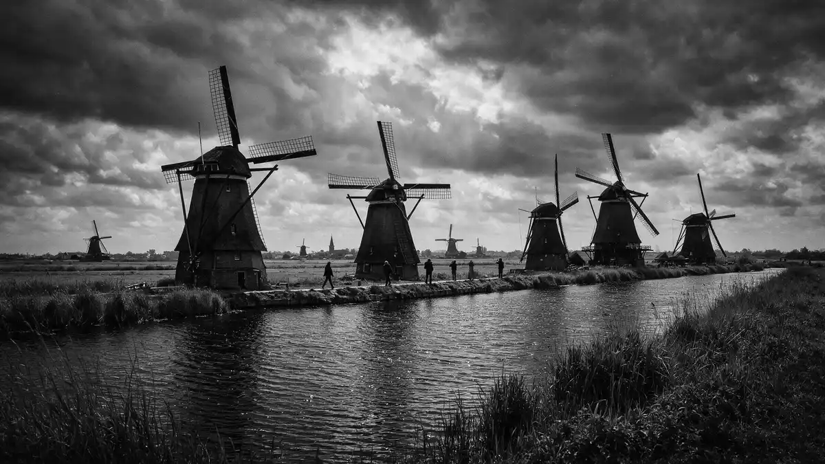
Kinderdijk in the Netherlands is a low-lying polder landscape where a dense network of windmills, canals and reservoirs has managed water for centuries. At Kinderdijk, nineteen historic drainage windmills stand alongside pumping stations and sluices, forming the Mill Network at Kinderdijk-Elshout, a UNESCO World Heritage Site inscribed in 1997.
A ribbon of windmills along the polder canals
The core experience at Kinderdijk is visual: rows of tall windmills lining narrow canals, their timber and brick bodies reflected in slow-moving water. The site lies in the Alblasserwaard polder in the province of South Holland, where land sits below the surrounding rivers and depends on engineered drainage to remain habitable.Alblasserwaard polder The majority of the mills belong to the village of Kinderdijk in the municipality of Molenlanden, with one, De Blokker, falling within neighbouring Alblasserdam.
Walking or cycling along the canals brings the layout into focus: parallel lines of waterways bordered by embankments, reed beds and footpaths, with the windmills spaced where their drainage function is needed. The mills face the water, their long sails rising above the dykes and farm fields, and the wider landscape includes storage basins, assembly houses and other hydraulic structures that complete the system.complex system of hydraulic works
From seventeenth-century mills to an eighteenth-century network
The story of Kinderdijk reaches back more than seven hundred years through Dutch attempts to control water in this low-lying region.over 700 years of water management Early water-drainage mills were built in the Alblasserwaard to pump excess water from the polder into higher channels, and the oldest surviving windmill at Kinderdijk, the Blokweerse Mill, has a documented predecessor on its site dating to the sixteenth century; the present structure dates from 1630. These individual installations were later joined by a coordinated network.
Between 1738 and 1740, sixteen drainage windmills were constructed and linked to storage basins, expanding the capacity to move water out of the polder.sixteen windmills connected to storage basins Another mill with a basin, the Hoge Molen in Nieuw-Lekkerland Polder, was added around 1740. Together with earlier structures, these works produced the present figure of nineteen windmills that define the landscape image of Kinderdijk and illustrate an eighteenth-century stage in Dutch hydraulic engineering.
Living World Heritage and Dutch water management
Kinderdijk’s Mill Network at Kinderdijk-Elshout carries World Heritage status as a cultural site recognised for its contribution to drainage technology and landscape organisation.Mill Network at Kinderdijk-Elshout The listing emphasises the combination of windmills, pumping stations, sluices and administrative buildings, together forming a layered water management system that has influenced practices beyond the Netherlands.drainage techniques used here The entire area is protected as a village view, and the mills themselves are national monuments.
Kinderdijk functions as a living landscape rather than a static monument. Several windmills remain inhabited by millers and their families, and museum mills are furnished to show domestic interiors alongside the machinery of the drainage system.windmills are still inhabited Visitors can walk along the dykes, look inside selected mills and see the relationship between house, work space and water level indicators. Together, canals, reservoirs and wind-powered mechanisms make Kinderdijk an open-air illustration of how the Netherlands has kept its reclaimed land dry.
Visiting Kinderdijk: what travellers from Western Europe should know
- Kinderdijk lies east of Rotterdam in South Holland, within the Alblasserwaard polder; it can be reached by regional bus routes and by waterbus services that link Rotterdam to the village.
- Paths follow the tops of dykes and the edges of canals, with long level stretches exposed to wind and weather; some access points involve steps and compact surfaces rather than wide ramps.
- Kinderdijk is surrounded by farmland and waterways, and the windmills stand close to the canals, so expect water on both sides of the main paths and limited shade from trees.
- The official language is Dutch and the currency is the euro.
Searching for Kinderdijk on social platforms
These links open searches for Kinderdijk on each platform.
Frequently asked questions about Kinderdijk
Where is Kinderdijk and what kind of place is it?
Kinderdijk is a village and polder landscape in South Holland, east of Rotterdam, known for its nineteen historic drainage windmills and associated water management works.
What should visitors expect when exploring Kinderdijk?
Visitors move along dykes and canal paths past windmills, reservoirs and pumping stations, with access to selected museum mills that show interiors and drainage machinery.
What makes Kinderdijk distinctive among Dutch landscapes?
Kinderdijk combines a high concentration of eighteenth-century windmills with canals, basins and hydraulic structures in a single coordinated drainage system recognised as a UNESCO World Heritage Site.


