
Kinderdijk’s windmill landscape and Dutch water mastery
Published on 09/16/2026 at 19:34 | Editorial responsibility: Rafael Müller, Editor-in-Chief AD HOC NEWS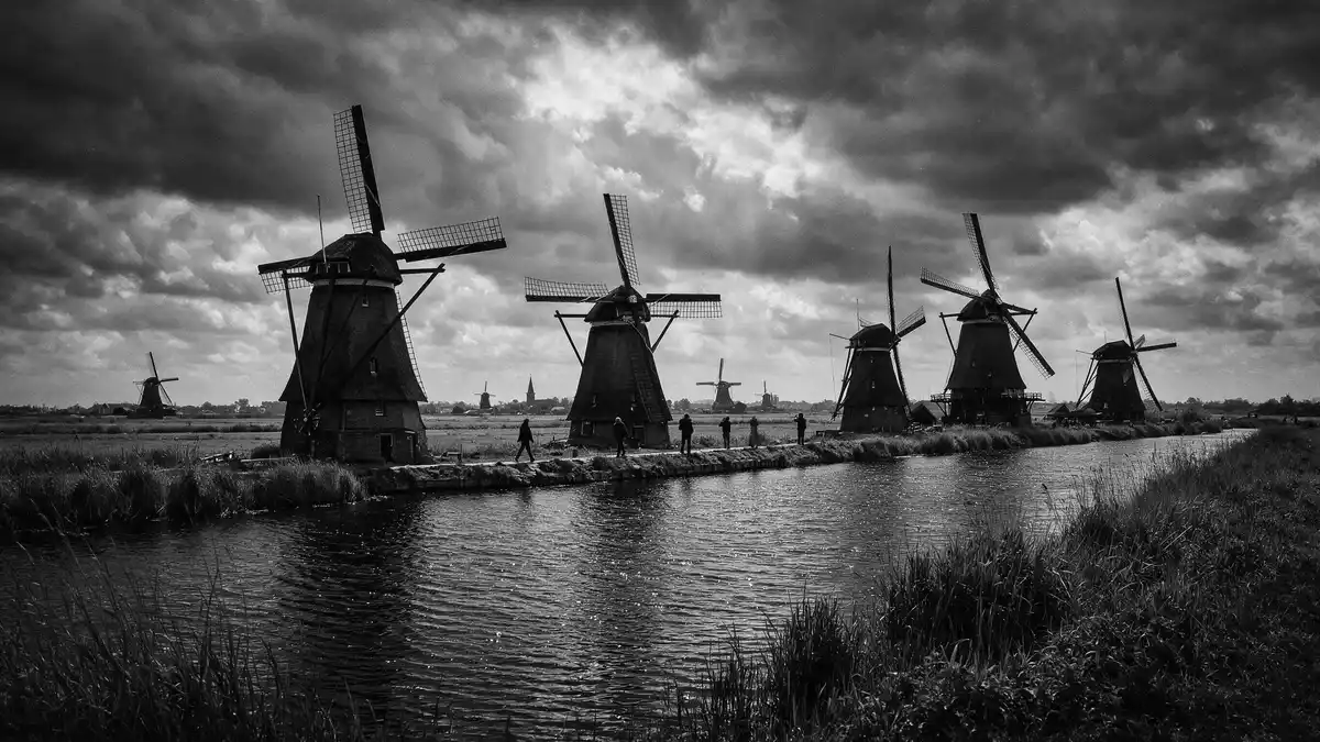
Kinderdijk in the Netherlands is a flat, watery landscape where a dense line of historic windmills still works with pumping stations, dykes and canals to keep a low-lying polder dry. The Mill Network at Kinderdijk-Elshout was inscribed as a UNESCO World Heritage Site in 1997, recognising a hydraulic system that has been developed over centuries in response to living below sea level.Mill Network at Kinderdijk-Elshout
Windmills along the Dutch polder canals
The best-known image of Kinderdijk is the straight canals bordered by grass banks, with windmills punctuating the horizon on both sides of the water. The site lies in the Alblasserwaard polder in the province of South Holland, where a network of waterways and reservoirs has been created to lift excess water away from the reclaimed land.Alblasserwaard polder The windmills stand in two main groups, traditionally known as Nederwaard and Overwaard, lining the canals in a pattern that is visible in many aerial photographs and maps.Nederwaard and Overwaard mills
In total there are 19 windmills at Kinderdijk, a concentration that makes this one of the most windmill-rich landscapes in the Netherlands.system of 19 windmills Sixteen of these were built between 1738 and 1740 to work with storage basins, lifting water from the polder up into reservoirs that can discharge into the river at controlled moments.built between 1738 and 1740 The windmills include round brick ground-sailers, thatched octagonal smock mills and a hollow post mill, giving the canal banks a varied silhouette even though the functional aim of each mill is similar.three types of windmill
A working water management system recognised by UNESCO
Kinderdijk is part of a larger hydraulic system that includes windmills, pumping stations, sluices, dykes, reservoirs and assembly houses for the regional water authorities, set up to drain and protect the polder from inundation.complex system of hydraulic works UNESCO recognises the Mill Network at Kinderdijk-Elshout as an outstanding example of water management, in which the long battle to keep land habitable in low-lying territory is visible in the preserved structures and landscape forms.outstanding example of water management
The World Heritage inscription, made in 1997, places Kinderdijk among a small group of Dutch sites recognised for cultural significance on a global scale.UNESCO World Heritage List The official UNESCO listing identifies criteria (i), (ii) and (iv), noting the way the site illustrates typical features of this technology, from dykes and reservoirs to pumping stations and an aligned series of windmills.criteria and listing details The area covered by the inscribed landscape is recorded as 322 ha (800 acres), setting a clear boundary around the canals, fields and structures that make up this human-made environment.area of 322 ha
Kinderdijk as a rural landscape and visitor destination
Kinderdijk is both a village and a landscape, with the canal-side windmills forming an immediate rural setting beyond the built-up area. The broader region lies near Dordrecht and Rotterdam in South Holland, and the site is often reached as a day trip from those cities.near Dordrecht The windmills line the Overwaard and Nederwaard canals in striking sequence, with grass paths and small bridges linking the embankments.
The windmills of Kinderdijk are described in many travel guides as the largest concentration of old windmills in the Netherlands, and the area is a well-established destination in the Dutch tourism landscape.largest concentration of old windmills Some of the mills are managed as museum mills, where the internal wooden gearing and millers’ living quarters can be seen, while others remain inhabited by millers and their families as part of an operating water management system.mills still inhabited
Visiting Kinderdijk: what travellers from Western Europe should know
- Kinderdijk lies in South Holland, east of Rotterdam and near Dordrecht, in the Alblasserwaard polder; it is reached by regional roads, public transport and boat services along the rivers.
- The main walking routes follow raised dykes beside the canals, with long level stretches on grass or paved surfaces and several small bridges that include short flights of steps.
- The surroundings are low-lying and exposed, with open fields and canals; wind and rain have a direct effect on conditions along the paths, and waterproof clothing is useful when the weather is unsettled.
- The official language is Dutch and the currency is the euro.
Searching for Kinderdijk on social platforms
These links open searches for Kinderdijk on each platform.
Frequently asked questions about Kinderdijk
Where is Kinderdijk and what kind of place is it?
Kinderdijk is a village and surrounding polder landscape in South Holland in the Netherlands, east of Rotterdam, known for its line of historic windmills along canals.
What can visitors expect when walking through Kinderdijk?
Visitors walk along dykes beside straight canals, with grass and paved paths passing windmills, pumping stations and fields, in an open rural landscape shaped by water management structures.
What makes Kinderdijk distinctive among Dutch landscapes?
The combination of 18th-century windmills, reservoirs, dykes and modern pumping stations in one clearly defined polder makes Kinderdijk a concentrated illustration of Dutch hydraulic engineering and rural life.


