
Kinderdijk’s mills and water landscape
Published on 09/09/2026 at 15:19 | Editorial responsibility: Rafael Müller, Editor-in-Chief AD HOC NEWS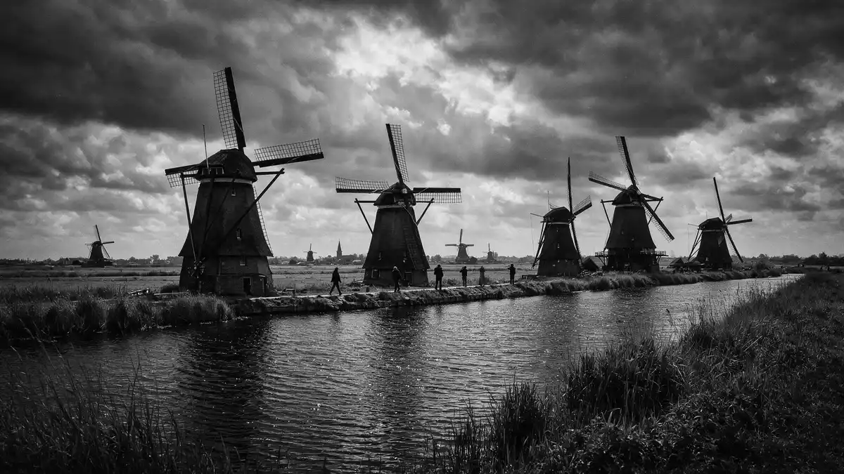
Kinderdijk is a Dutch water landscape defined by windmills, dykes, canals and pumping stations. The site forms part of the Mill Network at Kinderdijk-Elshout, inscribed as UNESCO World Heritage in 1997.
Kinderdijk’s mills in a worked landscape
The place is best read as a system rather than as a single monument. Nineteen drainage mills, three pumping stations, discharge sluices and watercourses sit together in a low-lying polder landscape.
The mills are not isolated ornaments. They stand among canals, embankments and open fields, and the long horizontal lines of the land meet their vertical forms. The world heritage listing notes that the area shows the Dutch technology of water handling across a landscape that began in the Middle Ages and continued for centuries. Water handling in the polder
Historic mills and later pumping works
The surviving mills belong to different phases of work at Kinderdijk. The site includes eight round brick ground-sailers, ten thatched octagonal smock mills and one hollow post mill, a group that gives the landscape its layered character.
Kinderdijk also contains later pumping infrastructure, including the Wisboom Pumping Station and the J.U. Smit Pumping Station. The present landscape therefore shows both wind-powered drainage and mechanical pumping in one place. Kinderdijk’s own history page traces the modern form of the system through the eighteenth century and identifies 1738 and 1740 as key building years for the larger mill network. eighteenth-century drainage mills
The oldest mill on the site, the Blokweerse Mill, dates from 1630 in its present form. It is one of the clearest reminders that the place is older than the famous eighteenth-century ensemble and that the landscape developed in layers. The official history also places the first drainage mills in the Alblasserwaard region, which is the low-lying area around Kinderdijk. Blokweerse Mill
Kinderdijk as a Dutch water-system landscape
Kinderdijk belongs to the Alblasserwaard in Zuid-Holland. The area formed around peat bogs, ditches, dykes and drainage channels, and its surviving structures make that history visible in the open land.
The UNESCO description emphasises reservoirs, pumping stations, administrative buildings and preserved windmills as part of one hydraulic ensemble. That combination gives Kinderdijk its specific identity: the mills are only part of a wider landscape of water control, settlement and agriculture. preserved windmills
For visitors, the appeal lies in the way the different elements remain legible together. The canals, dykes and mills form a clear pattern across flat land, and the place can be understood as a working historical landscape rather than a detached row of buildings.
Visiting Kinderdijk: what travellers from Western Europe should know
- Kinderdijk lies in the province of Zuid-Holland, in the Alblasserwaard area south-east of Rotterdam. It is reached through the roads and waterways of the Dutch river delta.
- The terrain is flat and low-lying, with canals, dykes and open ground around the mills. The site is spread across the polder landscape rather than concentrated in one compact square.
- The official language is Dutch and the currency is the euro.
- Entry requirements depend on your nationality; UK travellers can check the FCDO travel advice at gov.uk/foreign-travel-advice, Irish travellers the Department of Foreign Affairs at ireland.ie.
Searching for Kinderdijk on social platforms
These links open searches for Kinderdijk on each platform.
Frequently asked questions about Kinderdijk
Where is Kinderdijk?
Kinderdijk is in Zuid-Holland in the Netherlands, within the Alblasserwaard polder landscape. It lies in a low river region shaped by canals, dykes and drainage works.
What does a visit involve?
The site is a broad landscape of mills, pumping stations and water channels. Visitors encounter open land, straight water lines and the historic drainage structures that define the area.
What makes Kinderdijk distinctive?
Its defining feature is the combination of nineteenth- and eighteenth-century water-management works with preserved mills in one coherent landscape. The UNESCO-listed ensemble is read through its canals, dykes, reservoirs and mills.


