
Kerala Backwaters around Alappuzha: water, villages and rice fields
Published on 09/16/2026 at 07:22 | Editorial responsibility: Rafael Müller, Editor-in-Chief AD HOC NEWS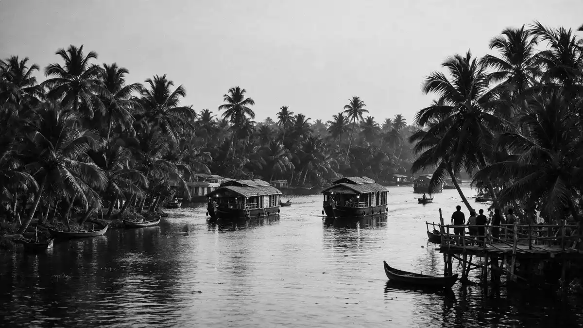
Kerala Backwaters near Alappuzha in India form a shallow, low-lying landscape of lagoons, canals and rivers running behind the Arabian Sea, with villages and paddy fields set directly along the water. Centuries of settlement and cultivation have turned this stretch of coastal wetland into one of India’s most distinctive water landscapes, centred on Vembanad Lake and the Kuttanad region.
Waterways between Vembanad Lake and the sea
The Kerala backwater system is not a single channel but an intricate chain of brackish lagoons, lakes, canals, rivers and estuaries that runs roughly parallel to the Malabar Coast of Kerala. The densest concentration of waterways lies in central Kerala around the Vembanad–Kuttanad lowland, where Alappuzha sits at the southern reach of Vembanad Lake.Vembanad–Kuttanad lowland The channels here link shoreline villages, paddy fields and small islands in a continuous water network.
Vembanad Lake, known locally as Punnamada Lake around Alappuzha, is recognised as India’s longest lake, stretching for around 96 km (60 mi) along the coast and forming the hydrological heart of Kerala’s backwaters.India’s longest lake The lake lies almost at sea level behind a narrow barrier of coconut-fringed land that separates it from the Arabian Sea, creating a long, shallow lagoon with salinity that shifts from nearly fresh water near Alappuzha during the monsoon to more saline conditions closer to Kochi.long, shallow lagoon
Houseboats, ferries and village life on the water
Around Alappuzha, the backwaters form a calm, navigable labyrinth where transport, trade and daily life take place along the water. Traditional wooden vessels share the channels with converted rice barges, now used as houseboats, and with regular ferries that link mainland jetties, island settlements and stretches of cultivated land. The shoreline is punctuated by simple landing steps, boat jetties and narrow paths, making the interface between water and land a constant feature of the landscape.guide to Kerala’s backwaters
Kerala’s backwaters around Alappuzha sit within one of South Asia’s more complex freshwater–brackish wetland systems, where river outflow, tidal inflow and coastal sedimentation have produced a mosaic of freshwater zones, brackish stretches, mangrove belts and flooded paddy fields.freshwater–brackish wetland system Small villages line the canals, often with houses facing directly onto narrow waterways, while palm-lined bunds carry footpaths and local traffic. Everyday scenes on the backwaters include local transport boats stopping at simple quays, people moving between fields and hamlets, and activity centred on the water rather than on roads.
Kuttanad’s below-sea-level paddy fields
South and east of Alappuzha, the southern lobes of Vembanad Lake enclose the Kuttanad region, an agro-ecological zone known for paddy cultivation carried out below mean sea level.below mean sea level Here, large tracts of reclaimed land lie between about 0.6 and 2.2 m (2.0 to 7.2 ft) below sea level, protected by bunds and managed through an intricate system of canals, sluices and pumping stations that keep fields from flooding during high water.reclaimed low-lying land The contrast between open lake, narrow canals and low paddy plots is one of the distinctive visual signatures of Kerala’s backwaters around Alappuzha.
Vembanad Lake and its wetland complex, including the Kuttanad lowlands, form the Vembanad-Kol wetland, recognised as a Ramsar site and listed among India’s key biodiversity areas.Vembanad-Kol wetland The backwaters support mangrove patches, reed beds, submerged vegetation and open water, alongside human-modified landscapes of bunded fields and settlement islands. This close balance between wetland ecology and long-standing cultivation shapes both the scenery and the rhythms of life along the canals and lake shores.
Visiting Kerala Backwaters: what travellers from Western Europe should know
- The backwaters around Alappuzha lie inland from the Arabian Sea on Kerala’s Malabar Coast in southern India, with Vembanad Lake forming the main water body in this area.
- Travel on the Kerala backwaters is primarily by boat, with local ferries and various types of houseboat operating on canals and lake channels between Alappuzha, nearby villages and paddy-field regions.
- The terrain is low-lying and water-dominated; access to many settlements involves short walks along narrow bunds or paths beside canals, and stepping down onto simple jetties and landing steps.
- The official language is Malayalam and the currency is the Indian rupee.
- Entry requirements depend on your nationality; UK travellers can check the FCDO travel advice at gov.uk/foreign-travel-advice, Irish travellers the Department of Foreign Affairs at ireland.ie.
Searching for Kerala Backwaters on social platforms
These links open searches for Kerala Backwaters on each platform.Frequently asked questions about Kerala Backwaters
Where are the Kerala backwaters around Alappuzha?
The Kerala backwaters near Alappuzha occupy a low-lying lagoon and canal system in central Kerala, focused on the southern reaches of Vembanad Lake behind the Arabian Sea.
What can travellers expect on a visit to the backwaters?
A visit to the backwaters brings close contact with calm canals, lakeside scenery, houseboats, ferries and village life along bunds and jetties, with paddy fields and wetland landscapes directly beside the water.
What makes this part of Kerala’s backwaters distinctive?
The combination of India’s longest lake, reclaimed below-sea-level paddy fields in Kuttanad and long-settled canal-side villages gives the Kerala backwaters around Alappuzha a character strongly shaped by both water and cultivation.


