
Kerala Backwaters and the broad waters of Alappuzha
Published on 09/03/2026 at 16:01 | Editorial responsibility: Rafael Müller, Editor-in-Chief AD HOC NEWS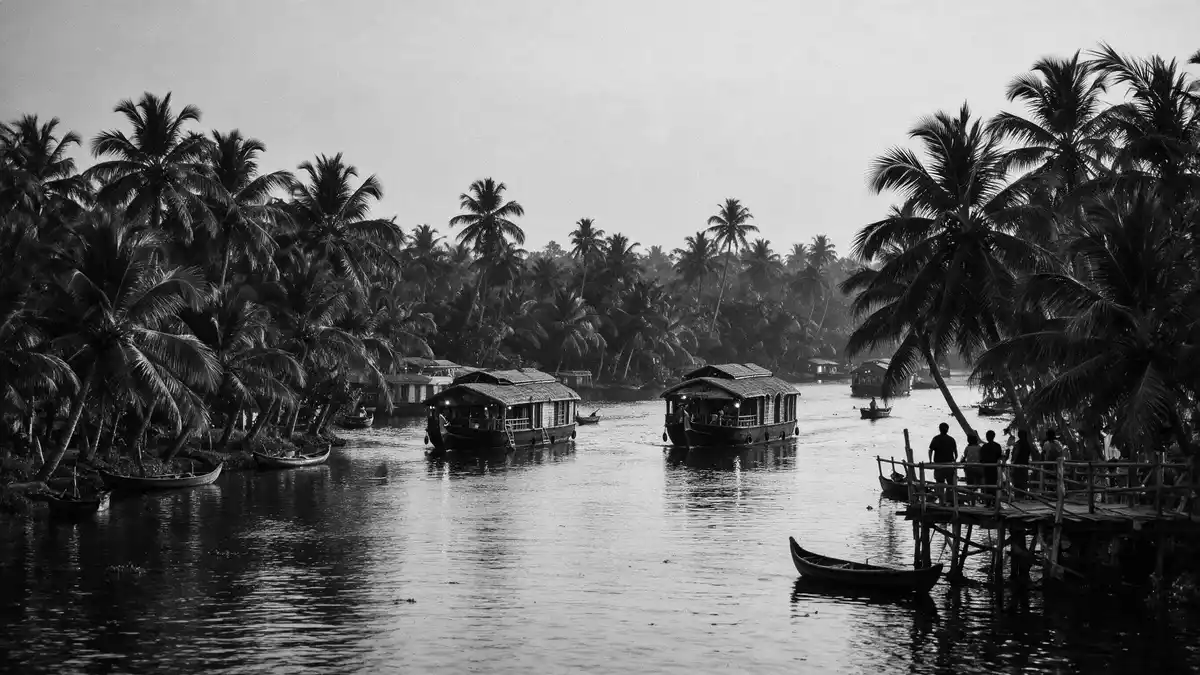
Kerala Backwaters around Alappuzha form a broad chain of canals, lagoons and lakes beside the Malabar Coast. Vembanad Lake and the western canal system give the area its wide, low water landscape.
Vembanad Lake and the canal web
The backwaters around Alappuzha belong to a linked water system rather than a single lake. Vembanad Lake, the largest lake in Kerala, stretches through Alappuzha, Kottayam and Ernakulam and sits at the centre of that system.largest lake in Kerala The district’s canals connect the lake with inland settlements and the coast, and the water network reaches into smaller kayals and narrow links.
Alappuzha has long been associated with water transport, and the district’s canal system remains part of its identity. The setting combines open lake stretches, straight canal sections and embanked edges, with navigation still central to the place’s character.district’s canal system
Kettuvallams on inland water
Houseboats are among the best-known craft on these waters, and the traditional kettuvallam remains the clearest visual link between older freight travel and leisure cruising. The boats have a long, low wooden profile and appear across the backwaters as floating accommodation rather than ordinary ferries.traditional kettuvallam
The boat traffic is only part of the scene. Coconut palms, paddy fields and village edges line many of the waterways, so the backwaters read as both working landscape and travel corridor.working landscape
Alappuzha’s place in Kerala’s water country
Alappuzha is the name most closely tied to the backwaters for English-language travellers, and the district lies on Kerala’s south-western coast. The wider system runs parallel to the Arabian Sea and brings together rivers, lakes and canals in a single coastal belt.runs parallel to the Arabian Sea
The region is also shaped by the low-lying land around Kuttanad, where paddy fields sit below sea level in places. That relationship between water and cultivation is one of the strongest visual signatures of the area, especially where narrow banks separate fields from the canals.Kuttanad
Visiting Kerala Backwaters: what travellers from Western Europe should know
- The backwaters are reached through Alappuzha town, by road from the coastal plain and by boat from canal-side landing points. Cochin International Airport and the railway station at Alappuzha are the usual reference points for the district.
- The terrain is flat, wet and broken by waterways, embankments and narrow lanes. Short walks are part of moving between the water’s edge, road links and village stretches.
- Boats dominate movement on the canals and lake edges. Houseboats, canoes and local ferries each show a different scale of the same water landscape.
- The main visual elements are water, palms, fields and low banks. The place reads as an inhabited wetland rather than a detached scenic reserve.
Searching for Kerala Backwaters on social platforms
These links open searches for Kerala Backwaters on each platform.
Frequently asked questions about Kerala Backwaters
Where are Kerala Backwaters?
They lie in Kerala, on India’s south-west coast, with Alappuzha as a central gateway. The system includes Vembanad Lake, canals and smaller lagoons.
What does a visit involve?
Most visits centre on boats, water routes and short stops along the banks. The landscape combines canals, fields and village edges rather than a single enclosed site.
What makes the place distinctive?
The strongest feature is the linked water network itself. Vembanad Lake, canals and paddy fields create a coastal inland landscape that is both lived in and travelled through.


