
Kenai Fjords National Park and the ice-carved coast of Seward
Published on 08/26/2026 at 17:00 | Editorial responsibility: Rafael Müller, Editor-in-Chief AD HOC NEWS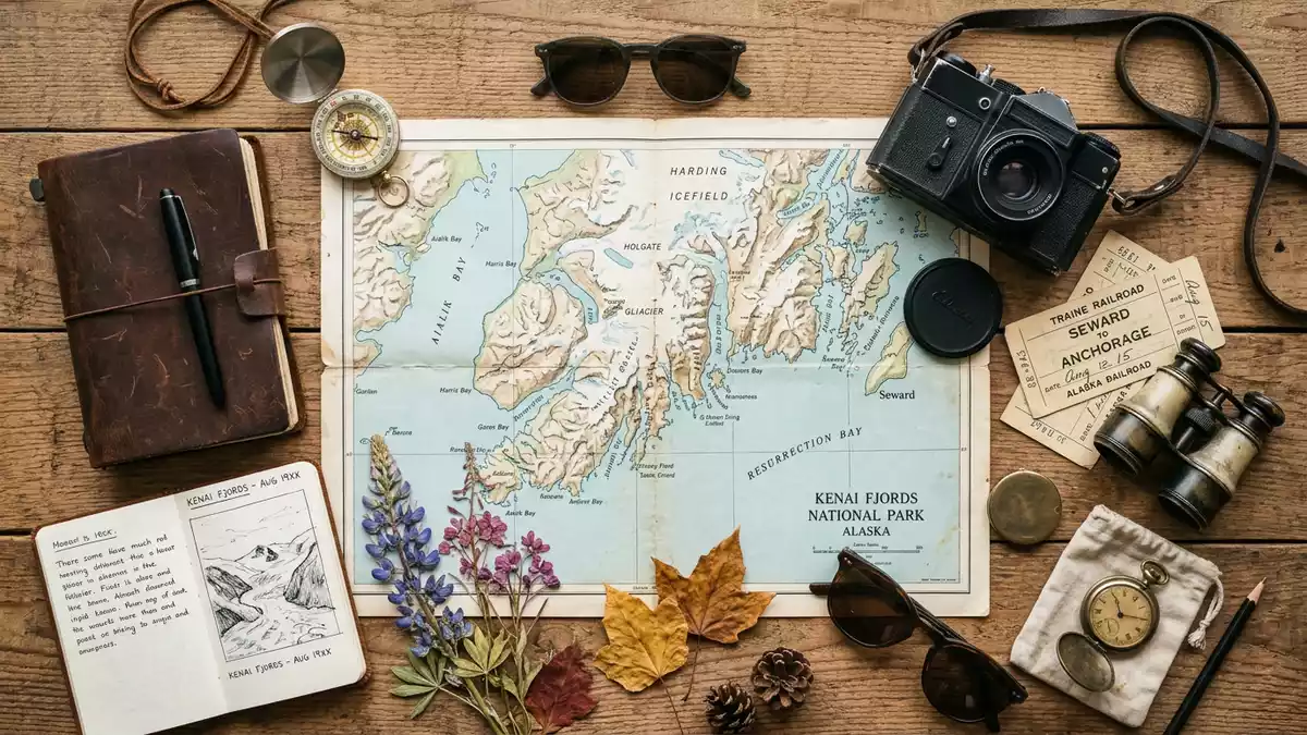
Kenai Fjords National Park on Alaska’s Kenai Peninsula is defined by a meeting of ocean, mountains and ice on the coast near Seward. Established as a national monument in 1978 and redesignated as a national park in 1980, it preserves a striking concentration of glaciers flowing from the Harding Icefield into deep fjords and the Gulf of Alaska.
Icefield and fjords on the Gulf of Alaska
The core of Kenai Fjords National Park is the Harding Icefield, a high plateau of snow and ice that covers much of the central Kenai Mountains above the Gulf of Alaska. The icefield extends for tens of kilometres, and its almost level surface lies far above the coastal inlets that cut into the range.Harding Icefield and its outflowing glaciers Glaciers descend from this plateau in many directions, carving valleys into the mountains and shaping the coastline into steep-sided fjords where seawater fills trenches that were once packed with ice.U-shaped valleys filled with seawater
Snow and ice cover roughly half of the protected area, with the icefield feeding dozens of glaciers that flow towards tidewater and high mountain basins. In the southwestern part of the park the fjords branch into narrow channels with rocky cliffs and headlands, creating a sharply indented coastline that faces the open Gulf of Alaska.steep bedrock walls and deep submarine valleys The combination of glaciated mountains, marine inlets and offshore islands makes Kenai Fjords one of Alaska’s most distinctive coastal landscapes.
Glaciers flowing from the Harding Icefield
Kenai Fjords National Park is extensively glaciated, with a large proportion of its surface under permanent ice and snow. The Harding Icefield is the largest single feature within the park, and more than thirty named glaciers originate from it.at least 38 glaciers flow from the icefield These glaciers differ in character: some end in mountain basins, while others reach down to sea level as tidewater glaciers that calve ice into the fjords.
Bear Glacier, in the coastal area south-west of Seward, is the park’s largest glacier and flows from the icefield towards a long lagoon behind low moraines.Bear Glacier as the largest glacier in the park Exit Glacier, closer to the road system near Seward, is an alpine glacier descending from the same icefield into a valley on the landward side of the mountains.Exit Glacier as an alpine glacier Other named glaciers, including Aialik, Holgate and Northwestern, reach into fjords that are accessible by boat, where walls of ice rise above the water at the heads of narrow inlets.
Geology, wildlife and the setting near Seward
The landscape of Kenai Fjords National Park records repeated glaciations over tens of thousands of years, from the height of the last Ice Age to more recent advances and retreats. Ice carved cirques high in the mountains and scoured deep valleys that later filled with seawater as sea levels rose and the climate warmed. The bedrock includes Cretaceous and younger marine and volcanic formations that were uplifted and deformed by plate movements along the margin of the North American and Pacific plates.geologically active landscape shaped by tectonics and glaciation
The fjords and surrounding waters support a rich marine ecosystem with whales, seals, sea lions, sea otters and seabirds occupying different parts of the food web in the Gulf of Alaska and adjacent inlets.marine wildlife along the fjords On land, the steep slopes above the fjords carry spruce and hemlock forests at lower elevations, while alpine zones around the icefield support hardy vegetation adapted to short growing seasons and heavy snow. Seward, at the head of Resurrection Bay, serves as the nearest town and harbour, providing a base at the end of the Seward Highway and the Alaska Railroad for access to the park’s coastal waters and nearby glaciers.Seward as the gateway to the park
Visiting Kenai Fjords National Park: what travellers from Western Europe should know
- Kenai Fjords National Park lies on the Kenai Peninsula in south-central Alaska, with access from the harbour town of Seward at the head of Resurrection Bay.
- Much of the park consists of rugged coastal fjords, steep mountain slopes and extensive ice, so travel on foot away from established trails involves uneven terrain and potentially exposed ground.
- Exit Glacier, inland from Seward, is reached by a road and trail network, while the marine fjords are visited by boats that depart from Seward’s harbour.
- The official language is English and the currency is the United States dollar.
- Entry requirements depend on your nationality; UK travellers can check the FCDO travel advice at gov.uk/foreign-travel-advice, Irish travellers the Department of Foreign Affairs at ireland.ie.
Searching for Kenai Fjords National Park on social platforms
These links open searches for Kenai Fjords National Park on each platform.
Frequently asked questions about Kenai Fjords National Park
Where is Kenai Fjords National Park?
Kenai Fjords National Park is on the Kenai Peninsula in south-central Alaska, with its gateway town of Seward at the head of Resurrection Bay on the Gulf of Alaska.
What should visitors expect on a visit?
Visitors encounter a landscape of deep coastal fjords, extensive glaciers flowing from the Harding Icefield, steep forested and alpine slopes, and marine wildlife in the Gulf of Alaska and adjacent inlets.
What makes Kenai Fjords National Park distinctive?
Kenai Fjords National Park is distinctive for its combination of the Harding Icefield, numerous glaciers including Bear and Exit glaciers, and fjords carved into the Kenai Mountains that bring sea, mountains and ice into a single coastal setting.


