
Kapadokya’s rock-cut landscape in Göreme
Published on 09/07/2026 at 22:01 | Editorial responsibility: Rafael Müller, Editor-in-Chief AD HOC NEWS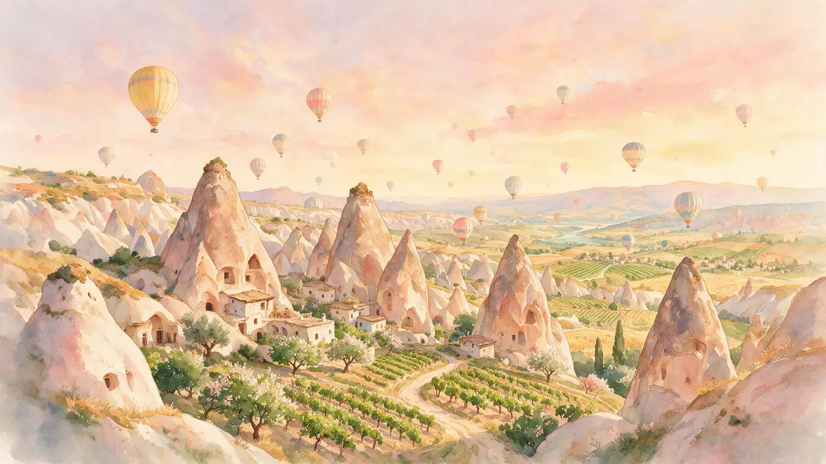
Kapadokya in Göreme is a landscape of eroded volcanic tuff, carved sanctuaries and underground settlements. The area forms part of Göreme National Park, inscribed on the World Heritage List in 1985.
Göreme’s carved rock and pale ridges
The valley and its surroundings are shaped by erosion into ridges, pinnacles and soft cones. The local rock has been cut into dwellings, troglodyte villages and sanctuaries, so the surface and the hollowed spaces sit side by side. rock-hewn sanctuaries and the surrounding forms belong to the same landscape.
In Göreme, the human work is visible in the rock itself. Churches, cells and other cut spaces occupy the cliffs and slopes, while the broader setting remains a volcanic terrain. That mix of geology and habit gives Kapadokya its defining appearance in Göreme.
Byzantine churches in the valley
Göreme is closely associated with Byzantine rock-cut churches and monastic life. The UNESCO description places the beginnings of that settled religious use in the fourth century, and later sanctuaries preserve painted decoration from the post-iconoclastic period.
Names such as Basileios the Great belong to that deeper history of the plateau, where anchorite communities lived in cells hewn from the rock. The setting also includes underground towns such as Kaymakl? and Derinkuyu, extending the same carved tradition beneath the surface. Kapadokya is therefore not only a scenic valley but a layered historical terrain.
World Heritage status and the wider Cappadocian setting
The World Heritage property covers more than the Göreme valley alone. It extends across a broader Cappadocian region between Nev?ehir, Ürgüp and Avanos, with other named sites included in the inscription. the 1985 inscription ties Göreme to that wider protected landscape.
The result is a place where rock-cut chapels, underground settlements and volcanic landforms belong to one historical geography. Kapadokya in Göreme is read most clearly through that combination of sculpted stone, Byzantine painting and inhabited rock.
Visiting Kapadokya: what travellers from Western Europe should know
- Göreme lies in central Anatolia, in Nev?ehir Province. The World Heritage property also reaches towards Ürgüp and Avanos.
- The terrain includes cut rock, slopes and underground spaces. Some parts involve steps and uneven passages.
- The official language is Turkish and the currency is the Turkish lira.
- Entry requirements depend on your nationality; UK travellers can check the FCDO travel advice at gov.uk/foreign-travel-advice, Irish travellers the Department of Foreign Affairs at ireland.ie.
Searching for Kapadokya on social platforms
These links open searches for Kapadokya on each platform.
Frequently asked questions about Kapadokya
Where is Kapadokya?
Kapadokya lies in central Anatolia around Göreme, within a wider World Heritage landscape that includes Nev?ehir, Ürgüp and Avanos.
What does a visit reveal?
It reveals eroded volcanic rock, carved churches and underground towns. The place is a historic landscape rather than a single monument.
What distinguishes Kapadokya in Göreme?
The combination of Byzantine sanctuaries, subterranean settlements and sculpted tuff gives Göreme its particular character. The rock surface and the hollowed interior spaces belong to one continuous setting.


