
Kangaroo Island’s wild edge and the harbour town of Kingscote
Published on 08/28/2026 at 07:02 | Editorial responsibility: Rafael Müller, Editor-in-Chief AD HOC NEWS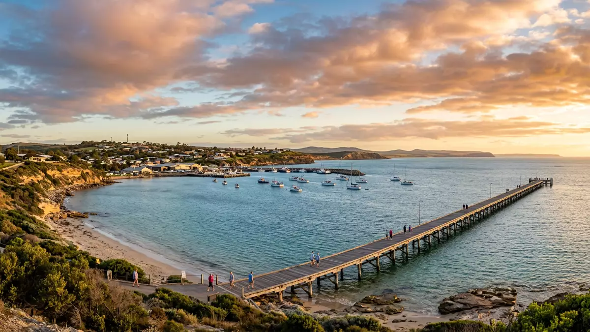
Kangaroo Island off the coast of South Australia combines ocean-facing wilderness with the compact scale of Kingscote, the island’s largest township and administrative centre. The island is Australia’s third-largest, with a length of around 150 km (93 mi) from east to west, and Kingscote developed as the principal settlement after the first official European landing in 1836.
An island of scale, plateaus and sea cliffs
Kangaroo Island is located at the entrance to Gulf St Vincent, around 110 km (70 mi) south-west of Adelaide, and lies a short distance offshore from Cape Jervis on the tip of the Fleurieu Peninsula.south-west of Adelaide Its outline runs roughly 150 km (93 mi) from east to west and up to about 55 km (34 mi) across at its widest, narrowing to barely a kilometre at its most slender point.statistics for length and width
The island forms a broad plateau that continues the line of the Mount Lofty and Flinders ranges from the mainland, rising to a maximum altitude of about 307 m (1,010 ft) above sea level.plateau linked to mainland ranges Its coastline extends for more than 500 km (310 mi), with a steeper, cliffed northern shore facing Gulf St Vincent and a rugged southern margin exposed to the Southern Ocean. Inland, the plateau tilts slightly from north to south and carries expanses of ironstone country, pockets of forest and low rolling hills that frame the road network linking settlements and national parks.
Kingscote: harbour town and earliest settlement
Kingscote stands on the north coast of Kangaroo Island beside Nepean Bay and serves as the island’s administrative and tourist centre.Kingscote as administrative centre With a resident population in the low thousands, it is the largest town on the island and concentrates council offices, shops and services around its waterfront streets.settlements including Kingscote
The town traces its European history to 27 July 1836, when settlers associated with the South Australia Company established a base at Reeves Point, just west of the present centre.first official European settlement Kingscote became the first official European settlement in South Australia, and markers along the shoreline recall its role in early colonial administration before attention shifted to Adelaide on the mainland.earliest settlement and former capital Today the harbour, low-rise streets and nearby beaches such as Emu Bay present a low-key coastal town framed by sea views and open countryside.
Wildlife, protected landscapes and island economy
Kangaroo Island’s area of about 4,400 km² (1,700 sq mi) carries a mix of protected reserves, farming districts and fishing grounds, and more than 30% of the land lies within national and conservation parks.parks covering more than 30% The island is known for coastal sites such as Remarkable Rocks in Flinders Chase National Park, the dunes of Little Sahara and wildlife experiences around rookeries and conservation areas.popular places to visit
Tourism sits alongside agriculture, cattle farming, apiculture with Ligurian honey bees and southern rock lobster fishing as major economic pillars, and the council area records a resident population of just over 4,400 people.economic mix including agriculture and tourism Visitors arrive from across Australia and overseas, including many from Europe, drawn to the combination of ocean coastline, wildlife and small-town settlements such as Kingscote, Penneshaw, Parndana and American River.main towns on the island
Visiting Kangaroo Island: what travellers from Western Europe should know
- Kangaroo Island lies off the south coast of Australia in the state of South Australia and is reached by ferry services from Cape Jervis or by flights into Kingscote Airport.
- Roads link Kingscote with other settlements and park entrances; many routes combine sealed and unsealed sections, and some viewing points stand above sea cliffs and exposed shorelines.
- The island’s terrain includes low plateaus, coastal dunes and rocky headlands, so walks to beaches or viewpoints can involve uneven ground, short climbs and exposure to strong ocean winds.
- The official language is English and the currency is the Australian dollar.
- Entry requirements depend on your nationality; UK travellers can check the FCDO travel advice at gov.uk/foreign-travel-advice, Irish travellers the Department of Foreign Affairs at ireland.ie.
Searching for Kangaroo Island on social platforms
These links open searches for Kangaroo Island on each platform.
Frequently asked questions about Kangaroo Island
Where is Kangaroo Island and how is Kingscote situated on it?
Kangaroo Island lies off the south coast of Australia at the entrance to Gulf St Vincent, and Kingscote stands on its north coast beside Nepean Bay.
What can visitors expect when they travel to Kangaroo Island?
Travellers encounter long coastal drives, sea cliffs, dunes and wildlife-rich reserves, alongside small towns such as Kingscote and Penneshaw linked by sealed and unsealed roads.
What makes Kangaroo Island distinctive among Australian islands?
Its combination of a large plateau rising to more than 300 m (1,010 ft), over 500 km (310 mi) of coastline and the early settlement history of Kingscote gives it a particular character among offshore islands.


