
Kangaroo Island and Kingscote’s historic coastal character
Published on 09/09/2026 at 15:47 | Editorial responsibility: Rafael Müller, Editor-in-Chief AD HOC NEWS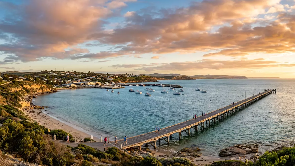
Kangaroo Island sits off the coast of South Australia, with the town of Kingscote forming the largest settlement and administrative centre on the island. The contrast between the island’s broad plateau and the indented bays around Kingscote gives this corner of Australia a distinctive coastal character grounded in both landscape and history.
An offshore island of plateaus and cliffs
Kangaroo Island lies southwest of Adelaide at the entrance to Gulf St Vincent, separated from the mainland by stretches of sea including the Backstairs Passage. Its landmass covers around 4,350 km² (1,680 sq mi), making it the third-largest Australian offshore island after Tasmania and Melville Island.third-largest Australian offshore island From west to east the island extends for about 145 km (90 mi), with a width that varies between roughly 34 and 55 km (21 to 34 mi) depending on the section of coast.extends for about 145 km
The overall form of Kangaroo Island is that of a low plateau rising to nearly 280 m (920 ft), structurally linked to the Mount Lofty and Flinders ranges on the mainland.low plateau rising to nearly 280 m Much of the centre consists of ironstone country with mallee scrub, bulloak and banksia shrubs, while the coasts are edged by cliffs, long beaches and inlets. On the northern side the shore tends to be steeper, facing into gulfs and bays, whereas the southern edge meets the Southern Ocean with rugged headlands and exposed surf.
Kingscote between Nepean Bay and Bay of Shoals
Kingscote occupies a small peninsula on the north coast of Kangaroo Island, set between Nepean Bay and the Bay of Shoals.between Nepean Bay and the Bay of Shoals The settlement looks out over sheltered water, with low cliffs and foreshore areas giving access to the bay, while farmland and low hills rise inland towards the centre of the island. Kingscote functions as the island’s principal town and administrative centre, linking surrounding communities and acting as a service hub for visitors and residents.principal town and administrative centre
The site bears traces of early colonial history. Nepean Bay was visited in 1802 by the English navigator Matthew Flinders, who named the island for its kangaroos, and in 1803 by Nicolas Baudin’s French expedition. Formal settlement followed later in the nineteenth century, when Reeves Point near Kingscote was chosen for landings by the South Australia Company in July 1836.Reeves Point near Kingscote was chosen Kingscote is therefore linked to South Australia’s earliest European settlement, a connection marked in local heritage studies and commemorative sites.
Coastal environment, wildlife areas and rural hinterland
Around Kingscote the coastline combines sheltered bays with tidal flats, jetties and beaches that face onto Nepean Bay. The wider island has more than 540 km (336 mi) of coastline, and visitors encounter long stretches of sand, rock platforms and reed-edged inlets along the drive between townships.more than 540 km of coastline Inland from Kingscote, roads lead through open paddocks and lightly wooded country towards places such as Parndana and American River, revealing the mixture of agricultural land and native vegetation that characterises much of Kangaroo Island.
Beyond the town, the island is known for protected areas including Flinders Chase National Park in the west and Seal Bay Conservation Park on the southern coast, where colonies of Australian sea lions occupy the shore.Flinders Chase National Park in the west The climate follows a warm-summer Mediterranean pattern with relatively mild, wet winters and warm, drier summers, and rainfall tends to be higher in the elevated interior than near the eastern bays.warm-summer Mediterranean pattern These conditions support both grazing and cropping in selected areas, alongside extensive tracts of scrub and woodland that provide habitat for wildlife.
Visiting Kangaroo Island: what travellers from Western Europe should know
- Kangaroo Island lies off the mainland of South Australia, with Kingscote on the north coast between Nepean Bay and Bay of Shoals; the island is reached by sea or air links from the state.
Roads from the landing points lead to Kingscote and other townships. - The terrain around Kingscote involves coastal slopes, low cliffs and sections of foreshore, while the interior plateau rises to about 280 m (920 ft); some approaches include unsealed roads and gently undulating farmland.
- The island experiences a Mediterranean-type climate with wet winters and warm, dry summers, and conditions vary between the higher central areas and the more sheltered eastern bays.
- The official language is English and the currency is the Australian dollar.
- Entry requirements depend on your nationality; UK travellers can check the FCDO travel advice at gov.uk/foreign-travel-advice, Irish travellers the Department of Foreign Affairs at ireland.ie.
Searching for Kangaroo Island on social platforms
These links open searches for Kangaroo Island on each platform.
Frequently asked questions about Kangaroo Island
Where is Kangaroo Island in relation to the Australian mainland?
Kangaroo Island lies off the south coast of Australia in the state of South Australia, about 112 km (70 mi) southwest of Adelaide at the entrance to Gulf St Vincent.
What should visitors expect when staying in Kingscote?
Visitors find a coastal town on a small peninsula between Nepean Bay and Bay of Shoals, with foreshore areas, nearby farmland and road connections to other settlements on the island.
What makes Kangaroo Island and Kingscote distinctive within South Australia?
The island combines a broad plateau rising to nearly 280 m (920 ft), extensive coastline and wildlife areas with Kingscote’s role as the principal township linked to South Australia’s earliest colonial settlement sites.


