
Jokulsarlon and the icebergs between glacier and sea
Published on 09/23/2026 at 01:42 | Editorial responsibility: Rafael Müller, Editor-in-Chief AD HOC NEWS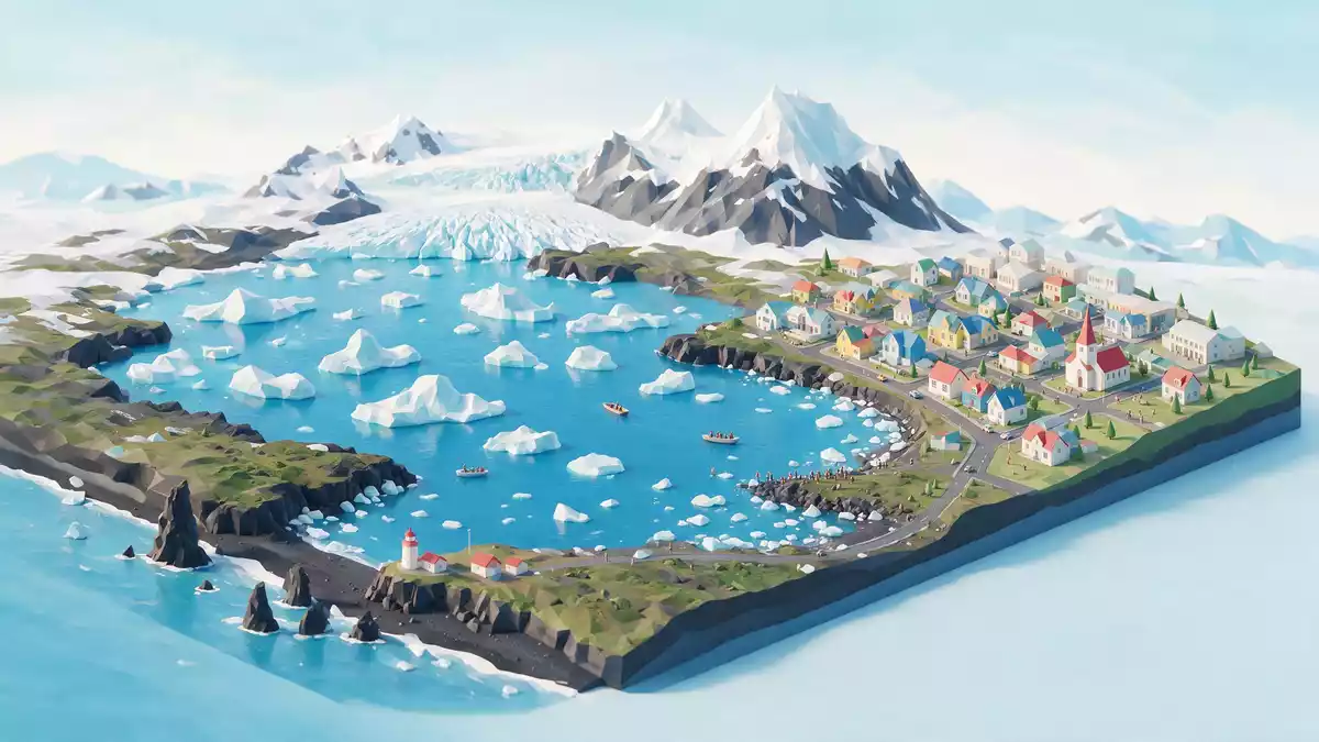
Jokulsarlon is a glacial lagoon on Iceland’s south-eastern coast, where ice from Breidamerkurjokull floats between Vatnajokull and the Atlantic Ocean. Its visible character comes from that meeting of glacier, dark water, drifting ice and low coastal sand.
Jokulsarlon: a lagoon shaped by moving ice
Jokulsarlon lies at the foot of Breidamerkurjokull, an outlet glacier from Vatnajokull. The lagoon formed as the glacier retreated from the coast, leaving a water-filled basin connected to the sea by a short glacial river.
The name Jokulsarlon translates as “glacial river lagoon”. The place belongs to the southern part of Vatnajokull National Park, a protected landscape of ice, outwash plains and coastal water.
Breidamerkurjokull, icebergs and the Atlantic
Icebergs break away from the glacier edge and enter the lagoon as blocks of different sizes and colours. Blue ice, white ice and darker pieces carrying volcanic material may appear together across the water.
The lagoon connects with the Atlantic through its outlet. Ice can therefore pass from the glacier into the lagoon, continue towards the coast and reach the black-sand shore known as Diamond Beach. The relationship between the floating ice and the open sea is a defining feature of Jokulsarlon.
Jokulsarlon is also a deep body of water. Figures for its area and depth vary between published descriptions, so the lagoon is best understood as a large and deep glacial lake rather than through one fixed measurement.
Jokulsarlon between Hofn and Skaftafell
The lagoon sits on Breidamerkursandur beside Iceland’s Route 1. Hofn lies to the east, while Skaftafell lies to the west within the wider Vatnajokull landscape. The road passes close to the water, with the glacier visible inland.
The surrounding terrain is broad and low near the coast, while the ice cap and outlet glacier rise inland. This gives Jokulsarlon a clear sequence of landscape elements: lagoon, outwash plain, glacier and ocean.
Across the water, icebergs may rotate, ground against shallow areas or drift towards the outlet. Their movement changes the arrangement of the lagoon without changing its basic geography. The shore also provides views towards Diamond Beach, where ice fragments rest against black volcanic sand.
The lagoon is part of a region shaped by glacial erosion, meltwater and volcanic geology. Vatnajokull supplies the ice, Breidamerkurjokull forms the immediate glacier connection, and the Atlantic receives water and ice through the outlet.
Visiting Jokulsarlon: what travellers from Western Europe should know
- Jokulsarlon is in south-eastern Iceland beside Route 1, between Hofn and Skaftafell. The lagoon lies within Vatnajokull National Park.
- The approach is coastal and open, but the landscape includes deep water, loose glacial material, black sand and ice close to the shore.
- Diamond Beach lies across the outlet from the lagoon. The two sites form part of the same glacier-to-sea landscape.
- The official language is Icelandic and the currency is the Icelandic króna.
- Entry requirements depend on your nationality; UK travellers can check the FCDO travel advice at gov.uk/foreign-travel-advice, Irish travellers the Department of Foreign Affairs at ireland.ie.
Searching for Jokulsarlon on social platforms
These links open searches for Jokulsarlon on each platform.Frequently asked questions about Jokulsarlon
Where is Jokulsarlon?
Jokulsarlon is in south-eastern Iceland beside Route 1, near Hofn and within Vatnajokull National Park.
What can visitors expect at Jokulsarlon?
The lagoon contains floating icebergs beside a glacier, with an outlet leading towards the Atlantic and Diamond Beach.
What makes Jokulsarlon distinctive?
Its ice moves through a visible chain from Breidamerkurjokull to the lagoon, the coast and the Atlantic Ocean.


