
Islas Galapagos and the volcanic shape of Ecuador
Published on 09/12/2026 at 15:20 | Editorial responsibility: Rafael Müller, Editor-in-Chief AD HOC NEWS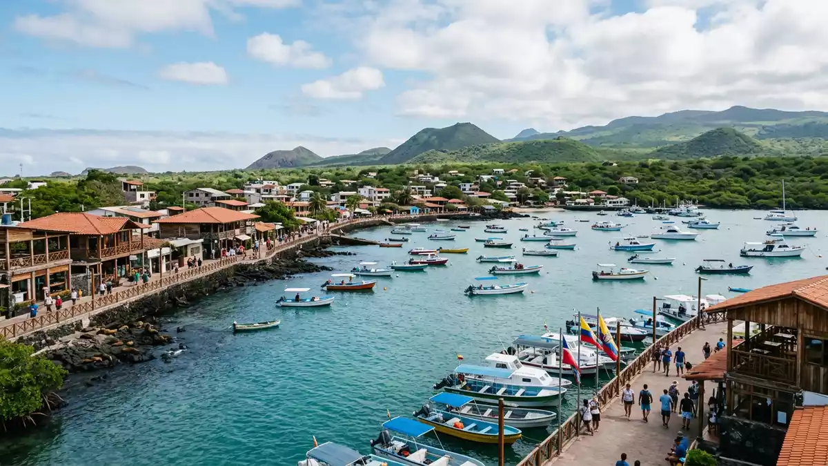
Islas Galapagos is an archipelago of volcanic islands in Ecuador, set in the eastern Pacific Ocean about 1,000 km from the mainland. Its UNESCO World Heritage status, first inscribed in 1978, sits alongside a landscape shaped by shield volcanoes and marine reserve waters.
Volcanic islands in the eastern Pacific
The Galápagos Islands are made up of islands, islets and surrounding seas, with lava-built landforms giving the archipelago its rough profile. The islands are part of Ecuador, and their position near the equator gives the group a sharply maritime character.
UNESCO World Heritage status helps define the islands in cultural and environmental terms, while the same listing also points to their volcanic origin and marine setting. Charles Darwin’s visit in 1835 remains tied to the islands’ wider historical identity, especially through the ideas he later developed about evolution.
Darwin, evolution and the islands’ legacy
Charles Darwin visited the Galápagos aboard HMS Beagle in 1835, and the islands became part of the story of natural selection through the observations he made there. That connection has given the archipelago a place in both science history and travel writing, with the islands read as a living landscape rather than a museum piece.
Charles Darwin’s 1835 visit and the later publication of his ideas link the islands to a major shift in biological thought. The Galápagos also appear in the scientific imagination as a place of endemic wildlife, shaped by isolation and volcanic ground.
Puerto Ayora and the inhabited side of the archipelago
Puerto Ayora on Santa Cruz is the best-known settlement in the Galápagos, and it gives the archipelago an urban edge amid a landscape dominated by rock, sea and low volcanic slopes. The town forms a practical base for movement through the islands, while the wider region remains defined by water and volcanic terrain.
the eastern Pacific and the 1,000 km separation from Ecuador help explain why the islands feel remote without being abstract. The 1978 designation and the continuing scientific reputation keep the archipelago legible as both landscape and landmark.
Visiting Islas Galapagos: what travellers from Western Europe should know
- The archipelago lies off Ecuador in the eastern Pacific. Travellers usually reach it by air, then continue by boat between islands.
- The ground is volcanic and uneven in many places. Paths can cross lava fields, low hills and rough shoreline rock.
- Puerto Ayora sits on Santa Cruz and acts as a practical base for travel through the islands. Ferries and boats link several inhabited islands.
- The official language is Spanish and the currency is the United States dollar.
- Entry requirements depend on your nationality; UK travellers can check the FCDO travel advice at gov.uk/foreign-travel-advice, Irish travellers the Department of Foreign Affairs at ireland.ie.
Searching for Islas Galapagos on social platforms
These links open searches for Islas Galapagos on each platform.
Frequently asked questions about Islas Galapagos
Where are Islas Galapagos?
Islas Galapagos lies in the eastern Pacific Ocean off Ecuador, and Puerto Ayora is on Santa Cruz within the archipelago. The islands form part of Ecuador.
What should a visit feel like?
Expect volcanic ground, sea crossings and a settlement pattern centred on islands rather than a single city. Puerto Ayora gives the archipelago its most recognisable townscape.
What makes Islas Galapagos distinctive?
The combination of volcanic origin, UNESCO status and Darwin’s 1835 visit gives the islands their distinctive identity. The landscape and the scientific history are closely linked.


