
iSimangaliso Wetland Park and the layered coast
Published on 09/16/2026 at 15:37 | Editorial responsibility: Rafael Müller, Editor-in-Chief AD HOC NEWS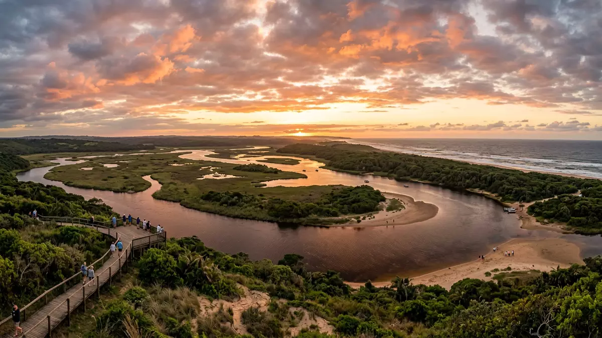
iSimangaliso Wetland Park around St. Lucia is a landscape of coral reefs, dunes, lakes, swamps and beaches rather than a single monument. It became South Africa’s first UNESCO World Heritage Site in 1999, and its coast stretches for about 220 km.
iSimangaliso Wetland Park’s shifting coastal mosaic
The park’s strongest visual quality is its variety. Coral reefs, long sandy beaches, coastal dunes, lake systems and reed wetlands sit within one protected landscape, and the World Heritage inscription describes the area as covering 239,566 ha.
The same coast also carries deep time in its landforms. The dunes include features formed over the past 25,000 years, and the UNESCO material records that the site’s fluvial, marine and aeolian processes have shaped the park into a mosaic of habitats.
iSimangaliso Wetland Park and South Africa’s first World Heritage Site
The park’s formal heritage status gives it a clear place in South Africa’s environmental history. Its UNESCO listing dates from 1999, and the protected area is linked to a long conservation record that began in 1895 with the first reserves in the St. Lucia system.
The modern name is isiZulu and means something wondrous. The park’s former name, Greater St. Lucia Wetland Park, places the St. Lucia lake system at the centre of its identity, while the present name restores local language to the site.
St. Lucia, lakes and the marine edge
St. Lucia gives the park a human reference point, but the landscape is larger than the town. The park runs along the KwaZulu-Natal coast, from Maphelane towards the Mozambique border, and includes marine, estuarine, wetland and terrestrial environments.
That mixture explains why the site reads as several landscapes at once. The UNESCO description refers to reefs, wetlands, beaches and lake systems, while the park’s own material highlights the meeting of ocean, dune, forest, lake, wetland, savannah and grassland.
Visiting iSimangaliso Wetland Park: what travellers from Western Europe should know
- St. Lucia is the main gateway settlement, and the park’s offices are in the town. The coast and lake system extend far beyond the town boundary.
- The landscape includes dunes, wetlands, beaches and estuarine water. That mix gives the area a changing ground surface and a wide open coastal scale.
- The park lies in KwaZulu-Natal, on South Africa’s east coast. The official language is English and the currency is the South African rand.
- Lake systems, reed beds and marine ground sit within one protected area. The terrain changes from coastal sand to wetter, flatter ground across short distances.
- Entry requirements depend on your nationality; UK travellers can check the FCDO travel advice at gov.uk/foreign-travel-advice, Irish travellers the Department of Foreign Affairs at ireland.ie.
Searching for iSimangaliso Wetland Park on social platforms
These links open searches for iSimangaliso Wetland Park on each platform.
Frequently asked questions about iSimangaliso Wetland Park
Where is iSimangaliso Wetland Park?
It lies on the east coast of South Africa in KwaZulu-Natal, with St. Lucia as a key settlement on its edge. The park reaches along the coast towards the Mozambique border.
What should a visit to iSimangaliso Wetland Park include?
A visit can combine coast, lake systems and wetland landscapes in one protected area. The site is made up of marine, coastal, estuarine and terrestrial parts, so the scenery changes from place to place.
What makes iSimangaliso Wetland Park distinctive?
Its combination of reefs, dunes, lakes, swamps and wetlands is the defining feature. The UNESCO inscription also records a long conservation history and a formally protected area of 239,566 ha.


