
Honghe Hani Titian and the terraced hillsides of Yuanyang
Published on 09/09/2026 at 08:05 | Editorial responsibility: Rafael Müller, Editor-in-Chief AD HOC NEWS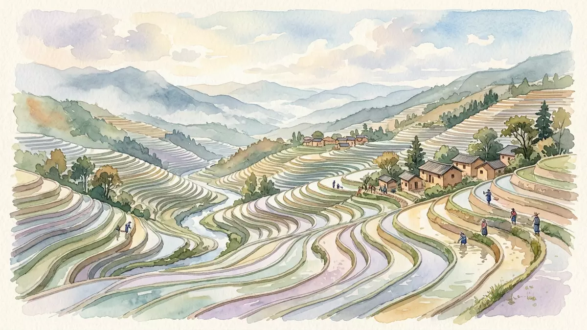
Honghe Hani Titian in Yuanyang refers to a band of rice terraces carved into the southern slopes of the Ailao Mountains, part of the Cultural Landscape of Honghe Hani Rice Terraces recognised as a UNESCO World Heritage cultural site in 2013.Cultural Landscape of Honghe Hani Rice Terraces The terraces form a stepped farming landscape where Hani communities have shaped hillside fields, forest and water over centuries into a single pattern of cultivated slopes in south-west China.
Terraces on the southern slopes of the Ailao Mountains
Honghe Hani Titian lies on south-facing slopes of the Ailao Mountains in Yuanyang County, within Honghe Hani and Yi Autonomous Prefecture in Yunnan Province in southern China.Honghe Hani Rice Terraces The terrace fields descend towards the Hong River, their lines following the contours of ridges and valleys so that pools of water and rice plots step down the hillsides in successive levels.terraces that cascade down the slopes
The wider terrace landscape extends across counties including Yuanyang, Honghe, Lvchun and Jinping, covering an area measured in tens of thousands of hectares, with Yuanyang providing one of the most concentrated terrace zones.Hani Rice Terraces are located in the Honghe Hani and Yi Autonomous Prefecture Within Yuanyang County the terraces spread across multiple scenic areas and village clusters, forming slopes where forest, settlement and irrigated fields occupy different bands of the mountain side.
A long-shaped agricultural landscape recognised by UNESCO
The Cultural Landscape of Honghe Hani Rice Terraces was inscribed on the UNESCO World Heritage List in 2013 as a cultural landscape, with a recognised core area extending over 16,603 hectares in southern Yunnan.core area extending over 16,603 hectares The inscription records the terraces as an integrated system combining forested mountain tops, village settlements, irrigated paddies and a network of water channels developed over more than a millennium.developed over the past 1300 years by the Hani people
Hani communities and other ethnic groups in the region have shaped the terraces over generations, adapting the steeper slopes of the Ailao Mountains for wet-rice cultivation by building retaining walls, channels and pools along the contours.terraced fields reflect an integrated four-fold system The terrace bands, forests above and villages between them form a continuous agricultural landscape where the visible pattern of fields and paths reflects this long agricultural history.
Fields, forests and villages sharing the slopes
Across Honghe Hani Titian, terrace clusters such as Bada, Tiger Mouth and Duoyishu form stepped fields that follow the shape of the hillsides, with water gathered from higher forest belts and directed along channels to the paddies.Hani Rice Terraces List in Yuanyang County Village groups sit on slightly raised ground above the terraces, while forested slopes rise further up, giving each valley a layered structure of trees, houses and flooded fields.
The terrace landscape functions as an agricultural system and a lived environment, with footpaths, small bridges and tracks linking villages to fields and forest plots along the slopes of Yuanyang. Visitors encounter terrace basins filled with water or growing rice, forested ridges above and clusters of earth-coloured houses between, all sharing the same mountain flanks in Honghe Hani and Yi Autonomous Prefecture.
Visiting Honghe Hani Titian: what travellers from Western Europe should know
- Honghe Hani Titian lies in Yuanyang County in Honghe Hani and Yi Autonomous Prefecture in Yunnan, China, on the southern slopes of the Ailao Mountains above the Hong River and is reached by road from other towns in the province.
- The terrace landscape involves movement across hillside paths, tracks and stairways between fields and villages, with gradients and steps on the slopes rather than level ground.
- The terraces sit in a mountainous part of southern Yunnan, where clouds and seasonal conditions can affect visibility across valleys and the appearance of the water-filled fields.
- The official language is Chinese and the currency is the yuan (CNY).
- Entry requirements depend on your nationality; UK travellers can check the FCDO travel advice at gov.uk/foreign-travel-advice, Irish travellers the Department of Foreign Affairs at ireland.ie.
Searching for Honghe Hani Titian on social platforms
These links open searches for Honghe Hani Titian on each platform.
Frequently asked questions about Honghe Hani Titian
Where is Honghe Hani Titian?
Honghe Hani Titian is in Yuanyang County in Honghe Hani and Yi Autonomous Prefecture in Yunnan Province in southern China, on the southern slopes of the Ailao Mountains above the Hong River.
What can travellers expect when visiting Honghe Hani Titian?
Travellers encounter hillside rice terraces arranged in stepped bands, with village clusters, forest belts and paths across the slopes forming a continuous agricultural landscape.
What makes Honghe Hani Titian distinctive as a place of interest?
Honghe Hani Titian is part of the UNESCO-recognised Cultural Landscape of Honghe Hani Rice Terraces, where irrigated fields, forests and villages have been shaped into terraced slopes over more than a thousand years.


