
Hakodateyama rises above a peninsula shaped by sea and city
Published on 09/23/2026 at 17:31 | Editorial responsibility: Rafael Müller, Editor-in-Chief AD HOC NEWS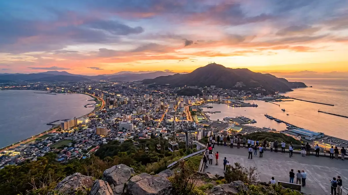
Hakodateyama is a wooded volcanic mountain at the southern end of Hakodate’s peninsula. Its summit reaches 334 m (1,096 ft), while the city, harbour and surrounding waters spread below its slopes.
Hakodateyama and the shape of Hakodate
Hakodateyama occupies the southern end of the landform carrying much of central Hakodate. The mountain rises directly above the harbour and the historic Motomachi district, making the transition from urban streets to forested hillside visible across the city.
Its summit presents a broad view across Hakodate Bay and the Tsugaru Strait. The two bodies of water frame the peninsula, while the city occupies the narrower ground between them. From above, roads, waterfront districts and the harbour form a compact urban pattern beneath the mountain. The summit elevation is recorded as 334 metres above sea level.
From volcanic mountain to military remains
Hakodateyama is an inactive volcanic mountain belonging to the Oshima Peninsula. Its wooded slopes contain a network of paths, viewpoints and historic military structures, including gun batteries associated with the fortress period of the Meiji era.
Military use restricted access to the mountain from 1899. Hakodate opened the mountain to the public in 1946, after the fortress role ended. The period of restricted entry also left a landscape in which woodland and historic masonry occupy the same slopes. Plant life and bird habitats form part of the mountain’s character alongside the summit facilities and paths.
The Hakodateyama Ropeway began operating in 1958. Its line connects the lower station with the summit area, where observation facilities stand above the city. The ropeway’s history is recorded in Hakodate’s post-war history.
The summit view over bay, strait and city lights
The summit view changes from a daytime geography lesson into a pattern of illuminated streets after dusk. Hakodate’s built-up peninsula appears between dark water on both sides, with the harbour districts close below.
The mountain’s height is modest by alpine standards, yet the summit’s position above the peninsula gives the view a clear spatial arrangement. Hakodate Bay lies to one side, the Tsugaru Strait to the other, and the city occupies the land between them. The view is therefore defined by coastline and urban form as much as by elevation.
The summit observatory provides the principal viewing area. The ropeway covers a 787 m (2,582 ft) line with a vertical interval of 278 m (912 ft), ending at the summit elevation. These figures describe the ascent and the mountain’s relationship with the city below, rather than an isolated peak in a remote landscape. The ropeway’s route and stations are detailed in the ropeway’s basic data.
Hakodateyama’s distinctive quality lies in this combination of woodland, volcanic geology, military history and urban panorama. A short mountain rises from the peninsula’s southern edge, while the summit reveals the city as a narrow piece of land between two waters.
Visiting Hakodateyama: what travellers from Western Europe should know
- Hakodateyama stands at Hakodate’s southern peninsula, above the harbour and Motomachi. The Hakodateyama Ropeway connects the mountain with its lower station, while Jujigai tram stop lies near the ropeway station.
- The summit reaches 334 m (1,096 ft). Hiking routes cross wooded slopes and pass historic fortress remains, including former gun-battery areas.
- The mountain is reached from Hakodate by tram, ropeway, road and walking routes. The lower ropeway station is approached from the Jujigai area.
- The official language is Japanese and the currency is the Japanese yen.
- Hakodate Bay and the Tsugaru Strait are both visible from the summit area, with Hakodate’s central districts between them.
Searching for Hakodateyama on social platforms
These links open searches for Hakodateyama on each platform.Frequently asked questions about Hakodateyama
Where is Hakodateyama?
Hakodateyama rises at the southern end of Hakodate’s peninsula in Hokkaido, Japan. It stands above the harbour, Motomachi and the city’s central districts.
What can visitors expect on the mountain?
The mountain combines a summit observatory, wooded paths, ropeway access and historic military remains. Views extend across Hakodate Bay, the Tsugaru Strait and the built-up peninsula.
What makes Hakodateyama distinctive?
Its 334 m summit sits directly above a narrow urban peninsula between two bodies of water. The same mountain also contains volcanic woodland and fortress remains linked with Hakodate’s history.


