
Guna Yala and El Porvenir, an indigenous sea of islands
Published on 09/09/2026 at 22:05 | Editorial responsibility: Rafael Müller, Editor-in-Chief AD HOC NEWS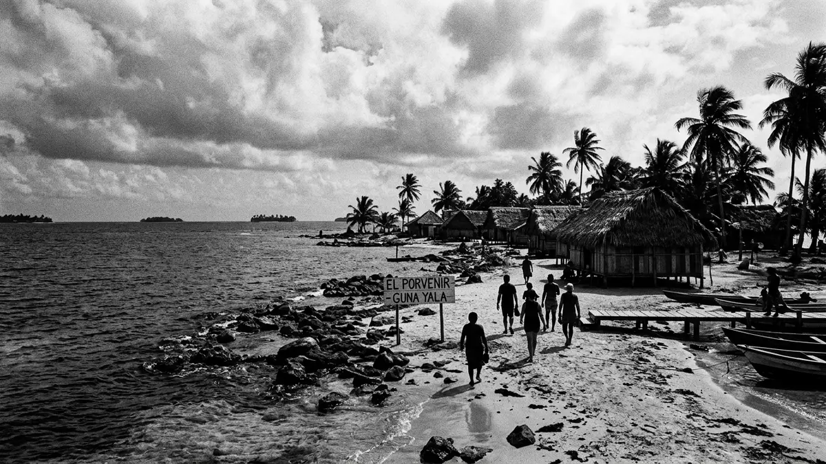
Guna Yala, once widely known as San Blas, is an autonomous indigenous territory on the Caribbean coast of Panama, where low coral islands and a narrow mainland strip form a distinct seascape governed by Guna communities.autonomous indigenous territory The administrative centre, El Porvenir, occupies a small island at the western edge of the archipelago and anchors travel into this scattered landscape of sea and land.small island at the western edge
Sea, shore and an island capital
Guna Yala runs along north-eastern Panama, bounded on the north by the Caribbean Sea and on the south by the mainland provinces and comarcas of Darién and Emberá-Wounaan.bounded by the Caribbean Sea and Darién It forms a long, relatively narrow band of territory, taking in both coastal jungle and the offshore archipelago that foreign visitors frequently call the San Blas Islands.offshore archipelago
El Porvenir, officially recognised as the administrative capital, lies on a compact island close to the mainland at the western end of the territory, acting as a junction between the Guna settlements and connections from the rest of Panama.administrative capital El Porvenir Small boats depart from the island towards nearby communities and outer islands, while aircraft use the short airstrip that shares the narrow space with administrative buildings and shoreline.
Landscape of coral islands and coastal jungle
The archipelago of Guna Yala consists of hundreds of low-lying islands scattered along the Caribbean, many fringed by pale sand and shallow water above coral formations.hundreds of low-lying islands Most Guna communities are organised on small islands just off the mainland shore, with houses and communal structures clustered close together and simple jetties reaching out into the sea.communities on small islands
Behind these islands, the mainland part of Guna Yala includes coastal lowlands and forested slopes that form part of the wider isthmus of Panama, extending towards the Colombian border and linking with one of the largest rainforest zones in the region.coastal lowlands and forested slopes The overall territory is described as a comarca indígena, a formal designation in Panamanian law that marks it out as an indigenous region with defined boundaries and internal organisation.
Guna autonomy and living culture
Guna Yala is recognised within Panama as a comarca indígena for the Guna people, meaning that local communities hold a significant degree of autonomy over internal affairs, territory and access.comarca indígena for the Guna people The name itself, Guna Yala, is explained as “Land of the Guna” or “Guna Mountain” in the Guna language, underlining the connection between the territory and its inhabitants.“Land of the Guna”
Within this framework, Guna Yala has its own governance structures, including bodies such as the Kuna General Congress, and maintains a special administrative regime inside the Republic of Panama.governance structures Cultural practices, from dress and hand-crafted textiles to local forms of social organisation, continue across the islands and mainland settlements, giving the territory a distinctive character rooted in indigenous life that visitors encounter in everyday settings rather than in separate display sites.
Visiting Guna Yala: what travellers from Western Europe should know
- Guna Yala lies along Panama’s north-eastern Caribbean coast, with El Porvenir on a small island at the western end of the territory, linked to the mainland and other islands by boats and domestic flights.
- Much of Guna Yala consists of low coral islands and coastal terrain, so travel frequently involves boarding small boats from simple jetties and walking across sand rather than paved surfaces.
- Guna Yala’s archipelago belongs to Panama and uses the Panamanian balboa and US dollar as legal currencies, while Spanish is the official national language alongside the Guna language in local use.
- Entry requirements depend on your nationality; UK travellers can check the FCDO travel advice at gov.uk/foreign-travel-advice, Irish travellers the Department of Foreign Affairs at ireland.ie.
Searching for Guna Yala on social platforms
These links open searches for Guna Yala on each platform.Frequently asked questions about Guna Yala
Where is Guna Yala and how is El Porvenir situated within it?
Guna Yala is on Panama’s north-eastern Caribbean coast, and El Porvenir is a small island town at the western end that functions as the administrative capital.
What should travellers expect when visiting Guna Yala?
Travellers encounter an indigenous territory of coral islands and coastal jungle, where movement between communities relies heavily on small boats and simple island infrastructure.
What makes Guna Yala distinctive compared with other coastal regions?
Guna Yala combines a long Caribbean shoreline and scattered islands with formal status as an indigenous comarca, in which Guna communities retain significant autonomy over their territory and governance.


